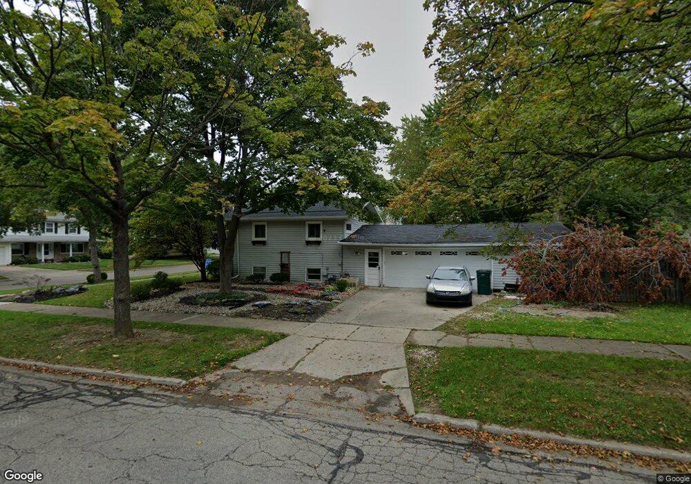
3021 Victor Ave Lansing, MI 48911
Pleasant Grove NeighborhoodEstimated Value: $209,000 - $227,000
3
Beds
3
Baths
1,565
Sq Ft
$138/Sq Ft
Est. Value
About This Home
This home is located at 3021 Victor Ave, Lansing, MI 48911 and is currently estimated at $215,599, approximately $137 per square foot. 3021 Victor Ave is a home located in Ingham County with nearby schools including Averill Elementary School, Attwood School, and J.W. Sexton High School.
Ownership History
Date
Name
Owned For
Owner Type
Purchase Details
Closed on
Nov 1, 1999
Sold by
Sting Andrea J
Bought by
Wade Keenan M
Current Estimated Value
Home Financials for this Owner
Home Financials are based on the most recent Mortgage that was taken out on this home.
Original Mortgage
$106,945
Outstanding Balance
$32,724
Interest Rate
7.78%
Mortgage Type
FHA
Estimated Equity
$182,875
Create a Home Valuation Report for This Property
The Home Valuation Report is an in-depth analysis detailing your home's value as well as a comparison with similar homes in the area
Home Values in the Area
Average Home Value in this Area
Purchase History
| Date | Buyer | Sale Price | Title Company |
|---|---|---|---|
| Wade Keenan M | $107,000 | -- |
Source: Public Records
Mortgage History
| Date | Status | Borrower | Loan Amount |
|---|---|---|---|
| Open | Wade Keenan M | $106,945 |
Source: Public Records
Tax History Compared to Growth
Tax History
| Year | Tax Paid | Tax Assessment Tax Assessment Total Assessment is a certain percentage of the fair market value that is determined by local assessors to be the total taxable value of land and additions on the property. | Land | Improvement |
|---|---|---|---|---|
| 2025 | $3,012 | $93,100 | $14,400 | $78,700 |
| 2024 | $24 | $84,100 | $14,400 | $69,700 |
| 2023 | $2,824 | $74,400 | $14,400 | $60,000 |
| 2022 | $2,546 | $65,500 | $12,500 | $53,000 |
| 2021 | $2,493 | $60,800 | $10,000 | $50,800 |
| 2020 | $2,478 | $57,700 | $10,000 | $47,700 |
| 2019 | $2,375 | $52,300 | $10,000 | $42,300 |
| 2018 | $2,226 | $44,400 | $10,000 | $34,400 |
| 2017 | $2,131 | $44,400 | $10,000 | $34,400 |
| 2016 | $2,038 | $39,000 | $10,000 | $29,000 |
| 2015 | $2,038 | $36,800 | $19,980 | $16,820 |
| 2014 | $2,038 | $36,100 | $19,980 | $16,120 |
Source: Public Records
Map
Nearby Homes
- 2710 Bedford Rd
- 2905 S Catherine St
- 2838 Sunderland Rd
- 2409 Victor Ave
- 2201 Pamela Place
- 2200 Rossiter Place
- 3425 Cooley Dr
- 3510 Christine Dr
- 3212 Ingham St
- 2505 Hanover Dr
- 3421 Troon Cir Unit 29
- 0 S Deerfield Ave
- 3200 Lawdor Rd
- 2920 Pleasant Grove Rd Unit 1
- 3600 Sandhurst Dr
- 2812 Pleasant Grove Rd
- 3508 Muirfield Dr
- 3334 Ingham St
- 3614 Cooley Dr
- 3324 Viking St
- 3015 Victor Ave
- 2741 S Deerfield Ave
- 3009 Victor Ave
- 2730 S Deerfield Ave
- 2803 S Deerfield Ave
- 2726 S Deerfield Ave
- 2736 S Deerfield Ave
- 2720 S Deerfield Ave
- 3022 Victor Ave
- 3003 Victor Ave
- 2802 S Deerfield Ave
- 3014 Victor Ave
- 2714 S Deerfield Ave
- 2740 S Catherine St
- 2809 S Deerfield Ave
- 2808 S Deerfield Ave
- 2943 Victor Ave
- 2802 S Catherine St
- 2718 Bedford Rd
- 2708 S Deerfield Ave