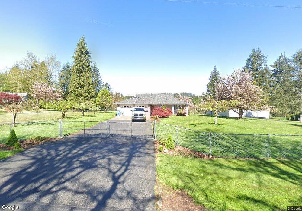
30212 NE Mcbride Rd Battle Ground, WA 98604
Estimated Value: $640,987 - $734,000
3
Beds
2
Baths
1,483
Sq Ft
$456/Sq Ft
Est. Value
About This Home
This home is located at 30212 NE Mcbride Rd, Battle Ground, WA 98604 and is currently estimated at $676,247, approximately $455 per square foot. 30212 NE Mcbride Rd is a home located in Clark County with nearby schools including Yacolt Primary School, Amboy Middle School, and Battle Ground High School.
Ownership History
Date
Name
Owned For
Owner Type
Purchase Details
Closed on
Jun 18, 2025
Sold by
Martin Dustin E and Martin Chelsey A
Bought by
Warren Benjamin Isaac and Warren Shannon Mae
Current Estimated Value
Home Financials for this Owner
Home Financials are based on the most recent Mortgage that was taken out on this home.
Original Mortgage
$620,500
Outstanding Balance
$618,907
Interest Rate
6.81%
Mortgage Type
New Conventional
Estimated Equity
$57,340
Purchase Details
Closed on
Nov 9, 2016
Sold by
Emerick Franklin W and Emerick Robert M
Bought by
Martin Dustin E and Martin Chelsey A
Home Financials for this Owner
Home Financials are based on the most recent Mortgage that was taken out on this home.
Original Mortgage
$285,000
Interest Rate
3.42%
Mortgage Type
New Conventional
Purchase Details
Closed on
Jul 1, 2013
Sold by
Tingley Yvonne J
Bought by
Emerick Franklin W and Emerick Roberta M
Create a Home Valuation Report for This Property
The Home Valuation Report is an in-depth analysis detailing your home's value as well as a comparison with similar homes in the area
Home Values in the Area
Average Home Value in this Area
Purchase History
| Date | Buyer | Sale Price | Title Company |
|---|---|---|---|
| Warren Benjamin Isaac | $730,000 | Chicago Title | |
| Martin Dustin E | $330,000 | Chicago Title Fl Vancouver | |
| Emerick Franklin W | $285,000 | Clark County Title Co |
Source: Public Records
Mortgage History
| Date | Status | Borrower | Loan Amount |
|---|---|---|---|
| Open | Warren Benjamin Isaac | $620,500 | |
| Previous Owner | Martin Dustin E | $285,000 |
Source: Public Records
Tax History Compared to Growth
Tax History
| Year | Tax Paid | Tax Assessment Tax Assessment Total Assessment is a certain percentage of the fair market value that is determined by local assessors to be the total taxable value of land and additions on the property. | Land | Improvement |
|---|---|---|---|---|
| 2025 | $5,006 | $597,261 | $301,959 | $295,302 |
| 2024 | $4,689 | $570,304 | $301,959 | $268,345 |
| 2023 | $4,723 | $596,082 | $316,391 | $279,691 |
| 2022 | $4,062 | $549,467 | $282,611 | $266,856 |
| 2021 | $4,209 | $437,962 | $213,584 | $224,378 |
| 2020 | $4,083 | $415,015 | $204,772 | $210,243 |
| 2019 | $3,350 | $394,688 | $204,772 | $189,916 |
| 2018 | $3,901 | $370,153 | $0 | $0 |
| 2017 | $3,533 | $355,357 | $0 | $0 |
| 2016 | $3,482 | $324,500 | $0 | $0 |
| 2015 | $3,397 | $294,813 | $0 | $0 |
| 2014 | -- | $273,907 | $0 | $0 |
| 2013 | -- | $252,957 | $0 | $0 |
Source: Public Records
Map
Nearby Homes
- 30108 NE Mcbride Rd
- 13706 NE River Bend Rd
- 29815 NE 152nd Ave
- 29139 NE Hammond Ct
- 29311 NE 124th Ave
- 9701 NE 299th St
- 16401 NE 278th St
- 16808 NE 281st Cir
- 17003 NE 281st Cir
- 16906 NE 281st Cir
- 16807 NE 281st Cir
- 16905 NE 281st Cir
- 16803 NE 281st Cir
- 17000 NE 281st Cir
- 00 NE 324th Cir
- 0 NE 324th Cir
- 29394 NE Kelly Rd
- 0 NE 279th St Unit 717779825
- 0 NE 279th St Unit 24075001
- 0 NE 279th St Unit 24073819
- 30209 NE Mcbride Rd
- 30310 NE Mcbride Rd
- 30303 NE Mcbride Rd
- 30410 NE Mcbride Rd
- 30411 NE Mcbride Rd
- 30010 NE Mcbride Rd
- 14105 NE 301st Cir
- 30610 NE Lewisville Hwy
- 14414 NE 301st Cir
- 30007 NE Mcbride Rd
- 30404 NE Lewisville Hwy
- 14303 NE 301st Cir
- 30002 NE Mcbride Rd
- 30608 NE Mcbride Rd
- 14309 NE 306th St
- 30740 NE Lewisville Hwy
- 14417 NE 301st Cir
- 30615 NE Mcbride Rd
- 29904 NE Mcbride Rd
- 30400 NE Lewisville Hwy