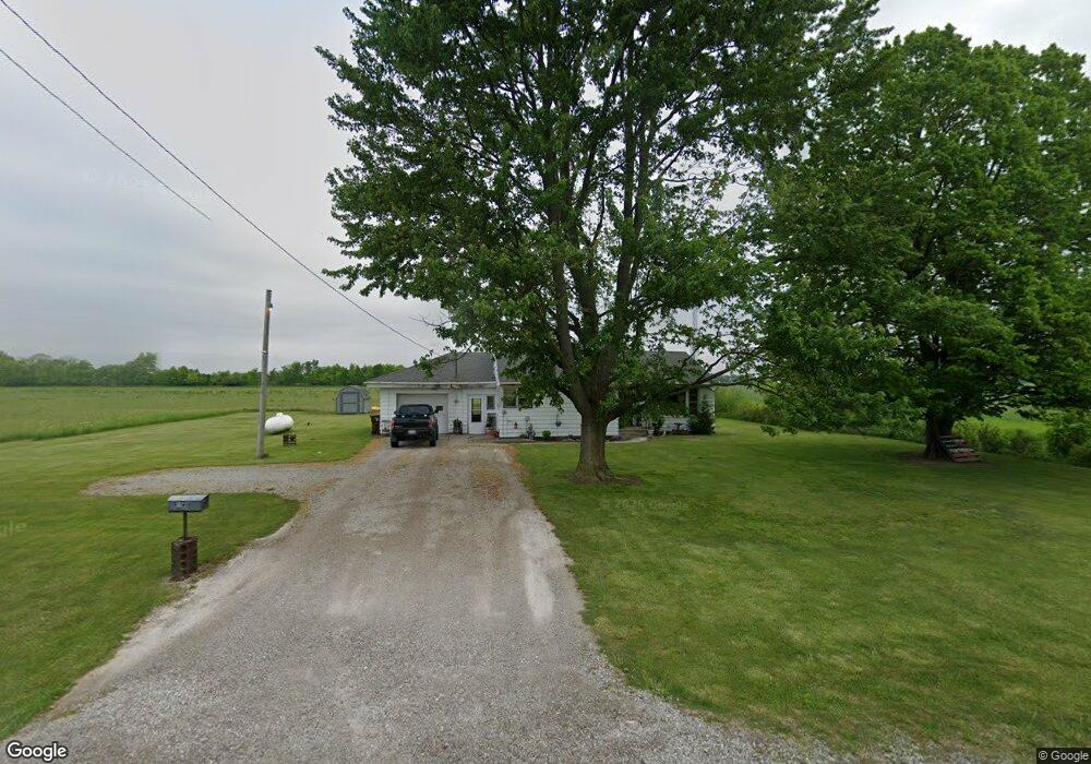
30237 State Route 281 Holgate, OH 43527
Estimated Value: $119,000 - $245,000
3
Beds
1
Bath
1,080
Sq Ft
$160/Sq Ft
Est. Value
About This Home
This home is located at 30237 State Route 281, Holgate, OH 43527 and is currently estimated at $173,142, approximately $160 per square foot. 30237 State Route 281 is a home located in Defiance County with nearby schools including Ayersville Elementary School and Ayersville High School.
Ownership History
Date
Name
Owned For
Owner Type
Purchase Details
Closed on
Oct 5, 2006
Sold by
Baker Donald J
Bought by
Baker Donald J and Donald J Baker Revocable Living Trust
Current Estimated Value
Create a Home Valuation Report for This Property
The Home Valuation Report is an in-depth analysis detailing your home's value as well as a comparison with similar homes in the area
Home Values in the Area
Average Home Value in this Area
Purchase History
| Date | Buyer | Sale Price | Title Company |
|---|---|---|---|
| Baker Donald J | -- | None Available |
Source: Public Records
Tax History Compared to Growth
Tax History
| Year | Tax Paid | Tax Assessment Tax Assessment Total Assessment is a certain percentage of the fair market value that is determined by local assessors to be the total taxable value of land and additions on the property. | Land | Improvement |
|---|---|---|---|---|
| 2024 | $1,113 | $29,330 | $7,320 | $22,010 |
| 2023 | $1,113 | $29,330 | $7,320 | $22,010 |
| 2022 | $1,227 | $27,040 | $7,250 | $19,790 |
| 2021 | $1,227 | $27,040 | $7,250 | $19,790 |
| 2020 | $1,255 | $27,040 | $7,250 | $19,790 |
| 2019 | $1,133 | $24,930 | $7,250 | $17,680 |
| 2018 | $1,122 | $24,930 | $7,250 | $17,680 |
| 2017 | $1,095 | $24,927 | $7,248 | $17,679 |
| 2016 | $1,101 | $24,881 | $7,248 | $17,633 |
| 2015 | $516 | $24,881 | $7,248 | $17,633 |
| 2014 | $516 | $24,881 | $7,248 | $17,633 |
| 2013 | $516 | $24,881 | $7,248 | $17,633 |
| 2012 | $516 | $24,882 | $7,249 | $17,633 |
Source: Public Records
Map
Nearby Homes
- 29432 State Route 18
- H011 County Road 17
- 405 W High St
- 28618 Steinmaier Rd
- 212 E High St
- 1459 Deerwood Dr
- 846 Deerwood Dr
- 850 Deerwood Dr
- 1365 Heatherdowns Dr
- 1408 Heatherdowns Dr
- 673 Burning Tree Dr
- 679 Burning Tree Dr
- 649 Burning Tree Dr
- 1819 Maumee Dr
- 655 Burning Tree Dr
- 1275 Byrnwyck Ct
- 1935 Edgewood Dr
- 1275 Pinehurst Dr
- 6767 Independence Rd
- 1768 Elmwood Dr
- 30098 Weichman Rd
- 30115 Weichman Rd
- 30513 State Route 281
- 30115 Weichman Rd
- 30601 State Route 281
- 11357 Snyder Rd
- 29826 State Route 281
- 11230 Snyder Rd
- 30312 Weichman Rd
- 30723 State Route 281
- 30425 Weichman Rd
- 29733 State Route 281
- 11531 Snyder Rd
- 11645 Snyder Rd
- 30949 State Route 281
- 30979 State Route 281
- 30984 State Route 281
- 29479 State Route 281
- 11172 Def Henry Co Line Rd
- 11576 Snyder Rd