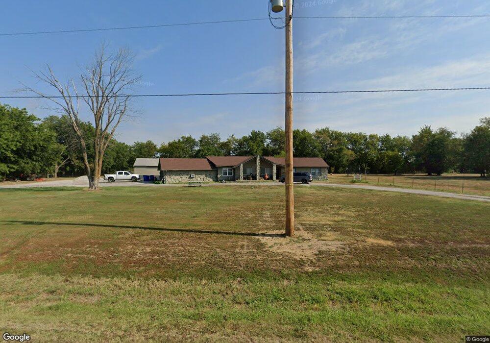
30247 E 83rd St S Broken Arrow, OK 74014
Estimated Value: $361,651 - $419,000
3
Beds
2
Baths
2,396
Sq Ft
$165/Sq Ft
Est. Value
About This Home
This home is located at 30247 E 83rd St S, Broken Arrow, OK 74014 and is currently estimated at $394,163, approximately $164 per square foot. 30247 E 83rd St S is a home located in Wagoner County with nearby schools including Donald P. Sloat Junior High School, Coweta Intermediate High School, and Coweta High School.
Ownership History
Date
Name
Owned For
Owner Type
Purchase Details
Closed on
Nov 16, 2021
Sold by
Hayes David L and Hayes Linda K
Bought by
Eberle Tami J and Eberle Joseph B
Current Estimated Value
Purchase Details
Closed on
Jan 27, 2012
Sold by
Lisk Robyn L
Bought by
Auer Chad R and Auer Megan
Purchase Details
Closed on
Oct 14, 2011
Sold by
Ocwen Loan Servicing Llc
Purchase Details
Closed on
May 31, 1995
Sold by
Bailey Christine
Create a Home Valuation Report for This Property
The Home Valuation Report is an in-depth analysis detailing your home's value as well as a comparison with similar homes in the area
Purchase History
| Date | Buyer | Sale Price | Title Company |
|---|---|---|---|
| Eberle Tami J | -- | None Available | |
| Auer Chad R | $20,000 | Executives Title & Escrow Co | |
| -- | $62,000 | -- | |
| Mccoy Joe | $61,699 | None Available | |
| -- | $87,000 | -- |
Source: Public Records
Tax History Compared to Growth
Tax History
| Year | Tax Paid | Tax Assessment Tax Assessment Total Assessment is a certain percentage of the fair market value that is determined by local assessors to be the total taxable value of land and additions on the property. | Land | Improvement |
|---|---|---|---|---|
| 2025 | $2,318 | $26,264 | $4,183 | $22,081 |
| 2024 | $2,318 | $25,499 | $4,061 | $21,438 |
| 2023 | $2,248 | $24,756 | $3,939 | $20,817 |
| 2022 | $2,159 | $24,035 | $3,806 | $20,229 |
| 2021 | $2,138 | $23,335 | $3,631 | $19,704 |
| 2020 | $2,013 | $22,655 | $3,444 | $19,211 |
| 2019 | $1,989 | $21,996 | $3,013 | $18,983 |
| 2018 | $1,890 | $20,540 | $1,852 | $18,688 |
| 2017 | $1,797 | $19,942 | $1,297 | $18,645 |
| 2016 | $1,747 | $19,362 | $780 | $18,582 |
| 2015 | -- | $17,526 | $780 | $16,746 |
| 2014 | -- | $17,792 | $1,344 | $16,448 |
Source: Public Records
Map
Nearby Homes
- 8310 S 301st East Ave
- 29006 E 79th Terrace S
- 29012 E 79th Terrace S
- 29047 E 79th Terrace S
- 29013 E 79th Terrace S
- 29024 E 79th Terrace S
- 29055 E 79th Terrace S
- 29105 E 79th Terrace S
- 29093 E 79th Terrace S
- 29036 E 79th Terrace S
- 29074 E 79th Place S
- 7956 S 290th E Ave
- 29035 E 79th Terrace S
- RC Clark Plan at East Village
- RC Carson Plan at East Village
- RC Magnolia Plan at East Village
- RC Fenway Plan at East Village
- RC Morgan Plan at East Village
- RC Coleman Plan at East Village
- RC Franklin Plan at East Village
- 30247 E 83rd St S
- 30310 E 83rd St S
- 30264 E 83rd St S
- 30165 E 83rd St S
- 30350 E 83rd St S
- 0 E 83rd St Unit 1128685
- 0 E 83rd St Unit 422121
- 0 E 83rd St Unit 2027876
- 0 E 83rd St Unit 2103282
- 30192 E 83rd St S
- 0 E 83rd St S
- 0 83rd St S Unit 2002967
- 0 83rd St S Unit 2002969
- 7653 S 301st East Ave
- 30105 E 83rd St S
- 8258 S 305th East Ave
- 8460 S 305th East Ave
- 8266 S 305th East Ave
- 8510 S 305th Ave E
- 8312 S 301st East Ave
