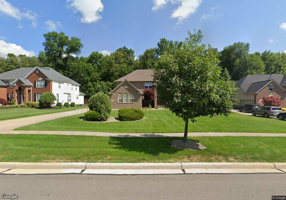
3025 Abrams Dr Twinsburg, OH 44087
Estimated Value: $598,000 - $661,000
5
Beds
4
Baths
3,395
Sq Ft
$186/Sq Ft
Est. Value
About This Home
This home is located at 3025 Abrams Dr, Twinsburg, OH 44087 and is currently estimated at $630,292, approximately $185 per square foot. 3025 Abrams Dr is a home located in Summit County with nearby schools including Wilcox Primary School, Dodge Intermediate School, and Samuel Bissell Elementary School.
Ownership History
Date
Name
Owned For
Owner Type
Purchase Details
Closed on
Mar 20, 2023
Sold by
Aoki Michael M and Aoki Patricia M
Bought by
Aoki Preservation Trust
Current Estimated Value
Purchase Details
Closed on
Jun 18, 2003
Sold by
Kimball Hill Abrams Farm Lp
Bought by
Aoki Michael M and Aoki Patricia M
Home Financials for this Owner
Home Financials are based on the most recent Mortgage that was taken out on this home.
Original Mortgage
$255,000
Interest Rate
5.71%
Mortgage Type
Purchase Money Mortgage
Create a Home Valuation Report for This Property
The Home Valuation Report is an in-depth analysis detailing your home's value as well as a comparison with similar homes in the area
Home Values in the Area
Average Home Value in this Area
Purchase History
| Date | Buyer | Sale Price | Title Company |
|---|---|---|---|
| Aoki Preservation Trust | -- | -- | |
| Aoki Michael M | $385,000 | Real Estate Title |
Source: Public Records
Mortgage History
| Date | Status | Borrower | Loan Amount |
|---|---|---|---|
| Previous Owner | Aoki Michael M | $255,000 |
Source: Public Records
Tax History Compared to Growth
Tax History
| Year | Tax Paid | Tax Assessment Tax Assessment Total Assessment is a certain percentage of the fair market value that is determined by local assessors to be the total taxable value of land and additions on the property. | Land | Improvement |
|---|---|---|---|---|
| 2025 | $8,939 | $185,728 | $34,969 | $150,759 |
| 2024 | $8,939 | $185,728 | $34,969 | $150,759 |
| 2023 | $8,939 | $185,728 | $34,969 | $150,759 |
| 2022 | $7,217 | $133,774 | $25,158 | $108,616 |
| 2021 | $7,252 | $133,774 | $25,158 | $108,616 |
| 2020 | $7,034 | $133,780 | $25,160 | $108,620 |
| 2019 | $7,327 | $130,240 | $29,180 | $101,060 |
| 2018 | $7,180 | $130,240 | $29,180 | $101,060 |
| 2017 | $6,353 | $130,240 | $29,180 | $101,060 |
| 2016 | $6,314 | $122,140 | $29,180 | $92,960 |
| 2015 | $6,353 | $122,140 | $29,180 | $92,960 |
| 2014 | $6,340 | $122,140 | $29,180 | $92,960 |
| 2013 | $6,389 | $123,200 | $29,180 | $94,020 |
Source: Public Records
Map
Nearby Homes
- 2825 Veron Ln
- 9740 Burton Dr
- 3281 Evans Way
- 2708 Edgebrook Crossing Unit 19
- 2627 Post Rd
- 2590 Post Rd
- 2869 Tinkers Ln
- 2923 Alling Dr
- 3284 Cannon Rd
- 10000 Ravenna Rd
- 3331 Shale Dr
- 2607 Burridge Cir Unit M29
- 10169 Timothy Ln
- 2619 E Aurora Rd
- 2609 E Aurora Rd
- 9933 Cynthia Dr
- 10358 Townley Ct
- 3320 Blossom Trail
- 3336 Blossom Trail
- 10085 Glen Eagle Ln Unit 35AG
- 3015 Abrams Dr
- 3035 Abrams Dr
- 3005 Abrams Dr
- 3045 Abrams Dr
- 9550 Windsor Way
- 9537 Windsor Way
- 3032 Abrams Dr
- 3022 Abrams Dr
- 2995 Abrams Dr
- 3055 Abrams Dr
- 3042 Abrams Dr
- 3012 Abrams Dr
- 3052 Abrams Dr
- 9558 Windsor Way
- 3002 Abrams Dr
- 2985 Abrams Dr
- 3065 Abrams Dr
- 3062 Abrams Dr
- 2992 Abrams Dr
- 9566 Windsor Way