B
Landlord's Agent in 2013
Beth Mackes
RE/MAX
Estimated Value: $304,000 - $329,625
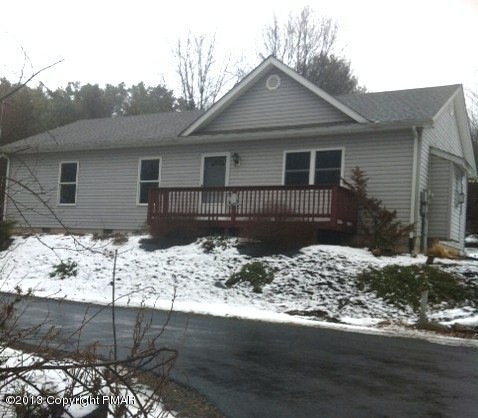
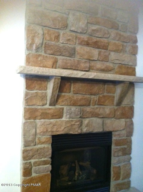
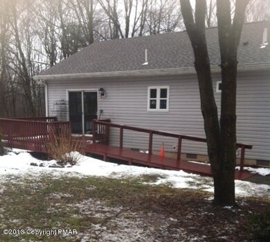
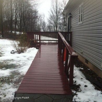
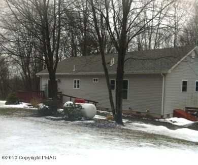
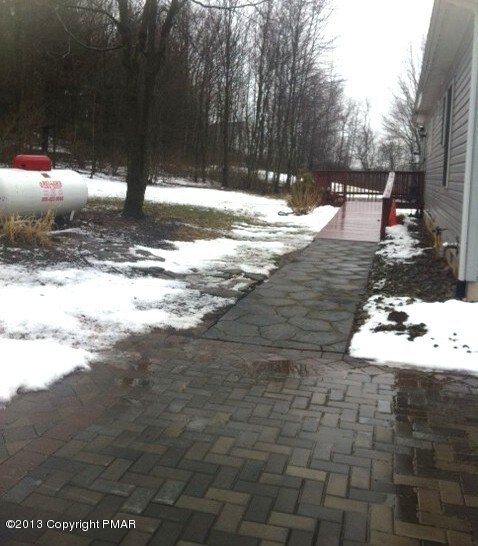
NO MORE SHOWINGS. Looking for privacy? Commuter's Dream. Close to major highways, is this Ranch offering 3BD 2BA situated on 4.46 Acres. Livingroom Fireplace.
Last Agent to Rent the Property
Beth Mackes
At Your Service Realty Listed on: 02/25/2013
Last Renter's Agent
Beth Mackes
At Your Service Realty Listed on: 02/25/2013
| Date | Buyer | Sale Price | Title Company |
|---|---|---|---|
| Gower Steven Lee | $175,000 | None Available | |
| Holland William T | -- | None Available | |
| Holland William T | $85,000 | None Available |
| Date | Status | Borrower | Loan Amount |
|---|---|---|---|
| Open | Gower Steven Lee | $166,250 |
| Date | Event | Price | List to Sale | Price per Sq Ft |
|---|---|---|---|---|
| 03/09/2013 03/09/13 | Rented | $1,100 | 0.0% | -- |
| 03/09/2013 03/09/13 | Under Contract | -- | -- | -- |
| 02/23/2013 02/23/13 | For Rent | $1,100 | -- | -- |
| Year | Tax Paid | Tax Assessment Tax Assessment Total Assessment is a certain percentage of the fair market value that is determined by local assessors to be the total taxable value of land and additions on the property. | Land | Improvement |
|---|---|---|---|---|
| 2025 | $1,286 | $157,990 | $46,440 | $111,550 |
| 2024 | $1,049 | $157,990 | $46,440 | $111,550 |
| 2023 | $4,784 | $157,990 | $46,440 | $111,550 |
| 2022 | $4,654 | $157,990 | $46,440 | $111,550 |
| 2021 | $4,436 | $157,990 | $46,440 | $111,550 |
| 2020 | $4,574 | $157,990 | $46,440 | $111,550 |
| 2019 | $3,520 | $19,750 | $5,180 | $14,570 |
| 2018 | $3,481 | $19,750 | $5,180 | $14,570 |
| 2017 | $3,441 | $19,750 | $5,180 | $14,570 |
| 2016 | $547 | $19,750 | $5,180 | $14,570 |
| 2015 | -- | $19,750 | $5,180 | $14,570 |
| 2014 | -- | $19,750 | $5,180 | $14,570 |
B
Landlord's Agent in 2013
Beth Mackes
RE/MAX
Source: Pocono Mountains Association of REALTORS®
MLS Number: 13-1329
APN: 02.14.1.29-1
Disclaimer: Certain information contained herein is derived from information provided by parties other than Homes.com. All information provided is deemed reliable, but is not guaranteed to be accurate and should be independently verified.
![]() The data relating to real estate for sale on this web site includes listings held by MLS-IDX Participants of the Internet Data Exchange program of the Multiple Listing Service of the Pocono Mountains Association of Realtors®. Listings marked with the Internet Data Exchange logo are not necessarilty the listings of the owner of this web site. All listing data is the copyrighted property of the aforesaid Associations and its MLS-IDX Participants with all rights reserved. The information contained herein is believed to be accurate, but no warranty as such is expressed or implied.
The data relating to real estate for sale on this web site includes listings held by MLS-IDX Participants of the Internet Data Exchange program of the Multiple Listing Service of the Pocono Mountains Association of Realtors®. Listings marked with the Internet Data Exchange logo are not necessarilty the listings of the owner of this web site. All listing data is the copyrighted property of the aforesaid Associations and its MLS-IDX Participants with all rights reserved. The information contained herein is believed to be accurate, but no warranty as such is expressed or implied.