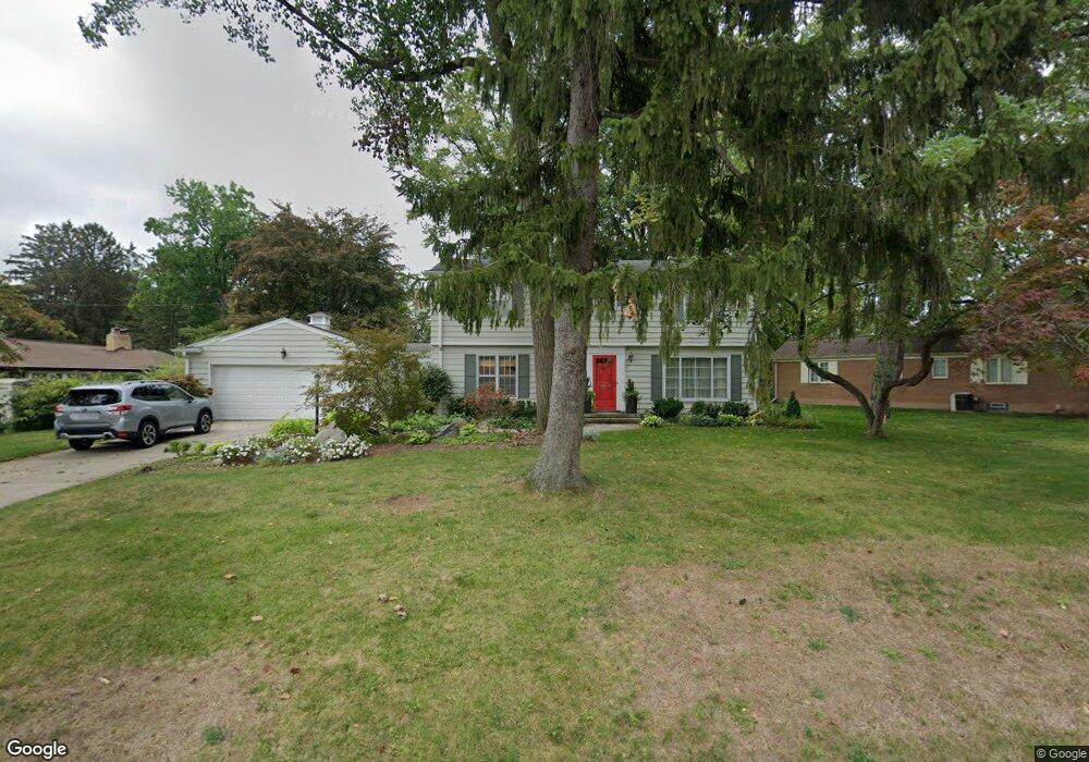
3026 S Cambridge Rd Lansing, MI 48911
Moores River Drive NeighborhoodEstimated Value: $324,483 - $463,000
3
Beds
3
Baths
2,464
Sq Ft
$160/Sq Ft
Est. Value
About This Home
This home is located at 3026 S Cambridge Rd, Lansing, MI 48911 and is currently estimated at $393,621, approximately $159 per square foot. 3026 S Cambridge Rd is a home located in Ingham County with nearby schools including Averill Elementary School, Pattengill Academy, and J.W. Sexton High School.
Ownership History
Date
Name
Owned For
Owner Type
Purchase Details
Closed on
May 6, 2014
Sold by
Roberts Marilyn
Bought by
Roberts Marilyn K and The Marilyn K Roberts Trust
Current Estimated Value
Purchase Details
Closed on
Apr 18, 2002
Sold by
Lindgren Eric D and Lindgren Dora H
Bought by
Roberts Marilyn
Home Financials for this Owner
Home Financials are based on the most recent Mortgage that was taken out on this home.
Original Mortgage
$180,000
Outstanding Balance
$73,605
Interest Rate
6.62%
Mortgage Type
Purchase Money Mortgage
Estimated Equity
$320,016
Purchase Details
Closed on
Mar 1, 1997
Sold by
Knostman June L
Bought by
Lindgren Eric D and Lindgren Dora H
Create a Home Valuation Report for This Property
The Home Valuation Report is an in-depth analysis detailing your home's value as well as a comparison with similar homes in the area
Home Values in the Area
Average Home Value in this Area
Purchase History
| Date | Buyer | Sale Price | Title Company |
|---|---|---|---|
| Roberts Marilyn K | -- | None Available | |
| Roberts Marilyn | $225,000 | -- | |
| Lindgren Eric D | $195,000 | -- |
Source: Public Records
Mortgage History
| Date | Status | Borrower | Loan Amount |
|---|---|---|---|
| Open | Roberts Marilyn | $180,000 |
Source: Public Records
Tax History Compared to Growth
Tax History
| Year | Tax Paid | Tax Assessment Tax Assessment Total Assessment is a certain percentage of the fair market value that is determined by local assessors to be the total taxable value of land and additions on the property. | Land | Improvement |
|---|---|---|---|---|
| 2025 | $5,269 | $141,300 | $28,400 | $112,900 |
| 2024 | $43 | $140,600 | $28,400 | $112,200 |
| 2023 | $4,936 | $129,700 | $28,400 | $101,300 |
| 2022 | $4,443 | $116,800 | $22,700 | $94,100 |
| 2021 | $4,351 | $106,600 | $9,900 | $96,700 |
| 2020 | $4,325 | $96,500 | $17,600 | $78,900 |
| 2019 | $4,150 | $92,400 | $17,600 | $74,800 |
| 2018 | $3,884 | $80,500 | $17,600 | $62,900 |
| 2017 | $3,720 | $80,500 | $17,600 | $62,900 |
| 2016 | $3,557 | $73,200 | $17,600 | $55,600 |
| 2015 | $3,557 | $68,100 | $35,230 | $32,870 |
| 2014 | $3,557 | $66,200 | $35,230 | $30,970 |
Source: Public Records
Map
Nearby Homes
- 3310 W Mount Hope Ave
- 1533 Cambridge Rd
- 3333 Moores River Dr Unit 812
- 2201 Pamela Place
- 2200 Rossiter Place
- 2505 Hanover Dr
- 3508 Muirfield Dr
- 3601 Muirfield Dr
- 2418 Rossiter Place
- 3421 Troon Cir Unit 29
- 3416 Cooley Dr
- 3425 Cooley Dr
- 2710 Bedford Rd
- 3614 Cooley Dr
- 3510 Christine Dr
- 3811 Cooley Dr
- 2409 Victor Ave
- 3214 Gingersnap Ln
- 2905 S Catherine St
- 2838 Sunderland Rd
- 3041 Westchester Rd
- 3016 S Cambridge Rd
- 2940 E Westchester Rd
- 3035 Westchester Rd
- 3025 S Cambridge Rd
- 3031 S Cambridge Rd
- 3118 S Cambridge Rd
- 3017 S Cambridge Rd
- 2930 E Westchester Rd
- 3038 Westchester Rd
- 3001 S Cambridge Rd
- 2935 E Westchester Rd
- 3105 S Cambridge Rd
- 3027 Westchester Rd
- 3036 Westchester Rd
- 1810 Bedford Rd
- 2929 E Westchester Rd
- 3123 S Cambridge Rd
- 2920 E Westchester Rd
- 3021 Westchester Rd