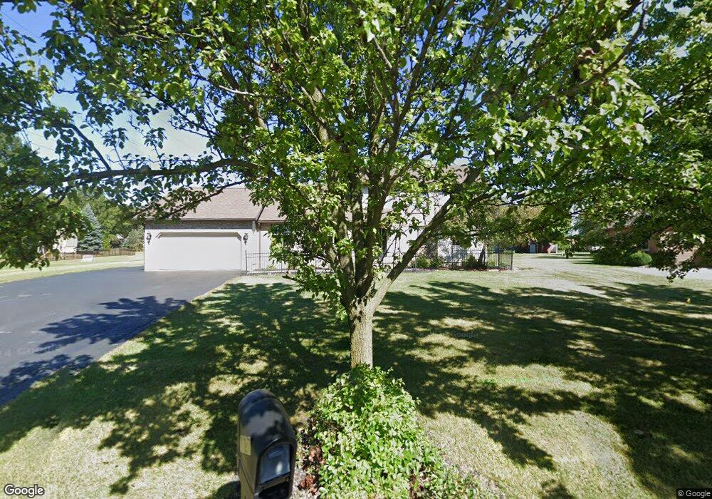
3027 Saddlebrook Findlay, OH 45840
Estimated Value: $402,954 - $456,000
4
Beds
3
Baths
2,520
Sq Ft
$169/Sq Ft
Est. Value
About This Home
This home is located at 3027 Saddlebrook, Findlay, OH 45840 and is currently estimated at $426,239, approximately $169 per square foot. 3027 Saddlebrook is a home located in Hancock County with nearby schools including Liberty-Benton Elementary School, Liberty-Benton Middle School, and Liberty-Benton High School.
Ownership History
Date
Name
Owned For
Owner Type
Purchase Details
Closed on
Jul 20, 2023
Sold by
Swisher Douglas N and Swisher Sharon L
Bought by
Swisher Douglas N and Swisher Sharon L
Current Estimated Value
Purchase Details
Closed on
Dec 18, 1992
Bought by
Swisher Douglas N and Swisher Sharon
Purchase Details
Closed on
Aug 14, 1991
Bought by
Krick Bryan J
Purchase Details
Closed on
Nov 21, 1989
Bought by
Findlay Hillcrest Golf Crs
Create a Home Valuation Report for This Property
The Home Valuation Report is an in-depth analysis detailing your home's value as well as a comparison with similar homes in the area
Home Values in the Area
Average Home Value in this Area
Purchase History
| Date | Buyer | Sale Price | Title Company |
|---|---|---|---|
| Swisher Douglas N | -- | None Listed On Document | |
| Swisher Douglas N | $20,000 | -- | |
| Krick Bryan J | $20,000 | -- | |
| Findlay Hillcrest Golf Crs | -- | -- |
Source: Public Records
Tax History Compared to Growth
Tax History
| Year | Tax Paid | Tax Assessment Tax Assessment Total Assessment is a certain percentage of the fair market value that is determined by local assessors to be the total taxable value of land and additions on the property. | Land | Improvement |
|---|---|---|---|---|
| 2024 | $3,077 | $102,390 | $18,700 | $83,690 |
| 2023 | $3,052 | $102,390 | $18,700 | $83,690 |
| 2022 | $3,051 | $102,390 | $18,700 | $83,690 |
| 2021 | $2,699 | $83,800 | $18,710 | $65,090 |
| 2020 | $2,722 | $83,800 | $18,710 | $65,090 |
| 2019 | $2,612 | $83,800 | $18,710 | $65,090 |
| 2018 | $2,175 | $78,450 | $13,360 | $65,090 |
| 2017 | $1,122 | $78,450 | $13,360 | $65,090 |
| 2016 | $2,182 | $78,450 | $13,360 | $65,090 |
| 2015 | $1,895 | $69,240 | $12,600 | $56,640 |
| 2014 | $1,912 | $69,240 | $12,600 | $56,640 |
| 2012 | $2,335 | $69,240 | $12,600 | $56,640 |
Source: Public Records
Map
Nearby Homes
- 3106 Saddlebrook
- 1405 Cypress Lake
- 3018 Gleneagle Dr
- 6535 Silver Lake Dr
- 1310 Muirfield Dr
- 933 Laurel Ln
- 0 County Road 95 Unit 6097574
- 925 W Melrose Ave
- 905 W Melrose Ave
- 3300 Crosshill Dr
- 615 Hillcrest Ave
- 0 Bushwillow Dr Or Rock Candy Rd Unit Lot 157
- 506 Hillcrest Ave
- 0 Rock Candy Rd Or Bushwillow Dr Unit Lot 173
- 0 Rock Candy Rd Unit Lot 159
- 0 Rock Candy Rd Unit Lot 170
- 0 Rock Candy Rd Unit Lot 172 206819
- 0 Rock Candy Rd Unit Lot 162
- 0 Rock Candy Rd Unit Lot 171
- 0 Rock Candy Rd Unit Lot 168
- 3021 Saddlebrook
- 3101 Saddlebrook
- 3024 Saddlebrook
- 3015 Saddlebrook
- 3010 Pepper Pike
- 3000 Gleneagle Dr
- 3012 Saddlebrook
- 3008 Innisbrook Dr
- 3001 Innisbrook Dr
- 3009 Saddlebrook
- 2932 Gleneagle Dr
- 3014 Pepper Pike
- 3107 Saddlebrook
- 3006 Saddlebrook
- 2928 Gleneagle Dr
- 3000 Innisbrook Dr
- 2935 Innisbrook Dr
- 3001 Saddlebrook
- 3015 Pepper Pike
- 3100 Gleneagle Dr