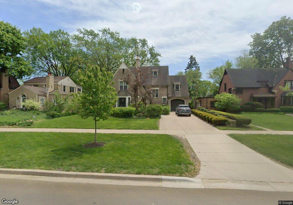
3028 Grant St Evanston, IL 60201
North Evanston NeighborhoodEstimated Value: $1,114,000 - $1,331,224
5
Beds
4
Baths
2,524
Sq Ft
$485/Sq Ft
Est. Value
About This Home
This home is located at 3028 Grant St, Evanston, IL 60201 and is currently estimated at $1,224,556, approximately $485 per square foot. 3028 Grant St is a home located in Cook County with nearby schools including Lincolnwood Elementary School, Haven Middle School, and Evanston Township High School.
Ownership History
Date
Name
Owned For
Owner Type
Purchase Details
Closed on
Sep 27, 2017
Sold by
Uziel Miller Nina and Miller Richard
Bought by
Uziel Miller Nina D and Nina D Uziel Miller Revocable Trust
Current Estimated Value
Purchase Details
Closed on
Jul 14, 2006
Sold by
Holman Judith S and Abiko Bonnie F
Bought by
Miller Richard and Uziel Miller Nina
Home Financials for this Owner
Home Financials are based on the most recent Mortgage that was taken out on this home.
Original Mortgage
$614,200
Interest Rate
6.36%
Mortgage Type
Unknown
Purchase Details
Closed on
Aug 3, 2004
Sold by
Bank One Trust Co Na
Bought by
Holman Judith S and Abiko Bonnie F
Create a Home Valuation Report for This Property
The Home Valuation Report is an in-depth analysis detailing your home's value as well as a comparison with similar homes in the area
Home Values in the Area
Average Home Value in this Area
Purchase History
| Date | Buyer | Sale Price | Title Company |
|---|---|---|---|
| Uziel Miller Nina D | -- | None Available | |
| Miller Richard | $877,500 | First American Title Ins Co | |
| Holman Judith S | -- | -- |
Source: Public Records
Mortgage History
| Date | Status | Borrower | Loan Amount |
|---|---|---|---|
| Previous Owner | Miller Richard | $614,200 |
Source: Public Records
Tax History Compared to Growth
Tax History
| Year | Tax Paid | Tax Assessment Tax Assessment Total Assessment is a certain percentage of the fair market value that is determined by local assessors to be the total taxable value of land and additions on the property. | Land | Improvement |
|---|---|---|---|---|
| 2024 | $21,988 | $94,142 | $28,392 | $65,750 |
| 2023 | $21,074 | $94,142 | $28,392 | $65,750 |
| 2022 | $21,074 | $94,142 | $28,392 | $65,750 |
| 2021 | $18,036 | $71,293 | $17,153 | $54,140 |
| 2020 | $20,055 | $79,695 | $17,153 | $62,542 |
| 2019 | $19,739 | $87,674 | $17,153 | $70,521 |
| 2018 | $17,262 | $66,443 | $14,196 | $52,247 |
| 2017 | $16,828 | $66,443 | $14,196 | $52,247 |
| 2016 | $16,183 | $66,443 | $14,196 | $52,247 |
| 2015 | $14,271 | $55,849 | $11,830 | $44,019 |
| 2014 | $16,061 | $63,042 | $11,830 | $51,212 |
| 2013 | $15,676 | $63,042 | $11,830 | $51,212 |
Source: Public Records
Map
Nearby Homes
- 2221 Lincolnwood Dr
- 2951 Colfax St
- 2113 Forestview Rd
- 2518 Ridgeway Ave
- 2422 Grant St
- 3131 Central St
- 2633 Crawford Ave
- 9833 Keystone Ave
- 2501 Crawford Ave
- 3233 Central St
- 2730 Central St Unit 3A
- 2726 Central St Unit 3D
- 2720 Central St Unit 4C
- 2022 Mcdaniel Ave
- 9628 Keystone Ave
- 2440 Simpson St
- 2555 Gross Point Rd Unit 112
- 3500 Church St Unit 204
- 2101 Pioneer Rd
- 115 16th St
- 3020 Grant St
- 3030 Grant St
- 3016 Grant St
- 3040 Grant St
- 3027 Normandy Place
- 3025 Normandy Place
- 3033 Normandy Place
- 2300 Marcy Ave
- 3044 Grant St
- 3021 Grant St
- 3015 Normandy Place
- 3039 Normandy Place
- 2306 Marcy Ave
- 2236 Central Park Ave
- 2240 Central Park Ave
- 2232 Central Park Ave
- 3045 Normandy Place
- 2228 Central Park Ave
- 2301 Lawndale Ave
- 2310 Marcy Ave