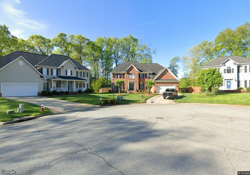
3028 Maple Branch Dr High Point, NC 27265
Bent Tree NeighborhoodEstimated Value: $540,000 - $623,998
4
Beds
4
Baths
4,115
Sq Ft
$139/Sq Ft
Est. Value
About This Home
This home is located at 3028 Maple Branch Dr, High Point, NC 27265 and is currently estimated at $574,000, approximately $139 per square foot. 3028 Maple Branch Dr is a home located in Guilford County with nearby schools including Southwest Elementary School, Southwest Guilford Middle School, and Southwest Guilford High School.
Ownership History
Date
Name
Owned For
Owner Type
Purchase Details
Closed on
Sep 2, 2010
Current Estimated Value
Purchase Details
Closed on
Jun 8, 2000
Sold by
The New Fortis Corp
Bought by
Hunter Willie E and Hunter Lisa M
Home Financials for this Owner
Home Financials are based on the most recent Mortgage that was taken out on this home.
Original Mortgage
$249,900
Interest Rate
7.25%
Create a Home Valuation Report for This Property
The Home Valuation Report is an in-depth analysis detailing your home's value as well as a comparison with similar homes in the area
Home Values in the Area
Average Home Value in this Area
Purchase History
| Date | Buyer | Sale Price | Title Company |
|---|---|---|---|
| -- | $269,000 | -- | |
| Hunter Willie E | $277,500 | -- |
Source: Public Records
Mortgage History
| Date | Status | Borrower | Loan Amount |
|---|---|---|---|
| Previous Owner | Hunter Willie E | $249,900 |
Source: Public Records
Tax History
| Year | Tax Paid | Tax Assessment Tax Assessment Total Assessment is a certain percentage of the fair market value that is determined by local assessors to be the total taxable value of land and additions on the property. | Land | Improvement |
|---|---|---|---|---|
| 2025 | $6,383 | $463,200 | $85,000 | $378,200 |
| 2024 | $6,383 | $463,200 | $85,000 | $378,200 |
| 2023 | $6,383 | $463,200 | $85,000 | $378,200 |
| 2022 | $6,244 | $463,200 | $85,000 | $378,200 |
| 2021 | $4,182 | $303,500 | $48,000 | $255,500 |
| 2020 | $4,182 | $303,500 | $48,000 | $255,500 |
| 2019 | $4,182 | $303,500 | $0 | $0 |
| 2018 | $4,161 | $303,500 | $0 | $0 |
| 2017 | $4,161 | $303,500 | $0 | $0 |
| 2016 | $3,686 | $262,800 | $0 | $0 |
| 2015 | $3,705 | $262,800 | $0 | $0 |
| 2014 | $3,769 | $262,800 | $0 | $0 |
Source: Public Records
Map
Nearby Homes
- 4301 Bradbury Way
- 3273 Alyssa Way
- 3025 Sycamore Point Trail
- 3477 Lilliefield Ln
- 4008 Deerfield St
- 3114 Ironwood Flat Dr
- 1515 Skeet Club Rd
- 4257 Pelican St
- 3924 Braddock Rd
- 1517 Skeet Club Rd
- 4358 Ashton Oaks Ct
- 3905 Wynne Brook Ct
- 3650 Single Leaf Ct
- 4304 Hardin Ct
- 3421 Wildwood Ave
- 4001 Tesa Ct
- 3912 Wynne Brook Ct
- 748 Carneros Cir
- 715 Piedmont Crossing Dr Unit 14
- 2431 Tweedmore Ct
- 3024 Maple Branch Dr
- 3032 Maple Branch Dr
- 3020 Maple Branch Dr
- 3107 Timberwolf Ave
- 3101 Timberwolf Ave
- 3111 Timberwolf Ave
- 3016 Maple Branch Dr
- 3035 Maple Branch Dr
- 3009 Timberwolf Ave
- 3113 Timberwolf Ave
- 3104 Timberwolf Ave
- 3106 Timberwolf Ave
- 3108 Timberwolf Ave
- 3115 Timberwolf Ave
- 3012 Maple Branch Dr
- 3027 Maple Branch Dr
- 3007 Timberwolf Ave
- 3110 Timberwolf Ave
- 3102 Timberwolf Ave
- 3023 Maple Branch Dr
Your Personal Tour Guide
Ask me questions while you tour the home.