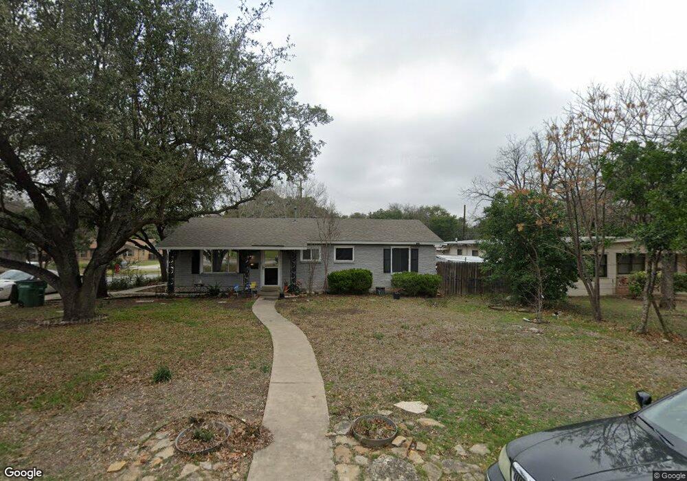
303 Burnside Dr San Antonio, TX 78209
Oak Park-Northwood NeighborhoodEstimated Value: $466,790 - $530,000
4
Beds
3
Baths
1,935
Sq Ft
$258/Sq Ft
Est. Value
About This Home
This home is located at 303 Burnside Dr, San Antonio, TX 78209 and is currently estimated at $499,698, approximately $258 per square foot. 303 Burnside Dr is a home located in Bexar County with nearby schools including Woodridge Elementary School, Alamo Heights Junior School, and Alamo Heights High School.
Ownership History
Date
Name
Owned For
Owner Type
Purchase Details
Closed on
Oct 16, 2009
Sold by
Bizzell James and Bizzell Brenda
Bought by
Baray Mario A
Current Estimated Value
Home Financials for this Owner
Home Financials are based on the most recent Mortgage that was taken out on this home.
Original Mortgage
$209,950
Outstanding Balance
$137,513
Interest Rate
5.14%
Mortgage Type
VA
Estimated Equity
$362,185
Purchase Details
Closed on
Mar 15, 2002
Sold by
Lejeune Robert Lee and Lejeune Doris M
Bought by
Bizzell James and Bizzell Brenda
Home Financials for this Owner
Home Financials are based on the most recent Mortgage that was taken out on this home.
Original Mortgage
$130,050
Interest Rate
7.01%
Create a Home Valuation Report for This Property
The Home Valuation Report is an in-depth analysis detailing your home's value as well as a comparison with similar homes in the area
Home Values in the Area
Average Home Value in this Area
Purchase History
| Date | Buyer | Sale Price | Title Company |
|---|---|---|---|
| Baray Mario A | -- | Commerce Title Company | |
| Bizzell James | -- | Commerce Title |
Source: Public Records
Mortgage History
| Date | Status | Borrower | Loan Amount |
|---|---|---|---|
| Open | Baray Mario A | $209,950 | |
| Previous Owner | Bizzell James | $130,050 |
Source: Public Records
Tax History Compared to Growth
Tax History
| Year | Tax Paid | Tax Assessment Tax Assessment Total Assessment is a certain percentage of the fair market value that is determined by local assessors to be the total taxable value of land and additions on the property. | Land | Improvement |
|---|---|---|---|---|
| 2025 | -- | $430,340 | $241,630 | $188,710 |
| 2024 | -- | $419,362 | $241,630 | $198,900 |
| 2023 | $8,584 | $381,238 | $241,630 | $178,490 |
| 2022 | $8,390 | $346,580 | $166,880 | $202,420 |
| 2021 | $7,863 | $315,073 | $145,100 | $170,390 |
| 2020 | $7,156 | $286,430 | $100,100 | $186,330 |
| 2019 | $7,326 | $286,370 | $100,100 | $186,270 |
| 2018 | $7,010 | $279,850 | $100,100 | $179,750 |
| 2017 | $6,534 | $260,840 | $100,100 | $160,740 |
| 2016 | $6,210 | $247,940 | $96,890 | $151,050 |
| 2015 | -- | $244,020 | $96,890 | $147,130 |
| 2014 | -- | $226,560 | $0 | $0 |
Source: Public Records
Map
Nearby Homes
- 215 Oakleaf Dr
- 134 Rockhill Dr
- 205 Larkwood Dr
- 419 Woodcrest Dr
- 127 Larkwood Dr
- 318 Northridge Dr
- 2603 Brookhurst Dr
- 315 Tophill Rd
- 215 Tophill Rd
- 351 Northridge Dr
- 8033 N New Braunfels Ave Unit 400D
- 8033 N New Braunfels Ave Unit 500C
- 8033 N New Braunfels Ave Unit 300E
- 2434 Toftrees Dr
- 510 Burnside Dr
- 623 E Nottingham Dr
- 411 E Nottingham Dr
- 631 Robinhood Place
- 530 Burnside Dr
- 2119 Flamingo St
- 307 Burnside Dr
- 2338 Blanton Dr
- 311 Burnside Dr
- 302 Burnside Dr
- 306 Burnside Dr
- 2343 Blanton Dr
- 2334 Blanton Dr
- 310 Burnside Dr
- 2339 Blanton Dr
- 315 Burnside Dr
- 7627 Woodridge Dr
- 2335 Blanton Dr
- 314 Burnside Dr
- 2330 Blanton Dr
- 7623 Woodridge Dr
- 303 Oakleaf Dr
- 319 Burnside Dr
- 307 Oakleaf Dr
- 7727 Woodridge Dr
- 311 Oakleaf Dr