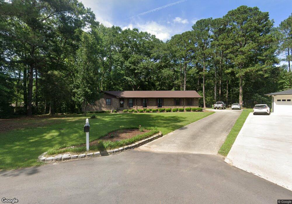
303 Cherokee Cir Jasper, AL 35501
Estimated Value: $241,391 - $298,000
--
Bed
--
Bath
2,193
Sq Ft
$118/Sq Ft
Est. Value
About This Home
This home is located at 303 Cherokee Cir, Jasper, AL 35501 and is currently estimated at $258,848, approximately $118 per square foot. 303 Cherokee Cir is a home located in Walker County with nearby schools including T. R. Simmons Elementary School, Maddox Intermediate School, and Memorial Park Elementary School.
Ownership History
Date
Name
Owned For
Owner Type
Purchase Details
Closed on
Apr 15, 2021
Sold by
Saul Andrew and Saul Elma
Bought by
Hort Matthew Ryan and Hoobler Kayla Roberts
Current Estimated Value
Home Financials for this Owner
Home Financials are based on the most recent Mortgage that was taken out on this home.
Original Mortgage
$173,000
Outstanding Balance
$156,198
Interest Rate
3%
Mortgage Type
New Conventional
Estimated Equity
$102,650
Create a Home Valuation Report for This Property
The Home Valuation Report is an in-depth analysis detailing your home's value as well as a comparison with similar homes in the area
Home Values in the Area
Average Home Value in this Area
Purchase History
| Date | Buyer | Sale Price | Title Company |
|---|---|---|---|
| Hort Matthew Ryan | $188,000 | None Available |
Source: Public Records
Mortgage History
| Date | Status | Borrower | Loan Amount |
|---|---|---|---|
| Open | Hort Matthew Ryan | $173,000 |
Source: Public Records
Tax History Compared to Growth
Tax History
| Year | Tax Paid | Tax Assessment Tax Assessment Total Assessment is a certain percentage of the fair market value that is determined by local assessors to be the total taxable value of land and additions on the property. | Land | Improvement |
|---|---|---|---|---|
| 2024 | $816 | $21,490 | $1,400 | $20,090 |
| 2023 | $816 | $19,180 | $1,400 | $17,780 |
| 2022 | $634 | $16,940 | $1,400 | $15,540 |
| 2021 | $618 | $15,590 | $1,400 | $14,190 |
| 2020 | $580 | $15,600 | $1,400 | $14,200 |
| 2019 | $609 | $14,920 | $1,400 | $13,520 |
| 2018 | $521 | $14,120 | $1,400 | $12,720 |
| 2017 | $1,129 | $28,220 | $2,800 | $25,420 |
| 2016 | $1,129 | $28,220 | $2,800 | $25,420 |
| 2015 | $1,081 | $27,020 | $2,800 | $24,220 |
| 2014 | $1,050 | $26,240 | $2,800 | $23,440 |
| 2013 | $6,655 | $26,240 | $2,800 | $23,440 |
Source: Public Records
Map
Nearby Homes
- 2305 Wildwood Dr
- 106 Cherokee Dr
- 2809 Wildwood Dr
- 207 Shererwood Dr
- 0 Jones Dairy Rd Unit 21419563
- 601 Glen Oaks Cir
- 564 Troubadour Ln
- 2900 Highway 78
- 0 Highway 78 E
- 21 Lancelot Cove
- DUPONT Plan at Viking Cove
- CABOT Plan at Viking Cove
- ROANOKE Plan at Viking Cove
- 53 Lancelot Cove
- 64 Lancelot Cove
- 88 Lancelot Cove
- 112 Lancelot Cove
- 1301 S Walston Bridge Rd
- 617 Golden Eagle Cir
- 900 Shades Cliff Rd
- 301 Cherokee Dr
- 301 Cherokee Dr
- 2405 Wildwood Dr
- 2403 Wildwood Dr
- 79 Cherokee Dr
- 302 Cherokee Cir
- 302 Cherokee Dr
- 0 Wildwood Drive Cherokee Dr Unit 21-688
- 204 Cherokee Cir
- 203 Cherokee Cir
- 300 Cherokee Dr
- 202 Cherokee Cir
- 204 Cherokee Dr
- 2301 Wildwood Dr
- 2303 Wildwood Dr
- 2203 Wildwood Dr
- 303 Cherokee Dr
- 200 Cherokee Cir
- 202 Cherokee Dr
- 2603 Wildwood Dr