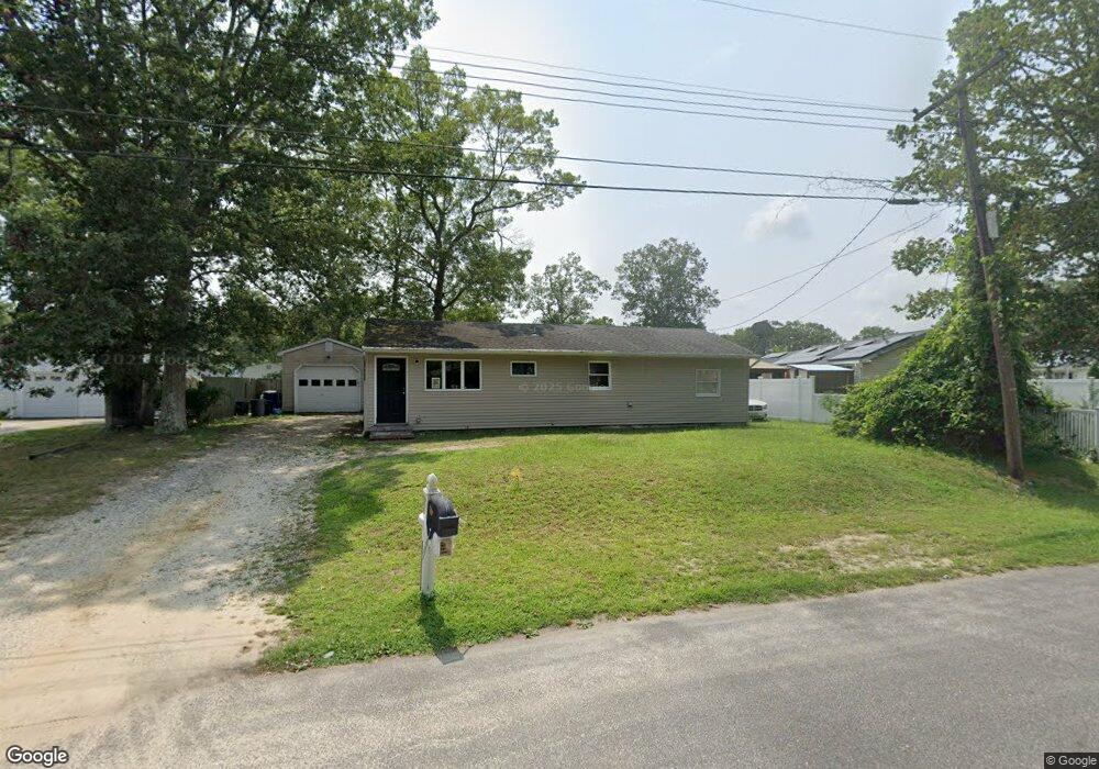
303 Enterprise Dr Forked River, NJ 08731
Estimated Value: $354,000 - $413,000
3
Beds
2
Baths
1,012
Sq Ft
$367/Sq Ft
Est. Value
About This Home
This home is located at 303 Enterprise Dr, Forked River, NJ 08731 and is currently estimated at $371,617, approximately $367 per square foot. 303 Enterprise Dr is a home located in Ocean County with nearby schools including Lacey Township High School.
Ownership History
Date
Name
Owned For
Owner Type
Purchase Details
Closed on
Dec 17, 2018
Sold by
Daly John and Piaggio Daly Jeanette
Bought by
Yellowstone Group Llc
Current Estimated Value
Home Financials for this Owner
Home Financials are based on the most recent Mortgage that was taken out on this home.
Original Mortgage
$99,900
Interest Rate
4.6%
Mortgage Type
Commercial
Purchase Details
Closed on
Jan 11, 2018
Sold by
Ocean County Tax Collector
Bought by
Us Bank Na
Purchase Details
Closed on
Feb 28, 2007
Sold by
Ewan Neil S and Hammarstrom Laurie
Bought by
Daly John and Piaggio Daly Jeanette
Home Financials for this Owner
Home Financials are based on the most recent Mortgage that was taken out on this home.
Original Mortgage
$229,000
Interest Rate
6.4%
Mortgage Type
Purchase Money Mortgage
Create a Home Valuation Report for This Property
The Home Valuation Report is an in-depth analysis detailing your home's value as well as a comparison with similar homes in the area
Home Values in the Area
Average Home Value in this Area
Purchase History
We collect this data history from publicly available records. To have your information removed, we recommend requesting removal directly through your county’s website.
| Date | Buyer | Sale Price | Title Company |
|---|---|---|---|
| Yellowstone Group Llc | $86,000 | Concord Title Agency Llc | |
| Us Bank Na | $797 | -- | |
| Daly John | $229,000 | Fidelity National Title Insu |
Source: Public Records
Mortgage History
We collect this data history from publicly available records. To have your information removed, we recommend requesting removal directly through your county’s website.
| Date | Status | Borrower | Loan Amount |
|---|---|---|---|
| Previous Owner | Yellowstone Group Llc | $99,900 | |
| Previous Owner | Daly John | $229,000 |
Source: Public Records
Tax History
| Year | Tax Paid | Tax Assessment Tax Assessment Total Assessment is a certain percentage of the fair market value that is determined by local assessors to be the total taxable value of land and additions on the property. | Land | Improvement |
|---|---|---|---|---|
| 2025 | $4,250 | $155,400 | $80,000 | $75,400 |
| 2024 | $3,681 | $155,400 | $80,000 | $75,400 |
| 2023 | $3,447 | $155,400 | $80,000 | $75,400 |
| 2022 | $3,447 | $152,300 | $80,000 | $72,300 |
| 2021 | $3,389 | $152,300 | $80,000 | $72,300 |
| 2020 | $3,281 | $152,300 | $80,000 | $72,300 |
| 2019 | $3,223 | $152,300 | $80,000 | $72,300 |
| 2018 | $3,185 | $152,300 | $80,000 | $72,300 |
| 2017 | $3,111 | $152,300 | $80,000 | $72,300 |
| 2016 | $3,099 | $152,300 | $80,000 | $72,300 |
| 2015 | $2,961 | $152,300 | $80,000 | $72,300 |
| 2014 | $3,308 | $192,300 | $120,000 | $72,300 |
Source: Public Records
Map
Nearby Homes
- 201 Nautilus Blvd
- 326 Normandie Dr
- 244 Juniper Ln
- 304 Merrimac Rd
- 353 Constitution Dr
- 363 Constitution Dr
- 371 Constitution Dr
- 234 Spruce Ln
- 137 Sunset Dr
- 203 Sunset Dr
- 101 Foxwood Ln
- 406 Cyprus Ct
- 504 Cyprus Ct
- 1304 Cyprus Ct
- 27 Penn Place
- 427 Boxwood Dr
- 26 Bayberry Dr
- 503 Buttonwood Dr
- 443 Stoney Point Dr
- 127 Driftwood Ln
- 303 Normandie Dr
- 0 Enterprise Dr Unit 21225124
- 0 Enterprise Dr Unit NJOC217954
- 0 Enterprise Dr Unit NJOC216756
- 309 Enterprise Dr
- 315 Normandie Dr
- 104 Nautilus Blvd
- 304 Enterprise Dr
- 102 Nautilus Blvd
- 108 Nautilus Blvd
- 311 Enterprise Dr
- 312 Normandie Dr
- 310 Normandie Dr
- 306 Normandie Dr
- 112 Nautilus Blvd
- 317 Normandie Dr
- 301 Normandie Dr
- 304 Normandie Dr
- 35 Titanic Rd
- 308 Enterprise Dr
Your Personal Tour Guide
Ask me questions while you tour the home.