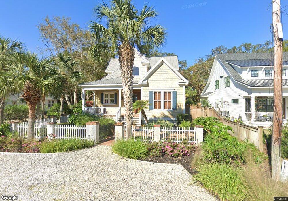
303 Kelsall Ave Saint Simons Island, GA 31522
Estimated Value: $1,583,347 - $1,778,000
3
Beds
4
Baths
2,838
Sq Ft
$593/Sq Ft
Est. Value
About This Home
This home is located at 303 Kelsall Ave, Saint Simons Island, GA 31522 and is currently estimated at $1,681,587, approximately $592 per square foot. 303 Kelsall Ave is a home located in Glynn County with nearby schools including St. Simons Elementary School, Glynn Middle School, and Glynn Academy.
Ownership History
Date
Name
Owned For
Owner Type
Purchase Details
Closed on
Jun 29, 2007
Sold by
Cherry John R
Bought by
Burkard Robert and Burkard Jerry L
Current Estimated Value
Home Financials for this Owner
Home Financials are based on the most recent Mortgage that was taken out on this home.
Original Mortgage
$125,000
Outstanding Balance
$77,230
Interest Rate
6.37%
Mortgage Type
New Conventional
Estimated Equity
$1,604,357
Create a Home Valuation Report for This Property
The Home Valuation Report is an in-depth analysis detailing your home's value as well as a comparison with similar homes in the area
Home Values in the Area
Average Home Value in this Area
Purchase History
| Date | Buyer | Sale Price | Title Company |
|---|---|---|---|
| Burkard Robert | $812,000 | -- |
Source: Public Records
Mortgage History
| Date | Status | Borrower | Loan Amount |
|---|---|---|---|
| Open | Burkard Robert | $125,000 |
Source: Public Records
Tax History Compared to Growth
Tax History
| Year | Tax Paid | Tax Assessment Tax Assessment Total Assessment is a certain percentage of the fair market value that is determined by local assessors to be the total taxable value of land and additions on the property. | Land | Improvement |
|---|---|---|---|---|
| 2025 | $14,621 | $583,000 | $200,000 | $383,000 |
| 2024 | $10,444 | $416,440 | $145,520 | $270,920 |
| 2023 | $2,779 | $416,440 | $145,520 | $270,920 |
| 2022 | $2,962 | $387,320 | $116,400 | $270,920 |
| 2021 | $3,044 | $352,800 | $87,320 | $265,480 |
| 2020 | $3,110 | $317,880 | $52,400 | $265,480 |
| 2019 | $3,110 | $317,880 | $52,400 | $265,480 |
| 2018 | $1,760 | $317,880 | $52,400 | $265,480 |
| 2017 | $1,760 | $317,880 | $52,400 | $265,480 |
| 2016 | $1,312 | $234,200 | $52,400 | $181,800 |
| 2015 | $1,312 | $169,360 | $52,400 | $116,960 |
| 2014 | $1,312 | $169,360 | $52,400 | $116,960 |
Source: Public Records
Map
Nearby Homes
- 413 Ashantilly Ave
- 409 Kelsall Ave
- 536 Delegal St
- 533 Timmons St
- 805 Mallery St Unit E
- 907 Mallery St
- 213 Magnolia Ave
- 800 Mallery St Unit 52
- 800 Mallery St Unit 90
- 800 Mallery St Unit C-30
- 800 Mallery St Unit J-89
- 316 Forest Oaks
- 1000 Mallery Street Extension Unit B5
- 1000 Mallery Street Extension Unit G62
- 850 Mallery St Unit 6N
- 850 Mallery St Unit 8K
- 850 Mallery St Unit 6A
- 850 Mallery St Unit 4W
- 850 Mallery St Unit S 3
- 850 Mallery St Unit 4O
- 305 Kelsall Ave
- 307 Kelsall Ave
- 301 Anguilla Ave
- 302 Kelsall Ave
- 306 Kelsall Ave
- 308 Kelsall Ave
- 303 Anguilla Ave
- 311 Kelsall Ave
- 222 Anguilla Ave
- 310 Kelsall Ave
- 224 Anguilla Ave
- 302 Anguilla Ave
- 220 Anguilla Ave
- 405 Ashantilly Ave
- 403 Ashantilly Ave
- 312 Kelsall Ave
- 304 Anguilla Ave
- 305 Anguilla Ave
- 313 Kelsall Ave
- 218 Anguilla Ave