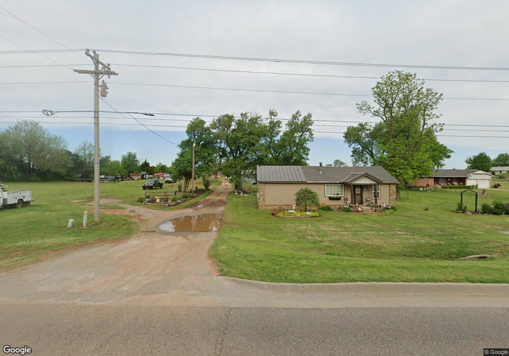
303 N Mustang Rd Tuttle, OK 73089
Estimated Value: $126,742 - $255,000
2
Beds
1
Bath
984
Sq Ft
$202/Sq Ft
Est. Value
About This Home
This home is located at 303 N Mustang Rd, Tuttle, OK 73089 and is currently estimated at $198,686, approximately $201 per square foot. 303 N Mustang Rd is a home located in Grady County with nearby schools including Tuttle Elementary School, Tuttle Intermediate School, and Tuttle Middle School.
Ownership History
Date
Name
Owned For
Owner Type
Purchase Details
Closed on
Oct 1, 2025
Sold by
Smalley Kirk Merton
Bought by
Hughes Kristi Kay and Smalley Heather Ashley
Current Estimated Value
Purchase Details
Closed on
Jul 29, 2025
Sold by
Jessup Gloria and Solheim Gloria
Bought by
Harwell Gary and Harwell Melissa
Purchase Details
Closed on
Sep 27, 2014
Sold by
Watson Bobby R and Watson Nora J
Bought by
Watson Bobby R
Create a Home Valuation Report for This Property
The Home Valuation Report is an in-depth analysis detailing your home's value as well as a comparison with similar homes in the area
Home Values in the Area
Average Home Value in this Area
Purchase History
| Date | Buyer | Sale Price | Title Company |
|---|---|---|---|
| Hughes Kristi Kay | -- | None Listed On Document | |
| Harwell Gary | $1,200,000 | Stewart Title Of Oklahoma | |
| Harwell Gary | $1,200,000 | Stewart Title Of Oklahoma | |
| Watson Bobby R | -- | -- |
Source: Public Records
Tax History Compared to Growth
Tax History
| Year | Tax Paid | Tax Assessment Tax Assessment Total Assessment is a certain percentage of the fair market value that is determined by local assessors to be the total taxable value of land and additions on the property. | Land | Improvement |
|---|---|---|---|---|
| 2025 | $600 | $6,696 | $2,458 | $4,238 |
| 2024 | $625 | $6,501 | $2,387 | $4,114 |
| 2023 | $625 | $6,312 | $2,125 | $4,187 |
| 2022 | $352 | $4,205 | $2,134 | $2,071 |
| 2021 | $340 | $4,084 | $2,031 | $2,053 |
| 2020 | $330 | $3,965 | $1,751 | $2,214 |
| 2019 | $312 | $3,850 | $1,479 | $2,371 |
| 2018 | $283 | $3,737 | $1,467 | $2,270 |
| 2017 | $279 | $3,628 | $1,338 | $2,290 |
| 2016 | $273 | $3,522 | $1,181 | $2,341 |
| 2015 | $238 | $3,420 | $1,001 | $2,419 |
| 2014 | $238 | $3,320 | $757 | $2,563 |
Source: Public Records
Map
Nearby Homes
- 5405 Daxton Dr
- 441 Silas Dr
- 5331 Daxton Dr
- 5417 Daxton Dr
- 408 Kale Rd
- 436 Labelle Ln
- 416 Labelle Ln
- 408 Labelle Ln
- 5409 Daxton Dr
- 5413 Daxton Dr
- 428 Labelle Ln
- 412 Labelle Ln
- 404 Labelle Ln
- 634 Audrey Dr
- RC Murrow II Plan at Hollow Brook
- RC Roselyn Plan at Hollow Brook
- RC Wright Plan at Hollow Brook
- RC Foster II Plan at Hollow Brook
- RC Magnolia Plan at Hollow Brook
- RC Armstrong II Plan at Hollow Brook
- 311 N Mustang Rd
- 217 N Mustang Rd
- 210 N Mustang Rd
- 303 Timber Creek Dr
- 315 N Mustang Rd
- 317 N Mustang Rd
- 225 Timber Creek Dr
- 313 N Mustang Rd
- 113 N Mustang Rd
- 404 N Mustang Rd
- 305 Timber Creek Dr
- 224 Timber Creek Dr
- 219 Timber Creek Dr
- 5115 Hughes Dr
- 206 Timber Creek Dr
- 5008 Hughes Dr
- 409 Timber Creek Dr
- 4907 E Highway 37
- 5113 Hughes Dr
- 115 Timber Creek Dr