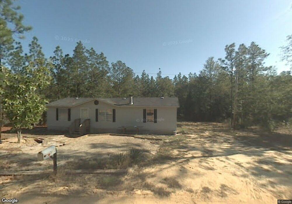
303 Sampson Rd Gilbert, SC 29054
Estimated Value: $29,468 - $218,000
Studio
--
Bath
--
Sq Ft
43,124
Sq Ft Lot
About This Home
This home is located at 303 Sampson Rd, Gilbert, SC 29054 and is currently estimated at $136,867. 303 Sampson Rd is a home located in Lexington County with nearby schools including Gilbert Elementary School, Gilbert Middle School, and Gilbert High School.
Ownership History
Date
Name
Owned For
Owner Type
Purchase Details
Closed on
Feb 22, 2024
Sold by
Price Tammy
Bought by
Aiken Housing Center Inc
Current Estimated Value
Purchase Details
Closed on
Oct 6, 2021
Sold by
Price Stephen Cory
Bought by
Price Tammy
Purchase Details
Closed on
Feb 5, 2013
Sold by
Glover Jamie and Glover Stephanie
Bought by
Price Stephen Cory
Purchase Details
Closed on
Jun 3, 2011
Sold by
Wagner Peter Anthony
Bought by
Glover Jamie and Glover Stephanie
Purchase Details
Closed on
Jun 27, 2005
Sold by
Wagner Peter Anthony
Bought by
Schultheis Amy E
Home Financials for this Owner
Home Financials are based on the most recent Mortgage that was taken out on this home.
Original Mortgage
$140,983
Interest Rate
5.57%
Mortgage Type
Purchase Money Mortgage
Purchase Details
Closed on
Aug 28, 2003
Sold by
Gunter Cedra Kay
Bought by
Wagner Peter A
Create a Home Valuation Report for This Property
The Home Valuation Report is an in-depth analysis detailing your home's value as well as a comparison with similar homes in the area
Purchase History
| Date | Buyer | Sale Price | Title Company |
|---|---|---|---|
| Aiken Housing Center Inc | $19,000 | None Listed On Document | |
| Price Tammy | -- | None Available | |
| Price Stephen Cory | $4,000 | -- | |
| Glover Jamie | $800 | -- | |
| Schultheis Amy E | $12,665 | -- | |
| Wagner Peter A | $16,000 | -- |
Source: Public Records
Mortgage History
| Date | Status | Borrower | Loan Amount |
|---|---|---|---|
| Previous Owner | Schultheis Amy E | $140,983 |
Source: Public Records
Tax History
| Year | Tax Paid | Tax Assessment Tax Assessment Total Assessment is a certain percentage of the fair market value that is determined by local assessors to be the total taxable value of land and additions on the property. | Land | Improvement |
|---|---|---|---|---|
| 2024 | $529 | $762 | $594 | $168 |
| 2023 | $377 | $762 | $594 | $168 |
| 2022 | $362 | $762 | $594 | $168 |
| 2020 | $364 | $762 | $594 | $168 |
| 2019 | $347 | $702 | $534 | $168 |
| 2018 | $345 | $702 | $534 | $168 |
| 2017 | $339 | $702 | $534 | $168 |
| 2016 | $328 | $702 | $534 | $168 |
| 2014 | $309 | $714 | $594 | $120 |
| 2013 | -- | $710 | $590 | $120 |
Source: Public Records
Map
Nearby Homes
- 820 Martin Smith Rd
- 342 Isiah Hallman Rd
- 257 Rimrock Rd
- 0 Ben Franklin Rd
- 201 Cedar Branch Ct
- 7050 Platt Springs Rd
- 0 Kelly Day Rd
- TBD Neely Wingard at Musket Rd
- 3562 Calks Ferry Rd
- 238 Bronze Bluff Ct
- 162 Copper Bluff Rd
- 1519 Elbert Taylor Rd
- 154 Copper Bluff Rd
- 304 Downwind Leg Rd
- 0 Platt Springs Rd Unit 601659
- 132 Hooker St
- Lot 15 Windsong Ln
- TBD Windsong Ln Unit 15
- TBD Windsong Ln Unit 16
- Lot 16 Windsong Ln
- 351 Sampson Rd
- 311 Sampson Rd
- 307 Sampson Rd
- 307 Sampson Rd
- 329 Elbert Taylor Rd
- 327 Elbert Taylor Rd
- 327 Elbert Taylor Rd
- 291 Sampson Rd
- 320 Elbert Taylor Rd
- 260 Elbert Taylor Rd
- 330 Elbert Taylor Rd
- 221 Elbert Taylor Rd
- 288 Sampson Rd
- 334 Elbert Taylor Rd
- 209 Elbert Taylor Rd
- 179 Seleta Cir
- 313 Sampson Rd
- 335 Elbert Taylor Rd
- 245 Sampson Rd
- 232 Elbert Taylor Rd
Your Personal Tour Guide
Ask me questions while you tour the home.