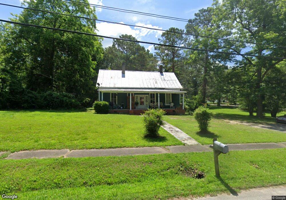
303 Thornton St Union Point, GA 30669
Estimated Value: $97,000 - $223,000
3
Beds
2
Baths
1,540
Sq Ft
$100/Sq Ft
Est. Value
About This Home
This home is located at 303 Thornton St, Union Point, GA 30669 and is currently estimated at $153,758, approximately $99 per square foot. 303 Thornton St is a home located in Greene County with nearby schools including Greene County High School.
Ownership History
Date
Name
Owned For
Owner Type
Purchase Details
Closed on
Apr 18, 2021
Sold by
Swenson Ann Charlotte
Bought by
Yalls Properties Llc
Current Estimated Value
Purchase Details
Closed on
Mar 25, 2009
Sold by
Fannie Mae
Bought by
Roberts Thomas B and Swenson Ann C
Purchase Details
Closed on
Oct 23, 2008
Sold by
Mapp Vivian
Bought by
Countrywide Home Loans Inc
Purchase Details
Closed on
Jul 2, 2008
Sold by
Countrywide Loans Inc Home
Bought by
Federal National Mortgage Association
Purchase Details
Closed on
Sep 23, 2004
Sold by
Mapp Vivian
Bought by
Smoke Rise Agents Realty Inc
Purchase Details
Closed on
Jul 1, 2004
Sold by
Crawford Home Improvement Ctr
Bought by
Mapp Vivian D
Purchase Details
Closed on
Aug 20, 2003
Sold by
Pearson Rico
Bought by
Crawford Home Improvement Ctr
Purchase Details
Closed on
Aug 18, 2003
Sold by
Wells Fargo Bank Minnesota
Bought by
Pearson Rico
Purchase Details
Closed on
Aug 17, 2003
Sold by
Lehman Capital
Bought by
Wells Fargo Bank Minnesota
Purchase Details
Closed on
Apr 14, 2003
Sold by
Dean Tina and Jeffrey Scott
Bought by
Lehman Capital
Purchase Details
Closed on
Jan 7, 2000
Sold by
Dickens Alvin R
Bought by
Dean Tina and Jeffrey Scott
Purchase Details
Closed on
Aug 2, 1995
Sold by
Dickson Alvin R
Bought by
Dickens Alvin R
Purchase Details
Closed on
Aug 1, 1995
Sold by
Stone Ethel Louise Edwards
Bought by
Dickson Alvin R
Purchase Details
Closed on
Jul 31, 1995
Sold by
Hill Ruth Beatrice and Hill
Bought by
Stone Ethel Louise Edwards
Purchase Details
Closed on
Jul 30, 1995
Sold by
Dickens Alvin R
Bought by
Hill Ruth Beatrice and Hill
Purchase Details
Closed on
Jul 11, 1995
Sold by
Stone Ward
Bought by
Dickens Alvin R
Purchase Details
Closed on
Jan 1, 1995
Sold by
Edwards Annie and Edwards Dobbins B
Bought by
Stone Ward
Purchase Details
Closed on
Jan 1, 1945
Sold by
Edwards C E Est
Bought by
Edwards Annie and Edwards Dobbins B
Purchase Details
Closed on
Jan 1, 1942
Bought by
Edwards C E Est
Create a Home Valuation Report for This Property
The Home Valuation Report is an in-depth analysis detailing your home's value as well as a comparison with similar homes in the area
Home Values in the Area
Average Home Value in this Area
Purchase History
| Date | Buyer | Sale Price | Title Company |
|---|---|---|---|
| Yalls Properties Llc | -- | -- | |
| Roberts Thomas B | $27,000 | -- | |
| Countrywide Home Loans Inc | -- | -- | |
| Federal National Mortgage Association | -- | -- | |
| Countrywide Home Loans Inc | -- | -- | |
| Smoke Rise Agents Realty Inc | -- | -- | |
| Mapp Vivian D | $75,000 | -- | |
| Crawford Home Improvement Ctr | $79,000 | -- | |
| Pearson Rico | $33,000 | -- | |
| Wells Fargo Bank Minnesota | -- | -- | |
| Lehman Capital | -- | -- | |
| Dean Tina | $45,000 | -- | |
| Dickens Alvin R | $24,500 | -- | |
| Dickson Alvin R | -- | -- | |
| Stone Ethel Louise Edwards | -- | -- | |
| Hill Ruth Beatrice | -- | -- | |
| Dickens Alvin R | $2,500 | -- | |
| Stone Ward | -- | -- | |
| Edwards Annie | -- | -- | |
| Edwards C E Est | -- | -- |
Source: Public Records
Tax History Compared to Growth
Tax History
| Year | Tax Paid | Tax Assessment Tax Assessment Total Assessment is a certain percentage of the fair market value that is determined by local assessors to be the total taxable value of land and additions on the property. | Land | Improvement |
|---|---|---|---|---|
| 2025 | $924 | $30,840 | $3,080 | $27,760 |
| 2024 | $877 | $28,920 | $3,080 | $25,840 |
| 2023 | $659 | $27,920 | $3,080 | $24,840 |
| 2022 | $622 | $26,200 | $3,080 | $23,120 |
| 2021 | $611 | $28,600 | $3,080 | $25,520 |
| 2020 | $562 | $19,800 | $5,400 | $14,400 |
| 2019 | $581 | $19,800 | $5,400 | $14,400 |
| 2018 | $442 | $19,800 | $5,400 | $14,400 |
| 2017 | $523 | $19,808 | $5,400 | $14,408 |
| 2016 | $547 | $20,625 | $5,400 | $15,225 |
| 2015 | $514 | $20,624 | $5,400 | $15,225 |
| 2014 | $511 | $19,949 | $5,400 | $14,549 |
Source: Public Records
Map
Nearby Homes
- 324 N Rhodes St
- 202 Veazey St
- 0 Woodland Ct Unit 10543600
- 215 Hunter St
- 112 Hendry St
- 0 S Rhodes St Unit 10618488
- 0 Washington Hwy Unit 7276060
- 1041 Hillcrest Dr
- 1241 Old Siloam Rd
- 1860 Washington Hwy
- 5401 Union Point Hwy
- 1581 Highway 77 S Hwy
- 1581 Highway 77 S
- 1201 Buffalo Lick Rd
- 0 Buffalo Lick Rd Unit 10551234
- 0 Buffalo Lick Rd Unit 10551325
- 1251 Adams Rd
- 0 Old Union Point Rd Unit 1 10557753
- 1251 Brick House Rd
- 1251 Brickhouse Rd