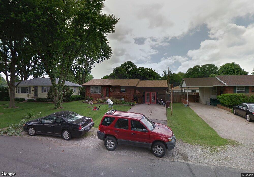
303 Tower Dr East Alton, IL 62024
Estimated Value: $115,000 - $164,000
3
Beds
1
Bath
1,164
Sq Ft
$121/Sq Ft
Est. Value
About This Home
This home is located at 303 Tower Dr, East Alton, IL 62024 and is currently estimated at $140,701, approximately $120 per square foot. 303 Tower Dr is a home located in Madison County with nearby schools including Eastwood Elementary School, East Alton Middle School, and East Alton-Wood River High School.
Ownership History
Date
Name
Owned For
Owner Type
Purchase Details
Closed on
Nov 22, 2010
Sold by
Harvey Jaimee Rene
Bought by
Harvey Charles G
Current Estimated Value
Purchase Details
Closed on
Aug 16, 2004
Sold by
Harvey Charles G
Bought by
Harvey Charles G and Harvey Jaimee R
Purchase Details
Closed on
Apr 11, 2003
Sold by
Harvey Debra K
Bought by
Harvey Charles G
Home Financials for this Owner
Home Financials are based on the most recent Mortgage that was taken out on this home.
Original Mortgage
$52,000
Interest Rate
5.87%
Mortgage Type
New Conventional
Create a Home Valuation Report for This Property
The Home Valuation Report is an in-depth analysis detailing your home's value as well as a comparison with similar homes in the area
Home Values in the Area
Average Home Value in this Area
Purchase History
| Date | Buyer | Sale Price | Title Company |
|---|---|---|---|
| Harvey Charles G | -- | None Available | |
| Harvey Charles G | -- | -- | |
| Harvey Charles G | -- | Chicago Title |
Source: Public Records
Mortgage History
| Date | Status | Borrower | Loan Amount |
|---|---|---|---|
| Closed | Harvey Charles G | $52,000 | |
| Closed | Harvey Charles G | $21,800 |
Source: Public Records
Tax History Compared to Growth
Tax History
| Year | Tax Paid | Tax Assessment Tax Assessment Total Assessment is a certain percentage of the fair market value that is determined by local assessors to be the total taxable value of land and additions on the property. | Land | Improvement |
|---|---|---|---|---|
| 2024 | $2,807 | $40,380 | $5,200 | $35,180 |
| 2023 | $2,807 | $37,650 | $4,850 | $32,800 |
| 2022 | $3,090 | $34,750 | $4,480 | $30,270 |
| 2021 | $2,801 | $32,390 | $4,180 | $28,210 |
| 2020 | $2,683 | $31,200 | $4,030 | $27,170 |
| 2019 | $2,630 | $30,270 | $3,910 | $26,360 |
| 2018 | $2,560 | $28,770 | $3,720 | $25,050 |
| 2017 | $2,616 | $28,080 | $3,630 | $24,450 |
| 2016 | $2,339 | $28,080 | $3,630 | $24,450 |
| 2015 | $2,240 | $27,780 | $3,590 | $24,190 |
| 2014 | $2,240 | $27,780 | $3,590 | $24,190 |
| 2013 | $2,240 | $28,180 | $3,640 | $24,540 |
Source: Public Records
Map
Nearby Homes
- 345 Illinois Ave
- 283 Hi Pointe Place
- 250 Hi Pointe Place
- 104 Whitelaw Ave
- 959 Cedar Dr
- 121 Whitelaw Ave
- 98 Wood River Ave
- 604 Wood River Ave
- 523 Wilson Ave
- 133 Lincoln Ave
- 523 Lincoln Ave
- 211 S 9th St
- 420 Bowman Ave
- 141 S 9th St
- 144 S 9th St
- 777 Condit St
- 833 State St
- 641 Leslie Ave
- 209 Elble Ave
- 726 Rice St