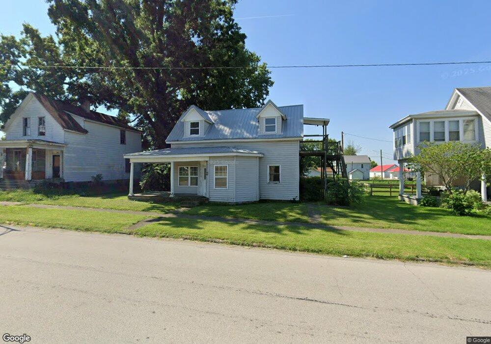
303 W State St Georgetown, OH 45121
Estimated Value: $61,139 - $179,000
--
Bed
1
Bath
1,700
Sq Ft
$72/Sq Ft
Est. Value
About This Home
This home is located at 303 W State St, Georgetown, OH 45121 and is currently estimated at $123,035, approximately $72 per square foot. 303 W State St is a home located in Brown County with nearby schools including Georgetown Elementary School and Georgetown Jr/Sr High School.
Ownership History
Date
Name
Owned For
Owner Type
Purchase Details
Closed on
Jun 24, 2017
Sold by
Lockard Paul E and Lockard Janice
Bought by
Clifton Thomas E and The Clifton Family Trust
Current Estimated Value
Home Financials for this Owner
Home Financials are based on the most recent Mortgage that was taken out on this home.
Original Mortgage
$6,184
Interest Rate
4.02%
Mortgage Type
Seller Take Back
Purchase Details
Closed on
Aug 23, 2007
Sold by
Lockard Paul E and Lockard Janice
Bought by
Clifton Bonnie and The Clifton Family Trust
Home Financials for this Owner
Home Financials are based on the most recent Mortgage that was taken out on this home.
Original Mortgage
$55,000
Interest Rate
6.63%
Mortgage Type
Seller Take Back
Purchase Details
Closed on
Apr 30, 2007
Sold by
Burns Kim and Lockard Paul Scott
Bought by
Lockard Paul E and Lockard Janice
Create a Home Valuation Report for This Property
The Home Valuation Report is an in-depth analysis detailing your home's value as well as a comparison with similar homes in the area
Home Values in the Area
Average Home Value in this Area
Purchase History
| Date | Buyer | Sale Price | Title Company |
|---|---|---|---|
| Clifton Thomas E | $60,000 | None Available | |
| Clifton Bonnie | $60,000 | Attorney | |
| Lockard Paul E | -- | Attorney |
Source: Public Records
Mortgage History
| Date | Status | Borrower | Loan Amount |
|---|---|---|---|
| Closed | Clifton Thomas E | $6,184 | |
| Previous Owner | Clifton Bonnie | $55,000 |
Source: Public Records
Tax History Compared to Growth
Tax History
| Year | Tax Paid | Tax Assessment Tax Assessment Total Assessment is a certain percentage of the fair market value that is determined by local assessors to be the total taxable value of land and additions on the property. | Land | Improvement |
|---|---|---|---|---|
| 2024 | $1,110 | $30,600 | $4,510 | $26,090 |
| 2023 | $1,110 | $25,130 | $3,810 | $21,320 |
| 2022 | $1,189 | $25,130 | $3,810 | $21,320 |
| 2021 | $1,471 | $25,130 | $3,810 | $21,320 |
| 2020 | $868 | $20,950 | $3,190 | $17,760 |
| 2019 | $336 | $20,950 | $3,190 | $17,760 |
| 2018 | $857 | $20,950 | $3,190 | $17,760 |
| 2017 | $943 | $27,210 | $7,620 | $19,590 |
| 2016 | $1,112 | $27,210 | $7,620 | $19,590 |
| 2015 | $1,125 | $27,210 | $7,620 | $19,590 |
| 2014 | $1,125 | $27,210 | $7,620 | $19,590 |
| 2013 | $1,115 | $27,210 | $7,620 | $19,590 |
Source: Public Records
Map
Nearby Homes
- 306 W 2nd St
- 402 S Pleasant St
- 102 Bill Dee Dr
- 505 S Water St
- 405 N Main St
- 104 Elm St
- 406 E North St
- 403 Elmwood Ct
- 401 Elmwood Ct
- 508 Mount Orab Pike
- 60 New St
- 418 Home St
- 331 Spring Grove Dr
- 0 St Rt 221 & Footbridge Unit 1826509
- 666 E State St
- 155 Free Soil Rd
- 708 E State St
- 427 Kenwood Ave
- 20 Heritage Hill Dr
- 874 Mount Orab Pike