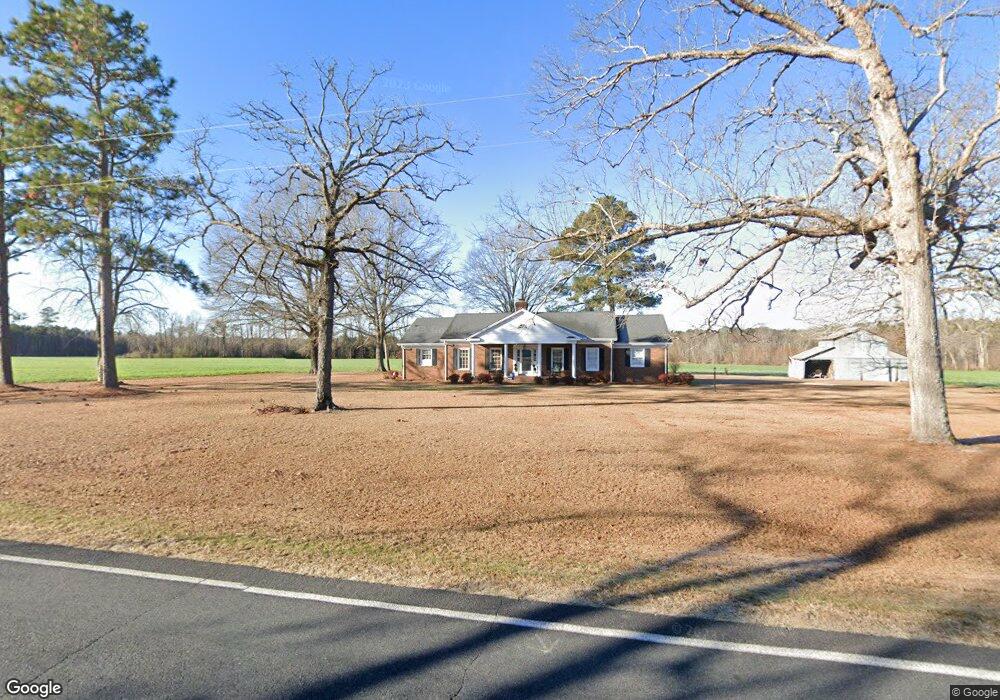
3030 Elliott Bridge Rd Bunnlevel, NC 28323
Estimated Value: $249,000 - $323,000
3
Beds
2
Baths
2,188
Sq Ft
$130/Sq Ft
Est. Value
About This Home
This home is located at 3030 Elliott Bridge Rd, Bunnlevel, NC 28323 and is currently estimated at $285,086, approximately $130 per square foot. 3030 Elliott Bridge Rd is a home located in Harnett County with nearby schools including Anderson Creek Primary School, South Harnett Elementary School, and Western Harnett Middle School.
Ownership History
Date
Name
Owned For
Owner Type
Purchase Details
Closed on
Aug 30, 2021
Sold by
Bain Charles R and Bain Carol K
Bought by
Bain Kyle Joseph
Current Estimated Value
Home Financials for this Owner
Home Financials are based on the most recent Mortgage that was taken out on this home.
Original Mortgage
$150,350
Outstanding Balance
$136,603
Interest Rate
2.7%
Mortgage Type
New Conventional
Estimated Equity
$148,483
Create a Home Valuation Report for This Property
The Home Valuation Report is an in-depth analysis detailing your home's value as well as a comparison with similar homes in the area
Home Values in the Area
Average Home Value in this Area
Purchase History
| Date | Buyer | Sale Price | Title Company |
|---|---|---|---|
| Bain Kyle Joseph | $155,000 | None Available | |
| Bain Kyle Joseph | $155,000 | None Listed On Document |
Source: Public Records
Mortgage History
| Date | Status | Borrower | Loan Amount |
|---|---|---|---|
| Open | Bain Kyle Joseph | $150,350 | |
| Closed | Bain Kyle Joseph | $150,350 |
Source: Public Records
Tax History
| Year | Tax Paid | Tax Assessment Tax Assessment Total Assessment is a certain percentage of the fair market value that is determined by local assessors to be the total taxable value of land and additions on the property. | Land | Improvement |
|---|---|---|---|---|
| 2025 | $1,490 | $194,871 | $0 | $0 |
| 2024 | $1,490 | $194,871 | $0 | $0 |
| 2023 | $1,490 | $194,871 | $0 | $0 |
| 2022 | $1,381 | $194,871 | $0 | $0 |
| 2021 | $1,381 | $147,270 | $0 | $0 |
| 2020 | $1,381 | $147,270 | $0 | $0 |
| 2019 | $1,366 | $147,270 | $0 | $0 |
| 2018 | $1,351 | $147,270 | $0 | $0 |
| 2017 | $1,351 | $147,270 | $0 | $0 |
| 2016 | $1,226 | $132,920 | $0 | $0 |
| 2015 | -- | $132,920 | $0 | $0 |
| 2014 | -- | $132,920 | $0 | $0 |
Source: Public Records
Map
Nearby Homes
- 7275 Nc 210 S Hwy
- 7275 Nc 210 S
- 0 Mike Williams Ln
- 687 Brock Rd
- 2574 Norrington Rd
- 206 Winged Foot Dr
- 205 Hookbill Ln Unit Lot 17
- 441 Lasater Rd
- 1510 Walker Rd
- 1250 Overhills Rd
- 237 Lemuel Black Rd
- 2292 Raynor McLamb Rd
- 49 Whisper Creek Ct
- 388 Black Duck Ln Unit Lot 80
- 309 Black Duck Ln Unit (Lot 97)
- 263 Black Duck Ln Unit (Lot 94)
- 423 Black Duck Ln Unit (Lot 100)
- 493 Black Duck Ln Unit Lot 105
- 322 Black Duck Ln Unit Lot 85
- 402 Black Duck (Lot 79) Ln
- 2792 Elliott Bridge Rd
- 2795 Elliott Bridge Rd
- 3250 Elliott Bridge Rd
- 5495 McLean Chapel Church Rd
- 3228A Elliott Bridge Rd
- 3228 Elliott Bridge Rd
- 2686 Elliott Bridge Rd
- 3389 Elliott Bridge Rd
- 3252 Elliott Bridge Rd
- 3252 Elliott Bridge Rd
- 5340 McLean Chapel Church Rd
- 0 Tract 2 Elliott Bridge Rd Unit Tract 2 100364018
- Tract 2 Elliott Bridge
- 2606 Elliott Bridge Rd
- 23 Youngsberry Park
- 667 Angel Oak Dr
- 635 Angel Oak Dr
- 651 Angel Oak Dr
- 22 Knotts Berry Rd
- 38 Knotts Berry Rd
Your Personal Tour Guide
Ask me questions while you tour the home.