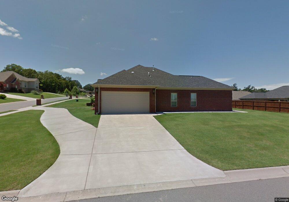
3032 Maelstrom Cir Sherwood, AR 72120
Estimated Value: $379,711 - $433,000
4
Beds
3
Baths
2,495
Sq Ft
$159/Sq Ft
Est. Value
About This Home
This home is located at 3032 Maelstrom Cir, Sherwood, AR 72120 and is currently estimated at $397,678, approximately $159 per square foot. 3032 Maelstrom Cir is a home located in Pulaski County with nearby schools including Sylvan Hills Elementary School, Sylvan Hills Middle School, and Sylvan Hills High School.
Ownership History
Date
Name
Owned For
Owner Type
Purchase Details
Closed on
Jun 22, 2012
Sold by
Sdh Custom Homes Llc
Bought by
Smith Vernon and Smith Sheila A
Current Estimated Value
Home Financials for this Owner
Home Financials are based on the most recent Mortgage that was taken out on this home.
Original Mortgage
$270,000
Outstanding Balance
$186,856
Interest Rate
3.8%
Mortgage Type
VA
Estimated Equity
$210,822
Purchase Details
Closed on
Jun 18, 2010
Sold by
Huiett Construction Inc
Bought by
Sdh Custom Homes Llc
Create a Home Valuation Report for This Property
The Home Valuation Report is an in-depth analysis detailing your home's value as well as a comparison with similar homes in the area
Home Values in the Area
Average Home Value in this Area
Purchase History
| Date | Buyer | Sale Price | Title Company |
|---|---|---|---|
| Smith Vernon | $293,000 | Lenders Title Company | |
| Sdh Custom Homes Llc | -- | Lenders Title Company |
Source: Public Records
Mortgage History
| Date | Status | Borrower | Loan Amount |
|---|---|---|---|
| Open | Smith Vernon | $270,000 |
Source: Public Records
Tax History Compared to Growth
Tax History
| Year | Tax Paid | Tax Assessment Tax Assessment Total Assessment is a certain percentage of the fair market value that is determined by local assessors to be the total taxable value of land and additions on the property. | Land | Improvement |
|---|---|---|---|---|
| 2025 | $2,783 | $64,288 | $7,200 | $57,088 |
| 2024 | $2,783 | $64,288 | $7,200 | $57,088 |
| 2023 | $2,783 | $64,288 | $7,200 | $57,088 |
| 2022 | $3,111 | $64,288 | $7,200 | $57,088 |
| 2021 | $3,032 | $53,410 | $7,700 | $45,710 |
| 2020 | $2,645 | $53,410 | $7,700 | $45,710 |
| 2019 | $2,645 | $53,410 | $7,700 | $45,710 |
| 2018 | $2,670 | $53,410 | $7,700 | $45,710 |
| 2017 | $2,662 | $53,410 | $7,700 | $45,710 |
| 2016 | $2,723 | $54,590 | $7,800 | $46,790 |
| 2015 | $2,773 | $54,590 | $7,800 | $46,790 |
| 2014 | $2,773 | $54,590 | $7,800 | $46,790 |
Source: Public Records
Map
Nearby Homes
- 2949 Maelstrom Cir
- 3032 Overcup Dr
- 9716 Wild Mountain Dr
- 9580 Robin Ln
- Lot 6 Johnson Dr
- Lot 5 Johnson Dr
- Lot 4 Johnson Dr
- Lot 2 Johnson Dr
- Lot 1 Johnson Dr
- 00 Johnson Dr
- 9460 Robin Ln
- 66 Oakbrooke Dr
- 3301 Brundle Ct
- 16 Patty Ln
- 109 Pamela Ln
- 111 Pamela Ln
- 1300 E Maryland Ave
- 14 Pamela Ln
- 2117 Ingleside Dr
- 105 Wild Oak Dr
- 3024 Maelstrom Cir
- 9601 Mercury Dr
- 9540 Journey Dr
- 9609 Mercury Dr
- 3016 Maelstrom Cir
- 3033 Maelstrom Cir
- 9417 Harmony Dr
- 3025 Maelstrom Cir
- 9617 Mercury Dr
- 9532 Journey Dr
- 0 Journey Dr Unit 20024618
- 0 Journey Dr Unit 17005070
- 9541 Journey Dr
- 3017 Maelstrom Cir
- 3008 Maelstrom Cir
- 9409 Harmony Dr
- 0 Lot 326 Mercury Dr Unit 10225098
- 9625 Mercury Dr
- 9600 Mercury Dr
- 0 Mercury Dr Unit 17035955