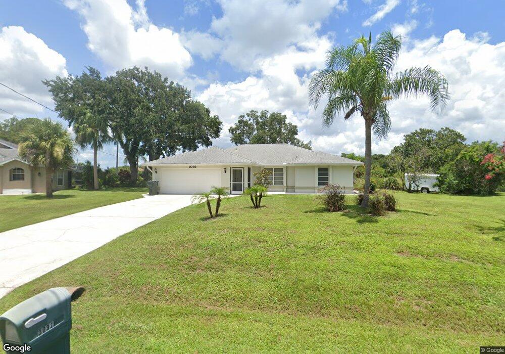
3032 Tonkin Dr North Port, FL 34287
Estimated Value: $326,000 - $375,000
3
Beds
2
Baths
1,712
Sq Ft
$202/Sq Ft
Est. Value
About This Home
This home is located at 3032 Tonkin Dr, North Port, FL 34287 and is currently estimated at $345,957, approximately $202 per square foot. 3032 Tonkin Dr is a home located in Sarasota County with nearby schools including North Port High School, Cranberry Elementary School, and Heron Creek Middle School.
Ownership History
Date
Name
Owned For
Owner Type
Purchase Details
Closed on
Sep 27, 2017
Sold by
Mccarren Kimberlee K and Mccarren Patrick M
Bought by
Mccarren Patrick M and Mccarren Kimberlee K
Current Estimated Value
Purchase Details
Closed on
Oct 28, 2010
Sold by
Mello Nancy W
Bought by
Mccarren Kimberlee K
Home Financials for this Owner
Home Financials are based on the most recent Mortgage that was taken out on this home.
Original Mortgage
$103,200
Interest Rate
4.38%
Mortgage Type
New Conventional
Create a Home Valuation Report for This Property
The Home Valuation Report is an in-depth analysis detailing your home's value as well as a comparison with similar homes in the area
Home Values in the Area
Average Home Value in this Area
Purchase History
| Date | Buyer | Sale Price | Title Company |
|---|---|---|---|
| Mccarren Patrick M | $45,000 | Attorney | |
| Mccarren Kimberlee K | $129,000 | Sunbelt Title Agency |
Source: Public Records
Mortgage History
| Date | Status | Borrower | Loan Amount |
|---|---|---|---|
| Previous Owner | Mccarren Kimberlee K | $103,200 |
Source: Public Records
Tax History Compared to Growth
Tax History
| Year | Tax Paid | Tax Assessment Tax Assessment Total Assessment is a certain percentage of the fair market value that is determined by local assessors to be the total taxable value of land and additions on the property. | Land | Improvement |
|---|---|---|---|---|
| 2024 | $2,206 | $139,313 | -- | -- |
| 2023 | $2,206 | $135,255 | $0 | $0 |
| 2022 | $2,112 | $131,316 | $0 | $0 |
| 2021 | $2,095 | $127,491 | $0 | $0 |
| 2020 | $2,066 | $125,731 | $0 | $0 |
| 2019 | $2,008 | $122,904 | $0 | $0 |
| 2018 | $1,866 | $120,612 | $0 | $0 |
| 2017 | $1,833 | $118,131 | $0 | $0 |
| 2016 | $1,819 | $148,800 | $8,600 | $140,200 |
| 2015 | $1,840 | $130,200 | $8,900 | $121,300 |
| 2014 | $1,815 | $112,300 | $0 | $0 |
Source: Public Records
Map
Nearby Homes
- 3714 Lothair Ave
- 0 Tonkin Dr Unit O6075861
- 2903 Pope St
- 0 Nimbus Dr Unit MFRC7513303
- 0 Town Terrace Unit A4486690
- 2576 Pecan St
- 0 Channing Ave Unit MFRA4640604
- 3956 Fairchild Ave
- 3300 S Salford Blvd
- 0 Walmsley Ave Unit MFRA4629289
- 0 Walmsley Ave Unit MFRC7507061
- 0 Yeadon Terrace
- 0 Wooley Ave Unit A4539985
- 0 Wooley Ave Unit A4539983
- 3680 Walmsley Ave
- 3008 Yeadon Terrace
- 3249 Vickers Ln
- 3005 Briant St
- 3294 Shalimar Terrace
- 2173 Cloras St
- 3610 Lothair Ave
- 3050 Tonkin Dr
- Lothair Ave
- 3068 Tonkin Dr
- 3636 Lothair Ave
- 3662 Lothair Ave
- 0 Tonkin Dr Unit N5915302
- 0 Tonkin Dr Unit MFRC7489770
- 0 Tonkin Dr Unit MFRA4599191
- 0 Tonkin Dr Unit MFRC7475423
- 0 Tonkin Dr Unit N6121838
- 0 Tonkin Dr Unit A4499257
- 0 Tonkin Dr Unit A4499252
- 2994 Nimbus Dr
- Tonkin Dr
- Tonkin Dr
- Tonkin Dr
- Champagne Ave
- Champagne Ave
- 3104 Tonkin Dr