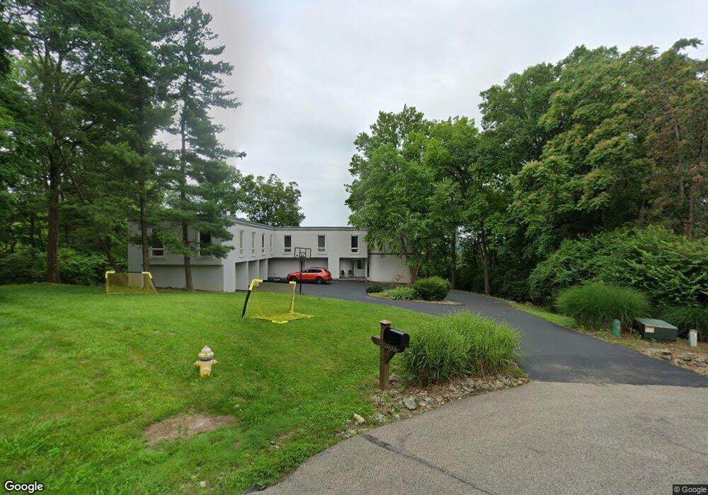
3033 Burning Tree Ln Cincinnati, OH 45237
Estimated Value: $1,179,256 - $1,387,000
5
Beds
5
Baths
5,626
Sq Ft
$231/Sq Ft
Est. Value
About This Home
This home is located at 3033 Burning Tree Ln, Cincinnati, OH 45237 and is currently estimated at $1,299,752, approximately $231 per square foot. 3033 Burning Tree Ln is a home located in Hamilton County with nearby schools including Pleasant Ridge Montessori School, Shroder High School, and Clark Montessori High School.
Ownership History
Date
Name
Owned For
Owner Type
Purchase Details
Closed on
Mar 13, 2007
Sold by
Gvozdanovic Marinko and Gvozdanovic Tricia L
Bought by
David Fay M
Current Estimated Value
Home Financials for this Owner
Home Financials are based on the most recent Mortgage that was taken out on this home.
Original Mortgage
$527,200
Outstanding Balance
$319,281
Interest Rate
6.27%
Mortgage Type
Unknown
Estimated Equity
$980,471
Purchase Details
Closed on
May 9, 2003
Sold by
Abe Fischer and Abe Taren B
Bought by
Gvozdanovic Marinko and Gvozdanovic Tricia L
Home Financials for this Owner
Home Financials are based on the most recent Mortgage that was taken out on this home.
Original Mortgage
$255,000
Interest Rate
4.87%
Mortgage Type
Unknown
Create a Home Valuation Report for This Property
The Home Valuation Report is an in-depth analysis detailing your home's value as well as a comparison with similar homes in the area
Home Values in the Area
Average Home Value in this Area
Purchase History
| Date | Buyer | Sale Price | Title Company |
|---|---|---|---|
| David Fay M | -- | Attorney | |
| Gvozdanovic Marinko | $340,000 | -- |
Source: Public Records
Mortgage History
| Date | Status | Borrower | Loan Amount |
|---|---|---|---|
| Open | David Fay M | $527,200 | |
| Previous Owner | Gvozdanovic Marinko | $255,000 |
Source: Public Records
Tax History Compared to Growth
Tax History
| Year | Tax Paid | Tax Assessment Tax Assessment Total Assessment is a certain percentage of the fair market value that is determined by local assessors to be the total taxable value of land and additions on the property. | Land | Improvement |
|---|---|---|---|---|
| 2024 | $16,902 | $272,462 | $74,988 | $197,474 |
| 2023 | $16,930 | $272,462 | $74,988 | $197,474 |
| 2022 | $16,160 | $232,887 | $73,682 | $159,205 |
| 2021 | $15,791 | $232,887 | $73,682 | $159,205 |
| 2020 | $15,974 | $232,887 | $73,682 | $159,205 |
| 2019 | $15,612 | $206,094 | $65,205 | $140,889 |
| 2018 | $15,637 | $206,094 | $65,205 | $140,889 |
| 2017 | $14,968 | $206,094 | $65,205 | $140,889 |
| 2016 | $12,616 | $165,557 | $68,467 | $97,090 |
| 2015 | $11,420 | $165,557 | $68,467 | $97,090 |
| 2014 | $11,493 | $165,557 | $68,467 | $97,090 |
| 2013 | $11,668 | $165,557 | $68,467 | $97,090 |
Source: Public Records
Map
Nearby Homes
- 7716 Creekwood Ln
- 2920 E Galbraith Rd
- 2281 E Galbraith Rd
- 3275 Legacy Trace
- L Apple Ridge Ln
- 3360 Legacy Trace
- 2558 Apple Ridge Ln
- 2071 Longmeadow Ln
- 2127 Longmeadow Ln
- 2758 Losantiridge Ave
- 6542 Cliff Ridge Ave
- 2783 Losantiridge Ave
- 636 Maple Dr
- 2543 Vera Ave
- 2541 Vera Ave
- 0 Hill St Unit 1616370
- 2537 Vera Ave
- 2539 Vera Ave
- 2652 Cedarbrook Dr
- 6501 Ridge Ave
- 3029 Burning Tree Ln
- 3036 Burning Tree Ln
- 3025 Burning Tree Ln
- 7707 Creekwood Ln
- 3028 Burning Tree Ln
- 7510 Fernwood Dr
- 3032 Burning Tree Ln
- 7500 Fernwood Dr
- 7438 E Aracoma Dr
- 3024 Burning Tree Ln
- 3021 Burning Tree Ln
- 7708 Creekwood Ln
- 2890 Belkay Ln
- 7439 E Aracoma Dr
- 7434 E Aracoma Dr
- 3020 Burning Tree Ln
- 2875 Belkay Ln
- 7505 Fernwood Dr
- 7712 Creekwood Ln
- 7540 Fernwood Dr
