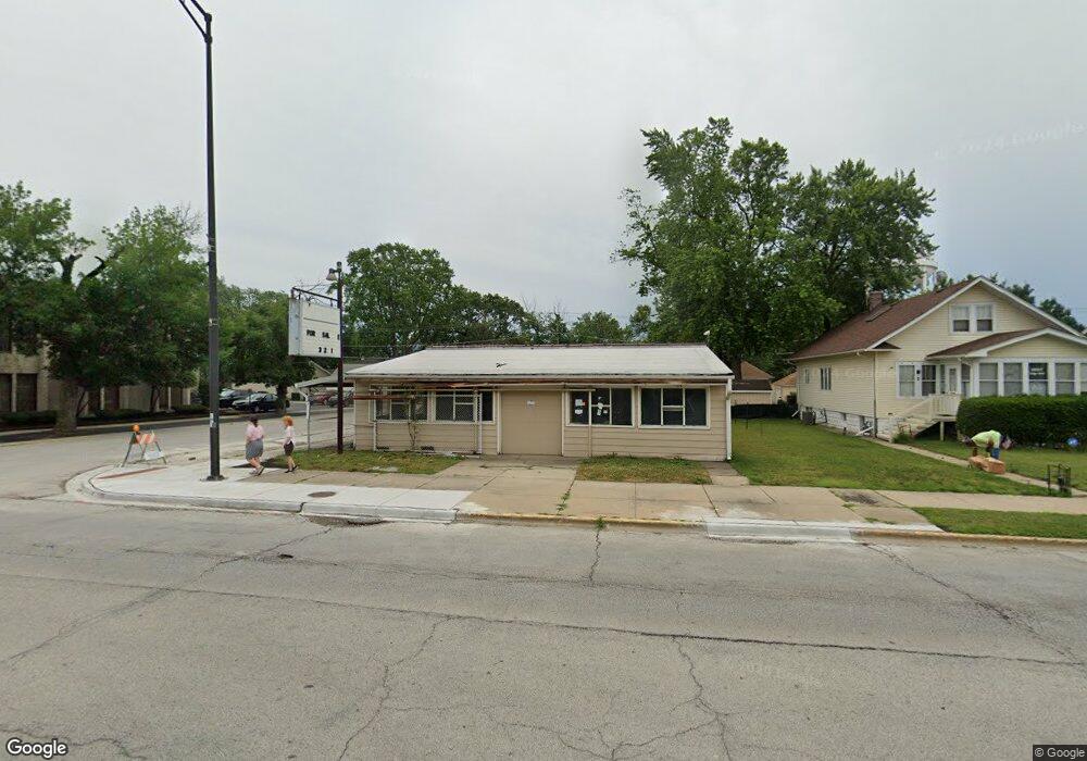
3033 Ridge Rd Lansing, IL 60438
Estimated Value: $174,598 - $188,000
3
Beds
1
Bath
960
Sq Ft
$189/Sq Ft
Est. Value
About This Home
This home is located at 3033 Ridge Rd, Lansing, IL 60438 and is currently estimated at $181,900, approximately $189 per square foot. 3033 Ridge Rd is a home located in Cook County with nearby schools including Coolidge Elementary School, Memorial Jr High School, and Thornton Fractnl So High School.
Ownership History
Date
Name
Owned For
Owner Type
Purchase Details
Closed on
Jul 19, 2021
Sold by
Peters Dean
Bought by
Madlock Robert E
Current Estimated Value
Home Financials for this Owner
Home Financials are based on the most recent Mortgage that was taken out on this home.
Original Mortgage
$120,065
Outstanding Balance
$104,595
Interest Rate
2.87%
Mortgage Type
FHA
Estimated Equity
$77,305
Purchase Details
Closed on
Dec 8, 2004
Sold by
Standard Bank & Trust Co
Bought by
Jansma David and Peters Dean
Home Financials for this Owner
Home Financials are based on the most recent Mortgage that was taken out on this home.
Original Mortgage
$108,000
Interest Rate
5.77%
Mortgage Type
Unknown
Purchase Details
Closed on
Apr 26, 2004
Sold by
First National Bank Of Illinois
Bought by
Standard Bank & Trust Co
Create a Home Valuation Report for This Property
The Home Valuation Report is an in-depth analysis detailing your home's value as well as a comparison with similar homes in the area
Home Values in the Area
Average Home Value in this Area
Purchase History
| Date | Buyer | Sale Price | Title Company |
|---|---|---|---|
| Madlock Robert E | $133,000 | Old Republic Title | |
| Jansma David | $135,000 | Ticor Title | |
| Standard Bank & Trust Co | -- | -- |
Source: Public Records
Mortgage History
| Date | Status | Borrower | Loan Amount |
|---|---|---|---|
| Open | Madlock Robert E | $120,065 | |
| Previous Owner | Jansma David | $108,000 |
Source: Public Records
Tax History
| Year | Tax Paid | Tax Assessment Tax Assessment Total Assessment is a certain percentage of the fair market value that is determined by local assessors to be the total taxable value of land and additions on the property. | Land | Improvement |
|---|---|---|---|---|
| 2025 | $6,096 | $12,601 | $3,188 | $9,413 |
| 2024 | $6,096 | $12,601 | $3,188 | $9,413 |
| 2023 | $6,041 | $12,601 | $3,188 | $9,413 |
| 2022 | $6,041 | $9,297 | $2,813 | $6,484 |
| 2021 | $5,876 | $9,295 | $2,812 | $6,483 |
| 2020 | $5,453 | $9,295 | $2,812 | $6,483 |
| 2019 | $4,216 | $7,406 | $2,625 | $4,781 |
| 2018 | $4,138 | $7,406 | $2,625 | $4,781 |
| 2017 | $4,179 | $7,406 | $2,625 | $4,781 |
| 2016 | $3,563 | $6,517 | $2,437 | $4,080 |
| 2015 | $3,311 | $6,517 | $2,437 | $4,080 |
| 2014 | $3,265 | $6,517 | $2,437 | $4,080 |
| 2013 | $3,437 | $7,634 | $2,437 | $5,197 |
Source: Public Records
Map
Nearby Homes
- 18241 Ridgewood Ave
- 18037 Ridgewood Ave
- 19510 Burnham Ave
- 18019 Lorenz Ave
- 18034 Ridgewood Ave
- 18315 Burnham Ave Unit 204
- 18006 Oakwood Ave
- 17917 Lorenz Ave
- 18324 Roy St
- 17913 Oakwood Ave
- 17946 Roy St
- 2715 Indiana Ave
- 18514 Ridgewood Ave
- 17925 Walter St
- 17858 Ridgewood Ave
- 3316 Ann St
- 18009 Commercial Ave
- 17926 Roy St
- 18275 Ada St
- 18235 Exchange Ave
- 3033 Ridge Rd
- 3023 182nd Place
- 3027 Ridge Rd
- 3023 Ridge Rd
- 3017 Ridge Rd
- 3024 182nd Place
- 3049 Ridge Rd
- 3028 182nd Place
- 3013 Ridge Rd
- 3034 Ridge Rd
- 3034 Ridge Rd
- 3024 182nd Place
- 3044 182nd Place
- 3042 Ridge Rd
- 3042 Ridge Rd
- 3034 182nd Place
- 3018 182nd Place
- 3053 Ridge Rd
- 3046 Ridge Rd
- 3009 Ridge Rd
Your Personal Tour Guide
Ask me questions while you tour the home.