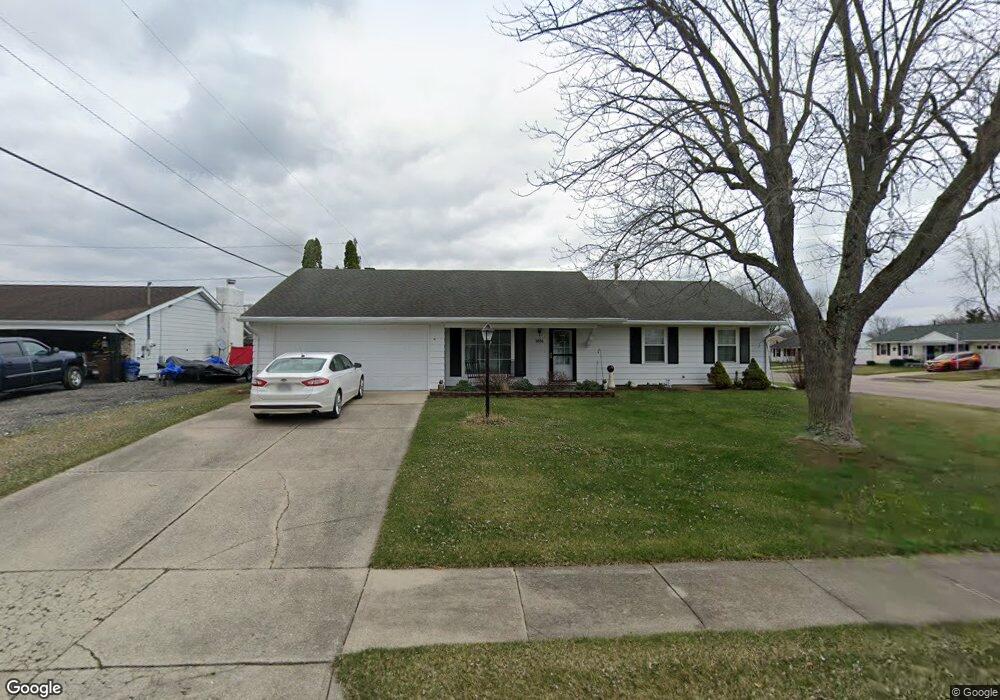
3036 Sturbridge St Springfield, OH 45503
Estimated Value: $187,000 - $209,000
3
Beds
2
Baths
1,251
Sq Ft
$157/Sq Ft
Est. Value
About This Home
This home is located at 3036 Sturbridge St, Springfield, OH 45503 and is currently estimated at $196,578, approximately $157 per square foot. 3036 Sturbridge St is a home located in Clark County with nearby schools including Kenton Elementary School, Roosevelt Middle School, and Springfield High School.
Ownership History
Date
Name
Owned For
Owner Type
Purchase Details
Closed on
Apr 29, 2025
Sold by
Allen Nellie M
Bought by
Taylor Sandra
Current Estimated Value
Home Financials for this Owner
Home Financials are based on the most recent Mortgage that was taken out on this home.
Original Mortgage
$89,900
Outstanding Balance
$89,340
Interest Rate
6.67%
Mortgage Type
New Conventional
Estimated Equity
$107,238
Purchase Details
Closed on
Sep 18, 2003
Sold by
Longo Anne Virginia and Longo Philip M
Bought by
Allen Philip N and Allen Nellie M
Create a Home Valuation Report for This Property
The Home Valuation Report is an in-depth analysis detailing your home's value as well as a comparison with similar homes in the area
Home Values in the Area
Average Home Value in this Area
Purchase History
| Date | Buyer | Sale Price | Title Company |
|---|---|---|---|
| Taylor Sandra | $179,900 | City Title | |
| Taylor Sandra | $179,900 | City Title | |
| Allen Philip N | $108,000 | -- |
Source: Public Records
Mortgage History
| Date | Status | Borrower | Loan Amount |
|---|---|---|---|
| Open | Taylor Sandra | $89,900 | |
| Closed | Taylor Sandra | $89,900 |
Source: Public Records
Tax History
| Year | Tax Paid | Tax Assessment Tax Assessment Total Assessment is a certain percentage of the fair market value that is determined by local assessors to be the total taxable value of land and additions on the property. | Land | Improvement |
|---|---|---|---|---|
| 2025 | $1,710 | $61,690 | $10,570 | $51,120 |
| 2024 | $1,696 | $44,370 | $10,040 | $34,330 |
| 2023 | $1,696 | $44,370 | $10,040 | $34,330 |
| 2022 | $1,758 | $44,370 | $10,040 | $34,330 |
| 2021 | $1,627 | $39,140 | $7,550 | $31,590 |
| 2020 | $1,631 | $39,140 | $7,550 | $31,590 |
| 2019 | $1,635 | $39,140 | $7,550 | $31,590 |
| 2018 | $1,357 | $33,020 | $8,000 | $25,020 |
| 2017 | $1,356 | $35,053 | $8,001 | $27,052 |
| 2016 | $1,358 | $35,053 | $8,001 | $27,052 |
| 2015 | $589 | $34,598 | $7,546 | $27,052 |
| 2014 | $1,172 | $34,598 | $7,546 | $27,052 |
| 2013 | $580 | $34,598 | $7,546 | $27,052 |
Source: Public Records
Map
Nearby Homes
- 1516 Hyannis Dr
- 1924 Marinette Dr
- 1948 Falmouth Ave
- 3214 Revels St
- 3300 Revels St
- 1032 Armsgate Rd
- 1811 Devon Dr
- 3124 El Camino Dr
- 2022 Westboro Ave
- 1040 Carson Ln
- 1139 Bradford Dr
- 2529 Marinette Dr
- 2553 Derr Rd
- 3135 Imperial Blvd
- 2043 Providence Ave
- 1136 Foxboro Rd Unit 202
- 1149 Foxboro Rd
- 2400 Thor Dr
- 615 Villa Rd Unit K
- 1046 Fruitland Rd
- 3038 Sturbridge St
- 3035 Woonsocket St
- 3111 Woonsocket St
- 3035 Sturbridge St
- 1639 Providence Ave
- 1631 Providence Ave
- 3040 Sturbridge St
- 1649 Providence Ave
- 3119 Woonsocket St
- 3037 Sturbridge St
- 1623 Providence Ave
- 1701 Providence Ave
- 3039 Sturbridge St
- 3131 Woonsocket St
- 3038 Ipswich St
- 3036 Ipswich St
- 1711 Providence Ave
- 1638 Marinette Dr
- 1722 Providence Ave
- 1630 Marinette Dr
Your Personal Tour Guide
Ask me questions while you tour the home.