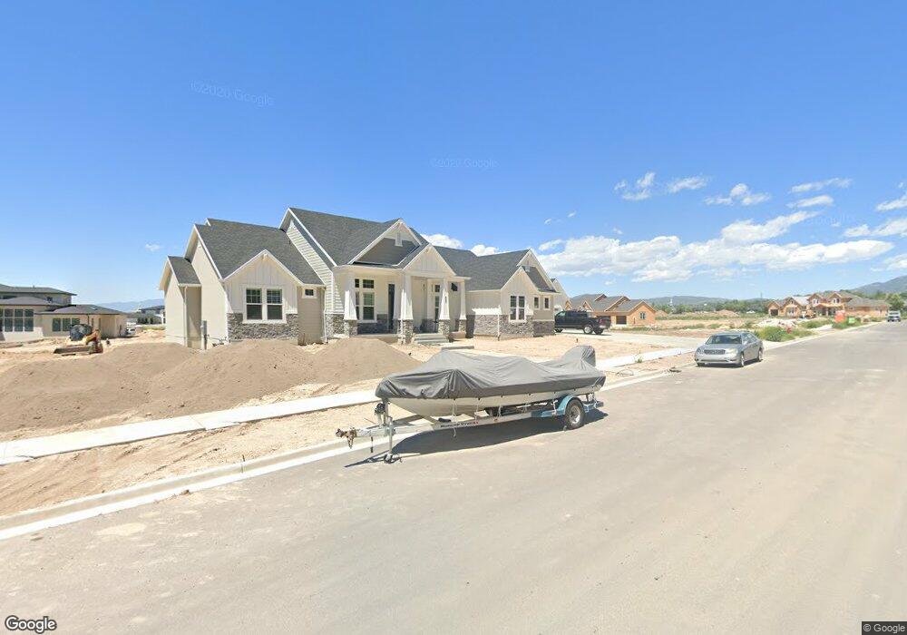
3037 N 550 W Unit 211 Pleasant Grove, UT 84062
Estimated Value: $1,686,000 - $1,955,240
3
Beds
3
Baths
7,880
Sq Ft
$225/Sq Ft
Est. Value
About This Home
This home is located at 3037 N 550 W Unit 211, Pleasant Grove, UT 84062 and is currently estimated at $1,769,810, approximately $224 per square foot. 3037 N 550 W Unit 211 is a home located in Utah County with nearby schools including Deerfield Elementary School, Mountain Ridge Junior High School, and American Fork High School.
Ownership History
Date
Name
Owned For
Owner Type
Purchase Details
Closed on
Aug 28, 2023
Sold by
Landon Darren and Landon Shantel
Bought by
Darren And Shantell Landon Living Trust and Landon
Current Estimated Value
Purchase Details
Closed on
Apr 17, 2019
Sold by
Arive Homes Llc
Bought by
Landon Darren and Landon Shantel
Home Financials for this Owner
Home Financials are based on the most recent Mortgage that was taken out on this home.
Original Mortgage
$768,664
Interest Rate
4.3%
Mortgage Type
New Conventional
Purchase Details
Closed on
Mar 11, 2019
Sold by
Poc Development Llc
Bought by
Arive Homes Llc
Home Financials for this Owner
Home Financials are based on the most recent Mortgage that was taken out on this home.
Original Mortgage
$768,664
Interest Rate
4.3%
Mortgage Type
New Conventional
Create a Home Valuation Report for This Property
The Home Valuation Report is an in-depth analysis detailing your home's value as well as a comparison with similar homes in the area
Home Values in the Area
Average Home Value in this Area
Purchase History
| Date | Buyer | Sale Price | Title Company |
|---|---|---|---|
| Darren And Shantell Landon Living Trust | -- | None Listed On Document | |
| Landon Darren | -- | Provo Land Title Co | |
| Arive Homes Llc | -- | Provo Land Title Co |
Source: Public Records
Mortgage History
| Date | Status | Borrower | Loan Amount |
|---|---|---|---|
| Previous Owner | Landon Darren | $768,664 | |
| Previous Owner | Arive Homes Llc | $215,000 |
Source: Public Records
Tax History Compared to Growth
Tax History
| Year | Tax Paid | Tax Assessment Tax Assessment Total Assessment is a certain percentage of the fair market value that is determined by local assessors to be the total taxable value of land and additions on the property. | Land | Improvement |
|---|---|---|---|---|
| 2025 | $7,390 | $1,040,820 | $467,400 | $1,425,000 |
| 2024 | $7,390 | $879,230 | $0 | $0 |
| 2023 | $6,202 | $757,680 | $0 | $0 |
| 2022 | $5,731 | $696,740 | $0 | $0 |
| 2021 | $4,933 | $913,100 | $265,900 | $647,200 |
| 2020 | $2,215 | $876,000 | $246,200 | $629,800 |
| 2019 | $2,215 | $228,600 | $228,600 | $0 |
Source: Public Records
Map
Nearby Homes
- 2837 N 550 W
- 9078 Renaissance Dr
- 8923 N Cottage Canyon Dr
- 9157 N Canyon Heights Dr
- 3408 W Bear Canyon Ln N Unit 53
- 3373 Bear Canyon Ln
- 8905 N Pine Hollow Dr
- 3810 W Valley View Dr
- 8944 Silver Lake Dr
- 9481 N 3830 W
- 2969 N 1350 W
- 9547 N Canyon Rd
- 9506 N 4000 W
- 532 W 2000 N
- 9575 Aztec Dr
- 4124 N 810 W
- 1897 N 900 W
- 636 N 1280 E
- 598 N 1280 E
- 2254 N 1560 W
- 3005 N 550 W Unit 210
- 3022 N 650 W
- 3047 N 550 W Unit 212
- 3038 N 650 W Unit 218
- 3028 N 550 W Unit 208
- 3006 N 650 W
- 3064 N 550 W
- 3008 N 550 W Unit 209
- 576 W 2900 N
- 602 W 2900 N
- 1075 N 650 W
- 3067 N 550 W Unit 213
- 3067 N 550 W
- 3058 N 650 W Unit 219
- 628 W 2900 N
- 3027 N 650 W Unit 222
- 522 W 2900 N
- 3076 N 550 W Unit 205
- 3001 Millcreek Rd
- 3007 N 650 W Unit 223