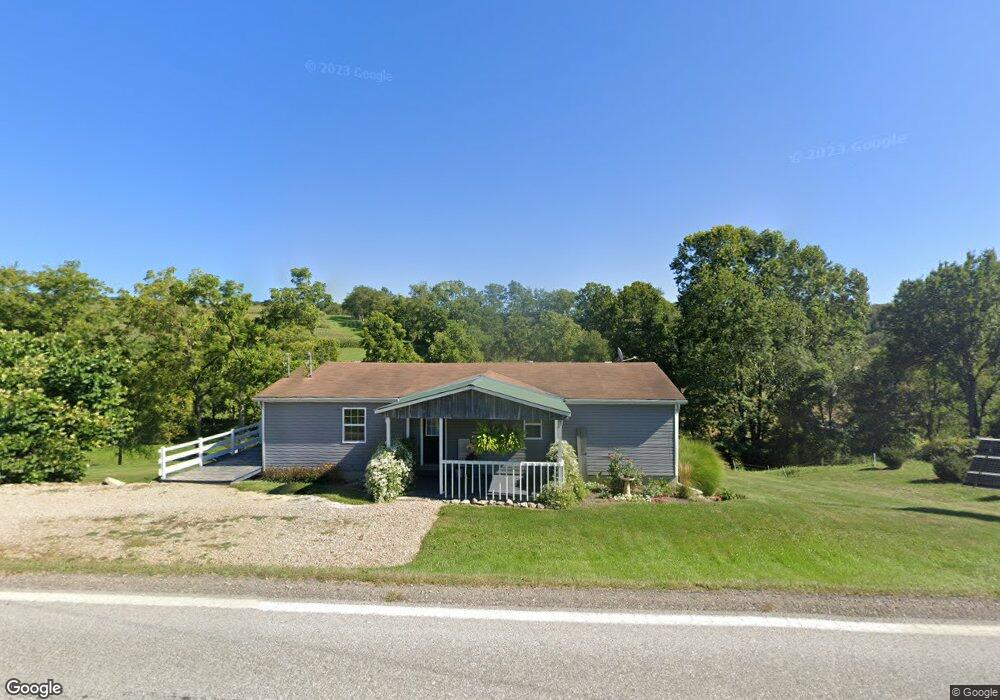
30370 State Route 643 Fresno, OH 43824
Estimated Value: $231,997 - $286,000
2
Beds
2
Baths
1,988
Sq Ft
$130/Sq Ft
Est. Value
About This Home
This home is located at 30370 State Route 643, Fresno, OH 43824 and is currently estimated at $259,249, approximately $130 per square foot. 30370 State Route 643 is a home located in Coshocton County with nearby schools including River View High School, White Oak School, and NEW BEDFORD SCHOOL.
Ownership History
Date
Name
Owned For
Owner Type
Purchase Details
Closed on
Sep 9, 2019
Sold by
Nisley John J and Nisley Clara J
Bought by
Yoder Lovina A
Current Estimated Value
Home Financials for this Owner
Home Financials are based on the most recent Mortgage that was taken out on this home.
Original Mortgage
$112,000
Outstanding Balance
$86,585
Interest Rate
3.7%
Mortgage Type
Future Advance Clause Open End Mortgage
Estimated Equity
$172,664
Purchase Details
Closed on
Nov 28, 2016
Sold by
Fowler Ii Carl J
Bought by
Nisley John J and Nisley Clara J
Purchase Details
Closed on
Nov 6, 1997
Bought by
Fowler Carl J
Create a Home Valuation Report for This Property
The Home Valuation Report is an in-depth analysis detailing your home's value as well as a comparison with similar homes in the area
Home Values in the Area
Average Home Value in this Area
Purchase History
| Date | Buyer | Sale Price | Title Company |
|---|---|---|---|
| Yoder Lovina A | $150,000 | Monroe Street Title Co Ltd | |
| Nisley John J | $137,900 | None Available | |
| Fowler Carl J | -- | -- |
Source: Public Records
Mortgage History
| Date | Status | Borrower | Loan Amount |
|---|---|---|---|
| Open | Yoder Lovina A | $112,000 |
Source: Public Records
Tax History Compared to Growth
Tax History
| Year | Tax Paid | Tax Assessment Tax Assessment Total Assessment is a certain percentage of the fair market value that is determined by local assessors to be the total taxable value of land and additions on the property. | Land | Improvement |
|---|---|---|---|---|
| 2024 | $2,087 | $58,790 | $14,880 | $43,910 |
| 2023 | $2,087 | $48,342 | $9,954 | $38,388 |
| 2022 | $1,842 | $48,342 | $9,954 | $38,388 |
| 2021 | $1,842 | $48,342 | $9,954 | $38,388 |
| 2020 | $1,247 | $32,480 | $9,975 | $22,505 |
| 2019 | $1,275 | $32,480 | $9,975 | $22,505 |
| 2018 | $1,180 | $32,480 | $9,975 | $22,505 |
| 2017 | $1,124 | $29,029 | $8,505 | $20,524 |
| 2016 | $1,066 | $29,029 | $8,505 | $20,524 |
| 2015 | $533 | $29,029 | $8,505 | $20,524 |
| 2014 | $2,312 | $27,861 | $6,143 | $21,718 |
Source: Public Records
Map
Nearby Homes
- 31509 Township Road 227
- 32469 Township Road 219
- 0 Township Road 219
- 0 Township Road 219
- 30945 County Road 126
- 28427 Ohio 83
- 31705 Township Road 236
- 0 Tr-88 Unit 5165275
- 0 County Road 1
- 26938 County Road 1
- 26929 County Road 1
- 0 State Rd 93 Unit 23494832
- 29466 Ohio 93
- 0 Ohio 93
- 53320 County Road 425
- 310 S Butler St
- 204 S Butler St
- 54500 Township Road 170
- 0 Township Road 176 Unit 5117122
- 23900 Airport Rd
- 30290 County Road 190
- 30240 County Road 190
- 31070 County Road 190
- 30401 State Route 643
- 30245 Township Road 214
- 30167 County Road 190
- 30080 County Road 190
- 30111 County Road 190
- 30386 Township Road 214
- 30556 Ohio 643
- 29245 Township Road 11
- 30034 State Route 643
- 50910 Township Road 225
- 29958 County Road 190
- 29968 State Route 643
- 30523 Township Road 11
- 29955 County Road 190
- 50973 Township Road 225
- 29951 County Road 190
- 29951 County Road 190 Unit 29955