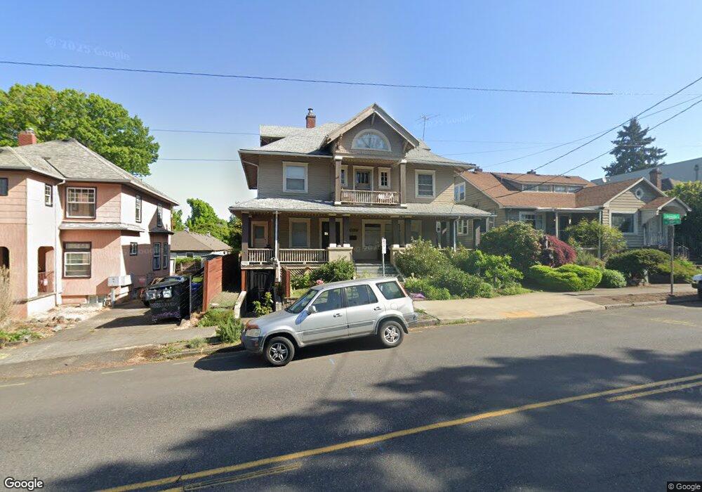
3039 E Burnside St Portland, OR 97214
Kerns NeighborhoodEstimated Value: $714,000 - $955,000
4
Beds
3
Baths
2,089
Sq Ft
$386/Sq Ft
Est. Value
About This Home
This home is located at 3039 E Burnside St, Portland, OR 97214 and is currently estimated at $806,929, approximately $386 per square foot. 3039 E Burnside St is a home located in Multnomah County with nearby schools including Sunnyside Environmental School, Franklin High School, and Le Monde French Immersion Public Charter School.
Ownership History
Date
Name
Owned For
Owner Type
Purchase Details
Closed on
Sep 17, 1997
Sold by
Taylor Duane M
Bought by
Orian Dwight Kahala
Current Estimated Value
Home Financials for this Owner
Home Financials are based on the most recent Mortgage that was taken out on this home.
Original Mortgage
$175,750
Outstanding Balance
$26,135
Interest Rate
7.45%
Mortgage Type
Purchase Money Mortgage
Estimated Equity
$780,794
Create a Home Valuation Report for This Property
The Home Valuation Report is an in-depth analysis detailing your home's value as well as a comparison with similar homes in the area
Home Values in the Area
Average Home Value in this Area
Purchase History
| Date | Buyer | Sale Price | Title Company |
|---|---|---|---|
| Orian Dwight Kahala | $185,000 | Ticor Title Insurance |
Source: Public Records
Mortgage History
| Date | Status | Borrower | Loan Amount |
|---|---|---|---|
| Open | Orian Dwight Kahala | $175,750 |
Source: Public Records
Tax History
| Year | Tax Paid | Tax Assessment Tax Assessment Total Assessment is a certain percentage of the fair market value that is determined by local assessors to be the total taxable value of land and additions on the property. | Land | Improvement |
|---|---|---|---|---|
| 2025 | $10,975 | $407,310 | -- | -- |
| 2024 | $10,580 | $395,450 | -- | -- |
| 2023 | $10,174 | $383,940 | $0 | $0 |
| 2022 | $9,954 | $372,760 | $0 | $0 |
| 2021 | $9,785 | $361,910 | $0 | $0 |
| 2020 | $8,976 | $351,373 | $0 | $0 |
| 2019 | $7,987 | $315,130 | $0 | $0 |
| 2018 | $7,753 | $305,960 | $0 | $0 |
| 2017 | $7,430 | $297,050 | $0 | $0 |
| 2016 | $6,800 | $288,400 | $0 | $0 |
Source: Public Records
Map
Nearby Homes
- 117 SE 30th Place
- 3136 NE Couch St
- 215 NE 30th Ave Unit 217
- 130 SE 31st Ave Unit 2
- 2854 SE Ankeny St
- 28 SE 28th Ave Unit 304
- 2903 SE Pine St Unit 2909
- 2712 SE Ash St
- 450 NE 32nd Ave
- 428 SE 30th Place
- 2625 SE Stark St
- 627 NE Randall Ave
- 623 NE Randall Ave
- 2342 SE Ankeny St
- 2820 NE Oregon St
- 2422 NE Glisan St
- 2604 SE Washington St
- 536 NE Hazelfern Place
- 2232 SE Ankeny St Unit 2
- 2234 SE Ankeny St Unit 3
- 3027 E Burnside St
- 3049 E Burnside St Unit 3053
- 3059 E Burnside St
- 3018 NE Couch St Unit 3020
- 3020 NE Couch St
- 3028 NE Couch St
- 20-50 NE 30th Ave
- 2050 NE 30th Ave
- 3036 NE Couch St
- 2955 E Burnside St
- 4 SE 30th Place
- 3046 NE Couch St
- 3028 E Burnside St Unit 1
- 9 SE 30th Place Unit 15
- 2954 NE Couch St
- 2943 E Burnside St Unit 2947
- 14 SE 30th Place
- 3056 NE Couch St
- 3068 E Burnside St Unit 3070
- 17 SE 30th Place
Your Personal Tour Guide
Ask me questions while you tour the home.