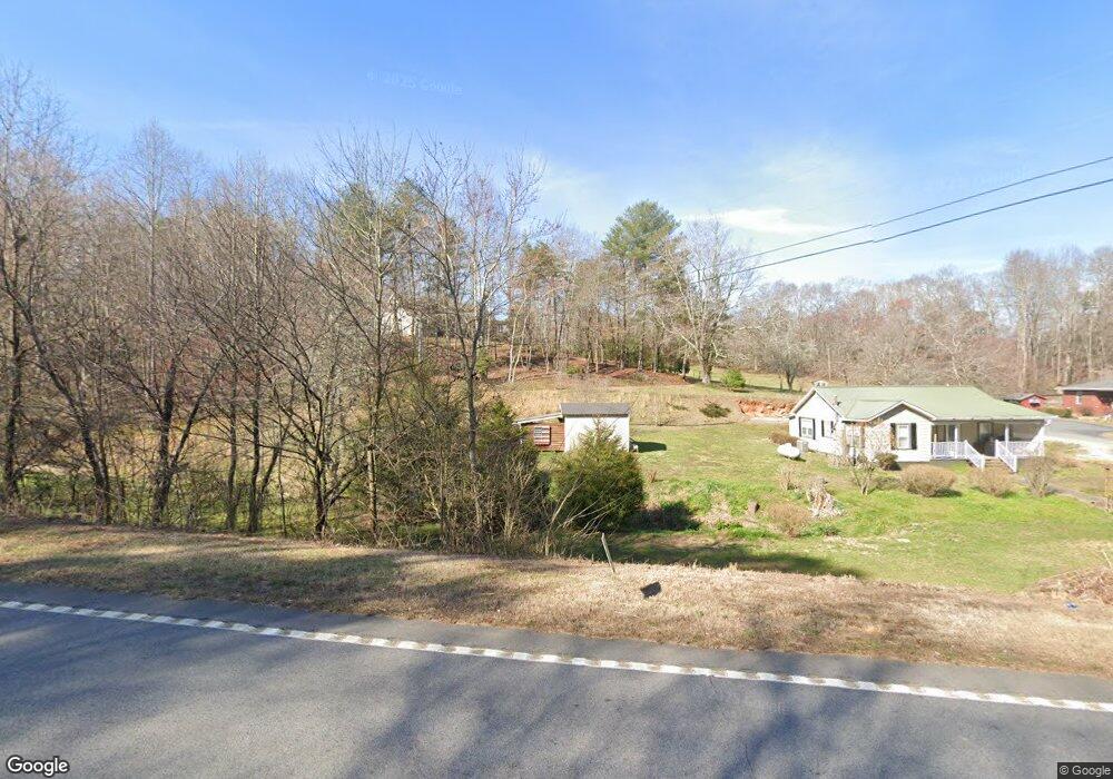
3039 Highway 197 Mount Airy, GA 30563
Estimated Value: $538,000 - $558,000
3
Beds
3
Baths
2,660
Sq Ft
$207/Sq Ft
Est. Value
About This Home
This home is located at 3039 Highway 197, Mount Airy, GA 30563 and is currently estimated at $549,706, approximately $206 per square foot. 3039 Highway 197 is a home located in Habersham County with nearby schools including Demorest Elementary School, Habersham Success Academy, and Wilbanks Middle School.
Ownership History
Date
Name
Owned For
Owner Type
Purchase Details
Closed on
Apr 2, 2019
Sold by
Barrett Scott Heath
Bought by
Demore Howard Scott
Current Estimated Value
Purchase Details
Closed on
Apr 30, 2009
Sold by
Ansley William Charles
Bought by
Barrett Scott H
Home Financials for this Owner
Home Financials are based on the most recent Mortgage that was taken out on this home.
Original Mortgage
$44,800
Interest Rate
4.79%
Mortgage Type
New Conventional
Purchase Details
Closed on
Apr 15, 2009
Sold by
Ansley Dwayne Stacey
Bought by
Ansley William Charles
Home Financials for this Owner
Home Financials are based on the most recent Mortgage that was taken out on this home.
Original Mortgage
$44,800
Interest Rate
4.79%
Mortgage Type
New Conventional
Create a Home Valuation Report for This Property
The Home Valuation Report is an in-depth analysis detailing your home's value as well as a comparison with similar homes in the area
Home Values in the Area
Average Home Value in this Area
Purchase History
| Date | Buyer | Sale Price | Title Company |
|---|---|---|---|
| Demore Howard Scott | -- | -- | |
| Barrett Scott H | $56,000 | -- | |
| Ansley William Charles | -- | -- |
Source: Public Records
Mortgage History
| Date | Status | Borrower | Loan Amount |
|---|---|---|---|
| Previous Owner | Ansley William Charles | $25,000 | |
| Previous Owner | Ansley William Charles | $44,800 |
Source: Public Records
Tax History Compared to Growth
Tax History
| Year | Tax Paid | Tax Assessment Tax Assessment Total Assessment is a certain percentage of the fair market value that is determined by local assessors to be the total taxable value of land and additions on the property. | Land | Improvement |
|---|---|---|---|---|
| 2025 | $4,557 | $236,903 | $22,225 | $214,678 |
| 2024 | -- | $217,660 | $8,392 | $209,268 |
| 2023 | $3,539 | $182,352 | $8,392 | $173,960 |
| 2022 | $3,862 | $158,440 | $8,392 | $150,048 |
| 2021 | $4,114 | $142,204 | $7,692 | $134,512 |
| 2020 | $2,826 | $106,996 | $13,364 | $93,632 |
| 2019 | $499 | $106,996 | $13,364 | $93,632 |
| 2018 | $495 | $20,448 | $13,364 | $7,084 |
| 2017 | $474 | $19,564 | $13,364 | $6,200 |
| 2016 | $458 | $48,910 | $13,364 | $6,200 |
| 2015 | $453 | $48,910 | $13,364 | $6,200 |
| 2014 | $474 | $50,100 | $13,364 | $6,676 |
| 2013 | -- | $20,040 | $13,364 | $6,676 |
Source: Public Records
Map
Nearby Homes
- 2240 Hazel Creek Rd
- 787 Ansley Rd
- 309 Morning Star Ln
- 161 Wayward Winds Dr
- 676 Sweetgrass Dr
- 799 Sweetgrass Dr
- 136 Sweetgrass Dr
- 815 Sweetgrass Ct
- 865 Sweetgrass Ct
- 877 Sweetgrass Ct
- 1126 Sydney Ln
- 1132 Sydney Ln
- 204 Linwood Dr
- 0 Sweetgrass Dr Unit 7658113
- 0 Sweetgrass Dr Unit 7658111
- 0 N Highway 365 Unit 10006830
- 1344 Blue Grass Ct
- 144 Rolling Ridge Rd
- 222 N Mize Rd
- 417 Sweetgrass Dr
- 133 Cedar Ln
- 0 Cedar Ln Unit 7098469
- 0 Cedar Ln Unit 8022601
- 0 Cedar Ln Unit 2917554
- 0 Cedar Ln
- 173 Cedar Ln
- 174 Cedar Ln
- 3240 S Sthwy 197
- 3240 Highway 197
- 3240 Highway 197
- 2947 Highway 197
- 205 Cedar Ln
- 3124 S St Highway 197
- 3124 Highway 197
- 2829 Highway 197
- 151 Evergreen Trail
- 131 Twin Branch Ct
- 2832 Highway 197
- 2824 Highway 197
- 790 Ansley Rd