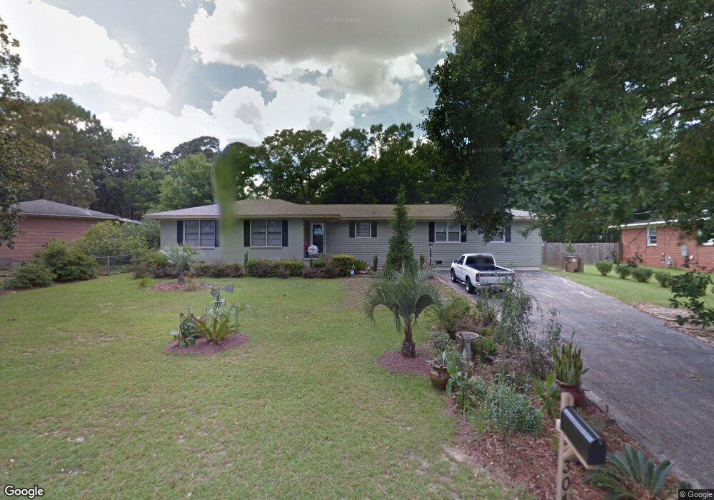
304 Azalea Rd Mobile, AL 36609
Jackson Heights NeighborhoodEstimated Value: $166,000 - $215,000
3
Beds
2
Baths
1,903
Sq Ft
$100/Sq Ft
Est. Value
About This Home
This home is located at 304 Azalea Rd, Mobile, AL 36609 and is currently estimated at $190,246, approximately $99 per square foot. 304 Azalea Rd is a home located in Mobile County with nearby schools including Elizabeth Fonde Elementary School, Chastang-Fournier K-8 School, and WP Davidson High School.
Ownership History
Date
Name
Owned For
Owner Type
Purchase Details
Closed on
Mar 9, 2010
Sold by
Wells Fargo Bank N A
Bought by
The Secretary Of Housing & Urban Develop
Current Estimated Value
Purchase Details
Closed on
Jul 20, 2009
Sold by
Hearn Charles C
Bought by
Wells Fargo Bank Na
Purchase Details
Closed on
Feb 11, 2005
Sold by
Carter Gerald M and Carter Shirley A
Bought by
Hearn Charles C
Home Financials for this Owner
Home Financials are based on the most recent Mortgage that was taken out on this home.
Original Mortgage
$97,826
Interest Rate
5.72%
Mortgage Type
FHA
Create a Home Valuation Report for This Property
The Home Valuation Report is an in-depth analysis detailing your home's value as well as a comparison with similar homes in the area
Home Values in the Area
Average Home Value in this Area
Purchase History
| Date | Buyer | Sale Price | Title Company |
|---|---|---|---|
| The Secretary Of Housing & Urban Develop | -- | None Available | |
| Wells Fargo Bank Na | $106,873 | None Available | |
| Hearn Charles C | $98,600 | Slt |
Source: Public Records
Mortgage History
| Date | Status | Borrower | Loan Amount |
|---|---|---|---|
| Previous Owner | Hearn Charles C | $97,826 |
Source: Public Records
Tax History
| Year | Tax Paid | Tax Assessment Tax Assessment Total Assessment is a certain percentage of the fair market value that is determined by local assessors to be the total taxable value of land and additions on the property. | Land | Improvement |
|---|---|---|---|---|
| 2025 | -- | $17,960 | $2,800 | $15,160 |
| 2024 | -- | $16,790 | $2,800 | $13,990 |
| 2023 | $0 | $16,170 | $2,800 | $13,370 |
| 2022 | $0 | $14,890 | $3,000 | $11,890 |
| 2021 | $0 | $13,520 | $2,500 | $11,020 |
| 2020 | $0 | $13,520 | $2,500 | $11,020 |
| 2019 | $725 | $12,480 | $0 | $0 |
| 2018 | $725 | $12,480 | $0 | $0 |
| 2017 | $704 | $12,140 | $0 | $0 |
| 2016 | $720 | $12,400 | $0 | $0 |
| 2013 | $678 | $10,320 | $0 | $0 |
Source: Public Records
Map
Nearby Homes
- 363 Mcqueen Ave
- 306 Thornton Place
- 421 Mcqueen Ave
- 812 Downtowner Loop W
- 728 Spring Station Rd
- 308 Mcqueen Ave
- 4059 Airport Blvd
- 4365 Downtowner Loop S
- 603 Thornton Place
- 4357 Downtowner Loop S
- 712 Spring Station Rd
- 4126 Springdale Rd
- 4131 Springdale Rd
- 3983 Wimbledon Park
- 0 Bellevue Ln
- 500 Castile Dr
- 502 Nantucket Cir
- 3972 Wimbledon Park
- 4001 Sunnyvale Ln S
- 4017 Meadow Wood Curve
- 302 Azalea Rd
- 306 Azalea Rd
- 363 Bourgeois Cir
- 4001 Michael Blvd
- 4003 Michael Blvd
- 361 Bourgeois Cir
- 3951 Bourgeois Dr
- 4007 Michael Blvd
- 360 Bourgeois Cir
- 4009 Michael Blvd
- 3959 Bourgeois Dr
- 362 Bourgeois Cir
- 416 Azalea Rd
- 4011 Michael Blvd
- 364 Bourgeois Cir
- 325 Wayne Place
- 3963 Bourgeois Dr
- 4001 Bourgeois Dr
- 4013 Michael Blvd
- 415 W Vista Ct
Your Personal Tour Guide
Ask me questions while you tour the home.