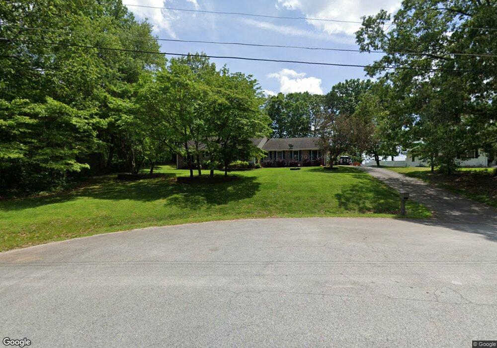
304 Beaverbrook Dr Unit 45 Toccoa, GA 30577
Estimated Value: $320,016 - $390,000
3
Beds
3
Baths
2,318
Sq Ft
$157/Sq Ft
Est. Value
About This Home
This home is located at 304 Beaverbrook Dr Unit 45, Toccoa, GA 30577 and is currently estimated at $365,004, approximately $157 per square foot. 304 Beaverbrook Dr Unit 45 is a home located in Stephens County with nearby schools including Stephens County High School.
Ownership History
Date
Name
Owned For
Owner Type
Purchase Details
Closed on
Mar 16, 2016
Sold by
Larock Kimberly
Bought by
Walker Clarence M and Walker Marcia L
Current Estimated Value
Purchase Details
Closed on
Aug 17, 2015
Sold by
Burruss Linda N
Bought by
Larock Kimberly
Purchase Details
Closed on
Jul 17, 2014
Sold by
Burruss Linda Norris
Bought by
Larock Kimberly and O Linda Norris Bu C
Purchase Details
Closed on
Jul 30, 2010
Sold by
Unger Lorraine M
Bought by
Burruss James K
Home Financials for this Owner
Home Financials are based on the most recent Mortgage that was taken out on this home.
Original Mortgage
$124,800
Interest Rate
4.61%
Mortgage Type
New Conventional
Create a Home Valuation Report for This Property
The Home Valuation Report is an in-depth analysis detailing your home's value as well as a comparison with similar homes in the area
Purchase History
| Date | Buyer | Sale Price | Title Company |
|---|---|---|---|
| Walker Clarence M | $146,000 | -- | |
| Larock Kimberly | -- | -- | |
| Larock Kimberly | -- | -- | |
| Burruss James K | $156,000 | -- |
Source: Public Records
Mortgage History
| Date | Status | Borrower | Loan Amount |
|---|---|---|---|
| Previous Owner | Burruss James K | $124,800 |
Source: Public Records
Tax History
| Year | Tax Paid | Tax Assessment Tax Assessment Total Assessment is a certain percentage of the fair market value that is determined by local assessors to be the total taxable value of land and additions on the property. | Land | Improvement |
|---|---|---|---|---|
| 2025 | $1,749 | $121,575 | $5,218 | $116,357 |
| 2024 | $1,306 | $78,912 | $5,218 | $73,694 |
| 2023 | $588 | $73,356 | $5,218 | $68,138 |
| 2022 | $990 | $69,209 | $5,218 | $63,991 |
| 2021 | $880 | $64,086 | $5,218 | $58,868 |
| 2020 | $880 | $63,813 | $5,218 | $58,595 |
| 2019 | $871 | $63,393 | $5,218 | $58,175 |
| 2018 | $871 | $63,393 | $5,218 | $58,175 |
| 2017 | $724 | $63,393 | $5,218 | $58,175 |
| 2016 | $2,010 | $63,393 | $5,218 | $58,175 |
| 2015 | -- | $66,208 | $5,218 | $60,990 |
| 2014 | -- | $66,209 | $5,218 | $60,991 |
| 2013 | -- | $66,644 | $5,924 | $60,720 |
Source: Public Records
Map
Nearby Homes
- 1292 Fernside Dr
- 668 Brookdale Rd
- 297 Ayers Creek Dr
- 327 Ayers Creek Dr
- 81 Boulder Dr
- 0 E Currahee St Unit 10544607
- 337 Rock Creek Rd
- 110 Valley Rd
- 0 Brookhaven Cir Unit 10616964
- 148 Moreland Dr
- 43 Sycamore Dr
- 156 White Pine Rd
- 104-110 White Pine Rd
- 321 Quail Forest Cir
- 5.10 ACRES Hwy 123
- 0 Hwy 17 Alt Unit 10577119
- 122 King St
- 535 Deer Chase
- 45 Hayes St
- Lot 21 Deer Chase
- 304 Beaver Brook Dr Unit 45
- 304 Beaver Brook Dr
- 286 Beaver Brook Dr
- 264 Beaver Brook Dr
- 309 Beaver Brook Dr
- 291 Beaver Brook Dr
- 256 Beaver Brook Dr
- 257 Beaver Brook Dr
- 214 Beaver Brook Dr
- 104 Beaver Brook Dr
- 185 Beaver Brook Dr
- 250 Indian Hill Dr
- 77 Beaver Brook Cir
- 19 Beaver Brook Cir
- 19 Beaver Brook Cir
- 128 Beaver Brook Dr
- 50 Beaver Brook Cir
- 72 Beaver Brook Dr
- 158 Ivy Brook Ln
- 220 Ivy Brook Ln
Your Personal Tour Guide
Ask me questions while you tour the home.