Estimated Value: $195,569 - $207,000
3
Beds
2
Baths
2,000
Sq Ft
$101/Sq Ft
Est. Value
About This Home
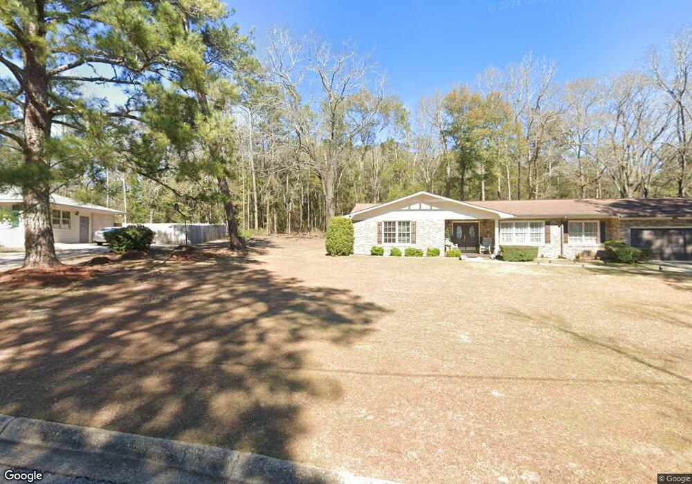
This home is located at 304 Briarcliff Rd, Ozark, AL 36360 and is currently estimated at $202,392, approximately $101 per square foot. 304 Briarcliff Rd is a home located in Dale County with nearby schools including Lisenby Primary School, Mixon Intermediate School, and D. A. Smith Middle School.
Ownership History
Date
Name
Owned For
Owner Type
Purchase Details
Closed on
Mar 3, 2022
Sold by
Diggs George T
Bought by
Reynolds Leticia
Current Estimated Value
Home Financials for this Owner
Home Financials are based on the most recent Mortgage that was taken out on this home.
Original Mortgage
$81,400
Outstanding Balance
$75,854
Interest Rate
3.69%
Mortgage Type
New Conventional
Estimated Equity
$126,538
Purchase Details
Closed on
Aug 27, 2021
Sold by
Sims Walter R and Sims Faye L
Bought by
Diggs George T and Diggs Baylies L
Create a Home Valuation Report for This Property
The Home Valuation Report is an in-depth analysis detailing your home's value as well as a comparison with similar homes in the area
Home Values in the Area
Average Home Value in this Area
Purchase History
| Date | Buyer | Sale Price | Title Company |
|---|---|---|---|
| Reynolds Leticia | $160,000 | None Listed On Document | |
| Diggs George T | -- | None Available |
Source: Public Records
Mortgage History
| Date | Status | Borrower | Loan Amount |
|---|---|---|---|
| Open | Reynolds Leticia | $81,400 |
Source: Public Records
Tax History Compared to Growth
Tax History
| Year | Tax Paid | Tax Assessment Tax Assessment Total Assessment is a certain percentage of the fair market value that is determined by local assessors to be the total taxable value of land and additions on the property. | Land | Improvement |
|---|---|---|---|---|
| 2024 | -- | $17,900 | $600 | $17,300 |
| 2023 | $0 | $15,520 | $600 | $14,920 |
| 2022 | $520 | $10,300 | $0 | $0 |
| 2021 | $1,123 | $22,240 | $1,200 | $21,040 |
| 2020 | $1,123 | $22,240 | $1,200 | $21,040 |
| 2019 | $1,123 | $22,240 | $1,200 | $21,040 |
| 2018 | $478 | $10,540 | $600 | $9,940 |
| 2017 | $478 | $10,540 | $600 | $9,940 |
| 2016 | $478 | $10,540 | $600 | $9,940 |
| 2015 | $478 | $10,540 | $600 | $9,940 |
| 2014 | $469 | $10,360 | $600 | $9,760 |
| 2013 | $465 | $10,360 | $600 | $9,760 |
Source: Public Records
Map
Nearby Homes
- 0 Briar Cliff Dr Lot 1 Blk D
- 0 Briar Cliff Rd Lot 5 Bk E
- 252 Del Rio Terrace
- 0 Del Rio Terrace
- 729 Pine Ave
- 00 Lot 9 & 10 Sandy Hill
- 166 Garner Dr
- 00
- 13.35 Acres U S 231
- 4.3 Acres U S 231
- 1.5 Acres U S 231
- 152 Short Pine Ave
- 00 Fairview Street Oak Ave
- 236 Choctaw Ave
- 1.144 Acres S Highway 231
- 179 Dixie Dr
- 0000 Magnolia St
- 129 Jackson St
- 124 Sandy Hills Ct
- 471 Magnolia St
- 324 Briarcliff Rd
- 300 Briarcliff Rd
- 295 Briarcliff Rd
- 321 Briarcliff Rd
- 340 Briarcliff Rd
- 349 Briarcliff Rd
- 265 Briarcliff Rd
- 347 Pine Ave
- 359 Pine Ave
- 137 Buena Vista Dr
- 137 Buena Vista Dr
- 247 Briarcliff Rd
- 383 Briarcliff Rd
- 0 Briarcliff Unit 5 & 6 187792
- 0 Briarcliff Unit 1 Blk D 187763
- 0 Briarcliff Unit 5 187789
- 0 Briarcliff Unit 1 BK A 187762
- 329 Pine Ave
- 232 Briarcliff Rd
- 156 Headland Ave