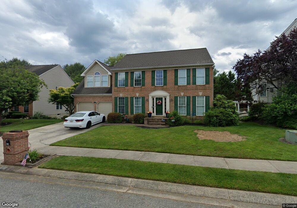
304 Cannery Ln Forest Hill, MD 21050
Estimated Value: $539,473 - $653,000
Studio
3
Baths
2,124
Sq Ft
$282/Sq Ft
Est. Value
About This Home
This home is located at 304 Cannery Ln, Forest Hill, MD 21050 and is currently estimated at $598,618, approximately $281 per square foot. 304 Cannery Ln is a home located in Harford County with nearby schools including Forest Hill Elementary School, Bel Air Middle School, and Bel Air High School.
Ownership History
Date
Name
Owned For
Owner Type
Purchase Details
Closed on
Jan 22, 2003
Sold by
Roberts Brian C
Bought by
Rocker Donald J and Rocker Lisa M
Current Estimated Value
Purchase Details
Closed on
May 11, 1998
Sold by
Nelthropp Gary S
Bought by
Roberts Brian C and Roberts Monica S
Purchase Details
Closed on
Nov 6, 1996
Sold by
Spenceola Farms L L C
Bought by
Nelthropp Gary S and Nelthropp Susan J
Create a Home Valuation Report for This Property
The Home Valuation Report is an in-depth analysis detailing your home's value as well as a comparison with similar homes in the area
Home Values in the Area
Average Home Value in this Area
Purchase History
| Date | Buyer | Sale Price | Title Company |
|---|---|---|---|
| Rocker Donald J | $305,000 | -- | |
| Roberts Brian C | $211,500 | -- | |
| Nelthropp Gary S | $196,900 | -- |
Source: Public Records
Mortgage History
| Date | Status | Borrower | Loan Amount |
|---|---|---|---|
| Closed | Nelthropp Gary S | -- |
Source: Public Records
Tax History
| Year | Tax Paid | Tax Assessment Tax Assessment Total Assessment is a certain percentage of the fair market value that is determined by local assessors to be the total taxable value of land and additions on the property. | Land | Improvement |
|---|---|---|---|---|
| 2025 | $4,083 | $382,900 | $124,300 | $258,600 |
| 2024 | $4,083 | $374,633 | $0 | $0 |
| 2023 | $3,993 | $366,367 | $0 | $0 |
| 2022 | $3,903 | $358,100 | $124,300 | $233,800 |
| 2021 | $4,036 | $353,900 | $0 | $0 |
| 2020 | $4,036 | $349,700 | $0 | $0 |
| 2019 | $3,987 | $345,500 | $128,100 | $217,400 |
| 2018 | $3,890 | $340,200 | $0 | $0 |
| 2017 | $3,830 | $345,500 | $0 | $0 |
| 2016 | $140 | $329,600 | $0 | $0 |
| 2015 | $4,080 | $329,600 | $0 | $0 |
| 2014 | $4,080 | $329,600 | $0 | $0 |
Source: Public Records
Map
Nearby Homes
- 314 Streett Cir
- 205 Kimary Ct Unit H
- 109 Marshall Dr
- 202 Kimary Ct Unit 1A
- 206 Kimary Ct Unit 1B
- 137 Spencer Cir
- 1721 Chrisemmett Ct Unit 3A
- 107 J Sunshine Ct
- 105 Sunshine Ct Unit G
- 2013 Columbine Ln
- 1605 Samantha Dr
- 203 Reba Ct
- 311 Willrich Cir Unit G
- 1615 Samantha Dr
- 112 Gwen Dr Unit 1K
- 1120 Spalding Dr Unit G
- 1809 Beth Bridge Cir
- 310 Willrich Cir
- 138 Paden Ct
- 142 Paden Ct
Your Personal Tour Guide
Ask me questions while you tour the home.