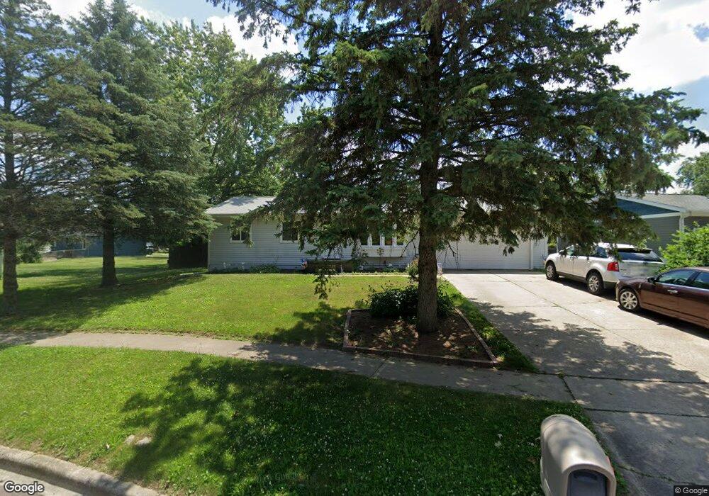
304 Cree Ct Tecumseh, MI 49286
Estimated Value: $179,000 - $232,641
3
Beds
2
Baths
988
Sq Ft
$208/Sq Ft
Est. Value
About This Home
This home is located at 304 Cree Ct, Tecumseh, MI 49286 and is currently estimated at $205,547, approximately $208 per square foot. 304 Cree Ct is a home located in Lenawee County with nearby schools including Tecumseh Middle School, Herrick Park Intermediate Learning Center, and Tecumseh High School.
Ownership History
Date
Name
Owned For
Owner Type
Purchase Details
Closed on
Apr 21, 2010
Sold by
Tcf National Bank National Assn
Bought by
Snead Michael E and Snead Dawn M
Current Estimated Value
Home Financials for this Owner
Home Financials are based on the most recent Mortgage that was taken out on this home.
Original Mortgage
$44,000
Outstanding Balance
$32,829
Interest Rate
7.62%
Mortgage Type
Adjustable Rate Mortgage/ARM
Estimated Equity
$172,718
Purchase Details
Closed on
Feb 11, 2010
Sold by
Mahony Kimber L and Mahony Kimber
Bought by
Tcf National Bank
Create a Home Valuation Report for This Property
The Home Valuation Report is an in-depth analysis detailing your home's value as well as a comparison with similar homes in the area
Home Values in the Area
Average Home Value in this Area
Purchase History
| Date | Buyer | Sale Price | Title Company |
|---|---|---|---|
| Snead Michael E | $52,000 | None Available | |
| Tcf National Bank | $75,000 | None Available |
Source: Public Records
Mortgage History
| Date | Status | Borrower | Loan Amount |
|---|---|---|---|
| Open | Snead Michael E | $44,000 |
Source: Public Records
Tax History Compared to Growth
Tax History
| Year | Tax Paid | Tax Assessment Tax Assessment Total Assessment is a certain percentage of the fair market value that is determined by local assessors to be the total taxable value of land and additions on the property. | Land | Improvement |
|---|---|---|---|---|
| 2025 | $2,695 | $94,500 | $0 | $0 |
| 2024 | $2,280 | $86,900 | $0 | $0 |
| 2023 | $2,650 | $81,600 | $0 | $0 |
| 2022 | $2,550 | $75,800 | $0 | $0 |
| 2021 | $2,704 | $71,200 | $0 | $0 |
| 2020 | $2,679 | $67,200 | $0 | $0 |
| 2019 | $2,633 | $64,800 | $8,200 | $56,600 |
| 2017 | $2,486 | $60,700 | $8,200 | $52,500 |
| 2016 | $2,481 | $58,000 | $7,500 | $50,500 |
| 2014 | $2,275 | $54,100 | $8,300 | $45,800 |
Source: Public Records
Map
Nearby Homes
- 301 Cree Ct
- 9103 N Union St Unit Lot 93
- 9103 N Union St Unit LOT 46
- 511 Nokomis St
- 765 Eagle View Point
- 758 Eagle View Way
- 766 Eagle View Point
- 756 Eagle View Way
- 752 Eagle View Way
- 734 Eagle View Way
- 748 Eagle View Way
- 744 Eagle View Way
- 741 Lone Oak Way
- 742 Eagle View Way
- 739 Lone Oak Way
- 740 Eagle View Way
- 716 Ternes Rd
- 736 Eagle View Way
- 732 Red Mill Point
- Elements 2070 Plan at Lone Oak of Red Mill Pond - Elements