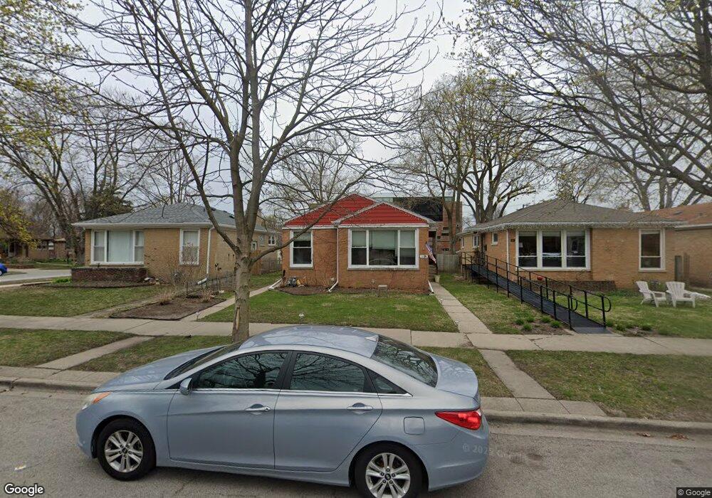
304 Darrow Ave Evanston, IL 60202
Southwest Evanston NeighborhoodEstimated Value: $438,000 - $497,211
About This Home
This home is located at 304 Darrow Ave, Evanston, IL 60202 and is currently estimated at $470,303, approximately $384 per square foot. 304 Darrow Ave is a home located in Cook County with nearby schools including Dawes Elementary School, Chute Middle School, and Evanston Township High School.
Ownership History
We collect this data history from publicly available records. To have your information removed, we recommend requesting removal directly through your county’s website.
Purchase Details
Home Financials for this Owner
Home Financials are based on the most recent Mortgage that was taken out on this home.Purchase Details
Purchase Details
Home Values in the Area
Average Home Value in this Area
Purchase History
We collect this data history from publicly available records. To have your information removed, we recommend requesting removal directly through your county’s website.
| Date | Buyer | Sale Price | Title Company |
|---|---|---|---|
| -- | Premier Title | ||
| -- | None Available | ||
| -- | Attorney |
Mortgage History
We collect this data history from publicly available records. To have your information removed, we recommend requesting removal directly through your county’s website.
| Date | Status | Borrower | Loan Amount |
|---|---|---|---|
| Open | $264,550 |
Tax History
We collect this data history from publicly available records. To have your information removed, we recommend requesting removal directly through your county’s website.
| Year | Tax Paid | Tax Assessment Tax Assessment Total Assessment is a certain percentage of the fair market value that is determined by local assessors to be the total taxable value of land and additions on the property. | Land | Improvement |
|---|---|---|---|---|
| 2025 | $7,036 | $39,000 | $13,839 | $25,161 |
| 2024 | $7,036 | $32,000 | $11,710 | $20,290 |
| 2023 | $6,725 | $32,000 | $11,710 | $20,290 |
| 2022 | $6,725 | $32,000 | $11,710 | $20,290 |
| 2021 | $6,450 | $27,313 | $8,516 | $18,797 |
| 2020 | $7,246 | $27,313 | $8,516 | $18,797 |
| 2019 | $5,779 | $30,518 | $8,516 | $22,002 |
| 2018 | $3,971 | $28,206 | $7,097 | $21,109 |
| 2017 | $5,982 | $28,206 | $7,097 | $21,109 |
| 2016 | $6,133 | $28,206 | $7,097 | $21,109 |
| 2015 | $4,869 | $22,402 | $5,855 | $16,547 |
| 2014 | $4,848 | $22,402 | $5,855 | $16,547 |
| 2013 | $4,708 | $22,402 | $5,855 | $16,547 |
Map
- 215 Dodge Ave Unit F
- 221 Dodge Ave Unit D
- 1823 Dobson St
- 1604 Dobson St
- 1609 Howard St Unit 2
- 1423 Kirk St
- 1400 Brummel St Unit 2E
- 1321 Brummel St
- 2540 W Jerome St Unit D
- 546 Dodge Ave
- 2646 W Birchwood Ave
- 7516 N California Ave
- 324 Asbury Ave
- 2909 W Howard St
- 600 Florence Ave
- 2924 W Jerome St
- 2009 Keeney St
- 1219 Hull Terrace Unit 2b
- 1219 Hull Terrace Unit 2C
- 2734 W Fargo Ave
- 301 Darrow Ave
- 1717 Mulford St
- 311 Darrow Ave
- 315 Darrow Ave
- 1726 Mulford St
- 1724 Mulford St
- 1713 Mulford St
- 317 Darrow Ave
- 1730 Mulford St
- 1720 Mulford St
- 300 Darrow Ave
- 306 Darrow Ave
- 1716 Mulford St
- 1800 Mulford St
- 321 Darrow Ave
- 312 Darrow Ave
- 1712 Mulford St
- 314 Darrow Ave
- 1804 Mulford St
- 323 Darrow Ave
Ask me questions while you tour the home.