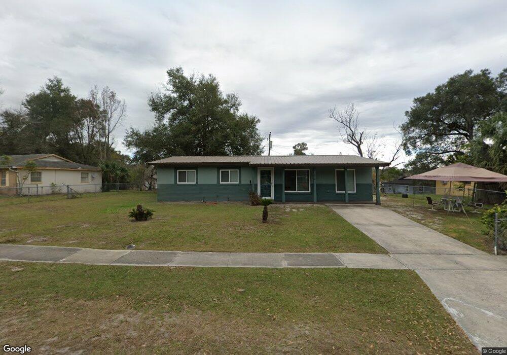
304 E Hubbard Ave Deland, FL 32724
Estimated Value: $201,000 - $232,000
3
Beds
1
Bath
1,348
Sq Ft
$161/Sq Ft
Est. Value
About This Home
This home is located at 304 E Hubbard Ave, Deland, FL 32724 and is currently estimated at $217,483, approximately $161 per square foot. 304 E Hubbard Ave is a home located in Volusia County with nearby schools including Deland High School, Freedom Elementary School, and Deland Middle School.
Ownership History
Date
Name
Owned For
Owner Type
Purchase Details
Closed on
Jan 9, 2025
Sold by
Harris Michael B and Harris Alice L
Bought by
Michael B Harris And Alice L Harris Revocable
Current Estimated Value
Purchase Details
Closed on
Dec 15, 1988
Bought by
Harris Michael B and Harris Alice L
Purchase Details
Closed on
Jul 15, 1988
Bought by
Harris Michael B and Harris Alice L
Purchase Details
Closed on
Oct 15, 1986
Bought by
Harris Michael B and Harris Alice L
Purchase Details
Closed on
Feb 15, 1984
Bought by
Harris Michael B and Harris Alice L
Create a Home Valuation Report for This Property
The Home Valuation Report is an in-depth analysis detailing your home's value as well as a comparison with similar homes in the area
Home Values in the Area
Average Home Value in this Area
Purchase History
| Date | Buyer | Sale Price | Title Company |
|---|---|---|---|
| Michael B Harris And Alice L Harris Revocable | $100 | None Listed On Document | |
| Harris Michael B | $100 | -- | |
| Harris Michael B | $36,600 | -- | |
| Harris Michael B | $33,500 | -- | |
| Harris Michael B | $28,500 | -- |
Source: Public Records
Tax History Compared to Growth
Tax History
| Year | Tax Paid | Tax Assessment Tax Assessment Total Assessment is a certain percentage of the fair market value that is determined by local assessors to be the total taxable value of land and additions on the property. | Land | Improvement |
|---|---|---|---|---|
| 2025 | $474 | $54,050 | -- | -- |
| 2024 | $474 | $52,527 | -- | -- |
| 2023 | $474 | $50,998 | $0 | $0 |
| 2022 | $468 | $49,513 | $0 | $0 |
| 2021 | $474 | $48,071 | $0 | $0 |
| 2020 | $368 | $42,867 | $0 | $0 |
| 2019 | $365 | $41,903 | $0 | $0 |
| 2018 | $108 | $29,815 | $0 | $0 |
| 2017 | $98 | $29,202 | $0 | $0 |
| 2016 | $83 | $28,601 | $0 | $0 |
| 2015 | $81 | $28,402 | $0 | $0 |
| 2014 | $77 | $28,177 | $0 | $0 |
Source: Public Records
Map
Nearby Homes
- 614 S Amelia Ave
- 13 Villa Villar Ct Unit 130
- 9 Villa Villar Ct
- 35 Villa Villar Ct Unit 35
- 0 S Garfield Ave Unit MFRV4945071
- 338 E Volusia Ave
- 47 Villa Villar Ct Unit 470
- 0 Deland Unit MFRV4942835
- 0 Deland Unit 1213697
- 0 Deland Unit R11052053
- 590 E Division St
- 127 Alexandria Cir
- 333 E Beresford Ave
- 205 E Voorhis Ave
- 610 E Euclid Ave
- 215 E Voorhis Ave Unit 2D
- 0 U S 92
- 233 Elmwood Ave Unit 290
- 205 W Division St
- 138 W Volusia Ave
- 308 E Hubbard Ave
- 302 E Hubbard Ave
- 607 Larry Dr
- 605 Larry Dr
- 609 Larry Dr
- 0 Barbara Ct Unit S4852699
- 312 E Hubbard Ave
- 603 Larry Dr
- 305 E Hubbard Ave
- 300 E Hubbard Ave
- 303 E Hubbard Ave
- 307 E Hubbard Ave
- 611 Larry Dr
- 301 E Hubbard Ave
- 602 S Amelia Ave
- 604 Larry Dr
- 608 Larry Dr
- 309 E Hubbard Ave
- 596 Laisy Dr
- 604 S Amelia Ave