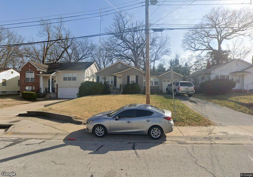
304 Euclid Ave Saint Louis, MO 63119
Estimated Value: $237,357 - $267,000
3
Beds
2
Baths
878
Sq Ft
$285/Sq Ft
Est. Value
About This Home
This home is located at 304 Euclid Ave, Saint Louis, MO 63119 and is currently estimated at $250,589, approximately $285 per square foot. 304 Euclid Ave is a home located in St. Louis County with nearby schools including Edgar Road Elementary School, Hixson Middle School, and Webster Groves High School.
Ownership History
Date
Name
Owned For
Owner Type
Purchase Details
Closed on
Oct 14, 2009
Sold by
Davidson James Matthew
Bought by
Roberts William A and Roberts Lisa A
Current Estimated Value
Home Financials for this Owner
Home Financials are based on the most recent Mortgage that was taken out on this home.
Original Mortgage
$152,192
Outstanding Balance
$99,480
Interest Rate
5.1%
Mortgage Type
FHA
Estimated Equity
$151,109
Purchase Details
Closed on
May 22, 2007
Sold by
Williams Precilla A and Bulard Mark Christopher
Bought by
Davidson James Matthew
Home Financials for this Owner
Home Financials are based on the most recent Mortgage that was taken out on this home.
Original Mortgage
$144,900
Interest Rate
6.16%
Mortgage Type
Purchase Money Mortgage
Create a Home Valuation Report for This Property
The Home Valuation Report is an in-depth analysis detailing your home's value as well as a comparison with similar homes in the area
Home Values in the Area
Average Home Value in this Area
Purchase History
| Date | Buyer | Sale Price | Title Company |
|---|---|---|---|
| Roberts William A | $155,000 | Htc | |
| Davidson James Matthew | $161,000 | None Available |
Source: Public Records
Mortgage History
| Date | Status | Borrower | Loan Amount |
|---|---|---|---|
| Open | Roberts William A | $152,192 | |
| Previous Owner | Davidson James Matthew | $144,900 |
Source: Public Records
Tax History Compared to Growth
Tax History
| Year | Tax Paid | Tax Assessment Tax Assessment Total Assessment is a certain percentage of the fair market value that is determined by local assessors to be the total taxable value of land and additions on the property. | Land | Improvement |
|---|---|---|---|---|
| 2025 | $2,733 | $45,920 | $22,930 | $22,990 |
| 2024 | $2,733 | $37,840 | $14,740 | $23,100 |
| 2023 | $2,764 | $37,840 | $14,740 | $23,100 |
| 2022 | $2,632 | $33,630 | $14,740 | $18,890 |
| 2021 | $2,616 | $33,630 | $14,740 | $18,890 |
| 2020 | $2,750 | $33,820 | $9,820 | $24,000 |
| 2019 | $2,734 | $33,820 | $9,820 | $24,000 |
| 2018 | $2,236 | $24,250 | $6,860 | $17,390 |
| 2017 | $2,225 | $24,250 | $6,860 | $17,390 |
| 2016 | $2,042 | $21,210 | $6,860 | $14,350 |
| 2015 | $1,969 | $21,210 | $6,860 | $14,350 |
| 2014 | $1,997 | $20,960 | $5,970 | $14,990 |
Source: Public Records
Map
Nearby Homes
- 312 Madison Ave
- 218 Euclid Ave
- 330 Lithia Ave
- 147 Euclid Ave
- 617 N Elm Ave
- 615 Cornell Ave
- 621 Cornell Ave
- 2918 Wingate Ct
- 703 Holland Ave
- 546 Holland Ave
- 426 W Kirkham Ave
- 9721 Greenwood Terrace
- 814 Holland Ave
- 1013 Bell Ave
- 136 E Waymire Ave
- 701 W Kirkham Ave
- 12 Berry Road Park
- 1146 Kortwright Ave
- 722 Glenvista Place
- 494 W Lockwood Ave
- 302 Euclid Ave
- 306 Euclid Ave
- 234 Euclid Ave
- 308 Euclid Ave
- 232 Euclid Ave
- 310 Euclid Ave
- 230 Euclid Ave
- 305 Euclid Ave
- 307 Euclid Ave
- 312 Euclid Ave
- 311 Euclid Ave
- 228 Euclid Ave
- 229 Euclid Ave
- 313 Euclid Ave
- 316 Euclid Ave
- 226 Euclid Ave
- 315 Euclid Ave
- 227 Euclid Ave
- 318 Euclid Ave
- 318 Madison Ave