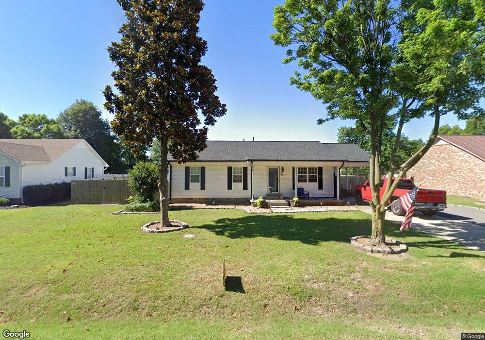
304 Manor Rd Steele, MO 63877
Estimated Value: $99,884 - $134,000
Studio
--
Bath
1,156
Sq Ft
$103/Sq Ft
Est. Value
About This Home
This home is located at 304 Manor Rd, Steele, MO 63877 and is currently estimated at $119,471, approximately $103 per square foot. 304 Manor Rd is a home with nearby schools including Central Elementary School and South Pemiscot High School.
Ownership History
Date
Name
Owned For
Owner Type
Purchase Details
Closed on
Sep 19, 2019
Sold by
Uselton Jaclyn K and Uselton Keith
Bought by
Laden Joshua
Current Estimated Value
Home Financials for this Owner
Home Financials are based on the most recent Mortgage that was taken out on this home.
Original Mortgage
$77,500
Outstanding Balance
$67,735
Interest Rate
3.6%
Mortgage Type
New Conventional
Estimated Equity
$51,736
Purchase Details
Closed on
Oct 5, 2009
Sold by
Booth Anthony J and Booth Shelia A
Bought by
Becker Jaclyn K
Home Financials for this Owner
Home Financials are based on the most recent Mortgage that was taken out on this home.
Original Mortgage
$87,720
Interest Rate
5.1%
Mortgage Type
New Conventional
Create a Home Valuation Report for This Property
The Home Valuation Report is an in-depth analysis detailing your home's value as well as a comparison with similar homes in the area
Purchase History
| Date | Buyer | Sale Price | Title Company |
|---|---|---|---|
| Laden Joshua | -- | None Available | |
| Becker Jaclyn K | -- | None Avaliable | |
| Becker Jaclyn K | -- | -- |
Source: Public Records
Mortgage History
| Date | Status | Borrower | Loan Amount |
|---|---|---|---|
| Open | Laden Joshua | $77,500 | |
| Previous Owner | Becker Jaclyn K | $87,720 |
Source: Public Records
Tax History
| Year | Tax Paid | Tax Assessment Tax Assessment Total Assessment is a certain percentage of the fair market value that is determined by local assessors to be the total taxable value of land and additions on the property. | Land | Improvement |
|---|---|---|---|---|
| 2025 | $695 | $12,710 | $0 | $0 |
| 2024 | $7 | $12,240 | $0 | $0 |
| 2023 | $692 | $12,240 | $0 | $0 |
| 2022 | $634 | $11,260 | $0 | $0 |
| 2020 | $648 | $11,260 | $0 | $0 |
| 2019 | $569 | $10,600 | $0 | $0 |
| 2018 | $564 | $10,600 | $0 | $0 |
| 2017 | $568 | $10,600 | $0 | $0 |
| 2016 | -- | $10,800 | $0 | $0 |
| 2015 | -- | $10,800 | $0 | $0 |
| 2013 | -- | $10,800 | $0 | $0 |
Source: Public Records
Map
Nearby Homes
- 312 Missouri St
- 333 Missouri St
- 107 Chickasaw St
- 201 Quapaw St
- 301 N Cooter Rd
- 317 Main St
- 5381 State Highway C
- 3337 E County Road 70
- 0 County Road 406
- 222 Shaw Rd
- 141 Ramblewood Dr
- 5024 N 6th St
- 0 Highway 412
- 3201 S Ward Ave
- 835 Missouri 84
- 906 W 19th St
- 104 Wingate St
- 1110 Collins Ave
- 1205 Ward
- 34 S Wedgewood Dr
Your Personal Tour Guide
Ask me questions while you tour the home.