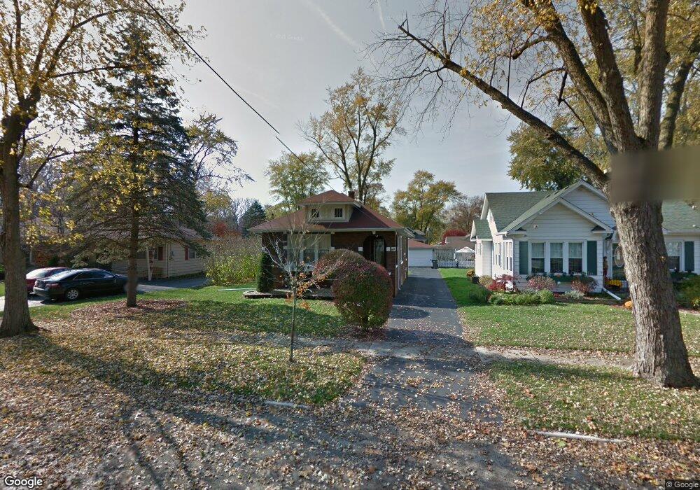
304 Maple Ln Thornton, IL 60476
Estimated Value: $151,000 - $183,000
2
Beds
1
Bath
1,042
Sq Ft
$163/Sq Ft
Est. Value
About This Home
This home is located at 304 Maple Ln, Thornton, IL 60476 and is currently estimated at $169,329, approximately $162 per square foot. 304 Maple Ln is a home located in Cook County with nearby schools including Wolcott School and Thornwood High School.
Ownership History
Date
Name
Owned For
Owner Type
Purchase Details
Closed on
Apr 1, 1997
Sold by
Lasalle National Bank
Bought by
South Holland Trust & Svgs Bank and Trust #11445
Current Estimated Value
Create a Home Valuation Report for This Property
The Home Valuation Report is an in-depth analysis detailing your home's value as well as a comparison with similar homes in the area
Home Values in the Area
Average Home Value in this Area
Purchase History
| Date | Buyer | Sale Price | Title Company |
|---|---|---|---|
| South Holland Trust & Svgs Bank | -- | -- |
Source: Public Records
Tax History
| Year | Tax Paid | Tax Assessment Tax Assessment Total Assessment is a certain percentage of the fair market value that is determined by local assessors to be the total taxable value of land and additions on the property. | Land | Improvement |
|---|---|---|---|---|
| 2025 | $3,377 | $11,475 | $3,000 | $8,475 |
| 2024 | $3,377 | $11,475 | $3,000 | $8,475 |
| 2023 | $1,142 | $14,000 | $3,000 | $11,000 |
| 2022 | $1,142 | $7,929 | $2,625 | $5,304 |
| 2021 | $1,181 | $7,929 | $2,625 | $5,304 |
| 2020 | $1,368 | $7,929 | $2,625 | $5,304 |
| 2019 | $1,330 | $8,449 | $2,437 | $6,012 |
| 2018 | $549 | $8,449 | $2,437 | $6,012 |
| 2017 | $539 | $8,449 | $2,437 | $6,012 |
| 2016 | $1,751 | $7,439 | $2,250 | $5,189 |
| 2015 | $1,542 | $7,439 | $2,250 | $5,189 |
| 2014 | $2,486 | $7,439 | $2,250 | $5,189 |
| 2013 | $2,295 | $7,762 | $2,250 | $5,512 |
Source: Public Records
Map
Nearby Homes
- 210 Maple Ln
- 305 Schwab St
- 308 Schwab St
- 113 N Hunter St
- 209 N Hunter St
- 214 N Hunter St
- 314 N Kinzie St
- 404 N Kinzie St
- 83 Indianwood Dr
- 19 Mohawk Dr
- 29 Arapaho Dr Unit 2
- 14 Arrowhead Dr
- 920 Sunnyside Ave
- 17331 Wausau Ct
- 147 E Maple Dr
- 636 E 173rd St
- 17249 School St
- 231 E Tulip Dr
- 350 E Tulip Dr
- 51 N Pine Ln
Your Personal Tour Guide
Ask me questions while you tour the home.