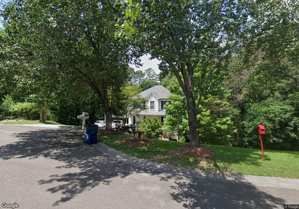
304 Michael Cir Canton, GA 30114
Sutallee NeighborhoodEstimated Value: $421,000 - $446,884
3
Beds
3
Baths
2,450
Sq Ft
$178/Sq Ft
Est. Value
About This Home
This home is located at 304 Michael Cir, Canton, GA 30114 and is currently estimated at $436,221, approximately $178 per square foot. 304 Michael Cir is a home located in Cherokee County with nearby schools including J. Knox Elementary School, Teasley Middle School, and Cherokee High School.
Ownership History
Date
Name
Owned For
Owner Type
Purchase Details
Closed on
Mar 6, 1998
Sold by
Emf Enterprises Inc
Bought by
Roland Kenneth and Roland Sandra
Current Estimated Value
Home Financials for this Owner
Home Financials are based on the most recent Mortgage that was taken out on this home.
Original Mortgage
$122,050
Outstanding Balance
$21,051
Interest Rate
7.07%
Mortgage Type
New Conventional
Estimated Equity
$415,170
Create a Home Valuation Report for This Property
The Home Valuation Report is an in-depth analysis detailing your home's value as well as a comparison with similar homes in the area
Home Values in the Area
Average Home Value in this Area
Purchase History
| Date | Buyer | Sale Price | Title Company |
|---|---|---|---|
| Roland Kenneth | $128,500 | -- |
Source: Public Records
Mortgage History
| Date | Status | Borrower | Loan Amount |
|---|---|---|---|
| Open | Roland Kenneth | $122,050 |
Source: Public Records
Tax History Compared to Growth
Tax History
| Year | Tax Paid | Tax Assessment Tax Assessment Total Assessment is a certain percentage of the fair market value that is determined by local assessors to be the total taxable value of land and additions on the property. | Land | Improvement |
|---|---|---|---|---|
| 2025 | $827 | $186,052 | $34,800 | $151,252 |
| 2024 | $795 | $158,340 | $28,000 | $130,340 |
| 2023 | $703 | $173,548 | $28,000 | $145,548 |
| 2022 | $781 | $141,316 | $24,000 | $117,316 |
| 2021 | $2,690 | $103,720 | $18,800 | $84,920 |
| 2020 | $2,444 | $93,000 | $16,000 | $77,000 |
| 2019 | $2,302 | $86,880 | $16,000 | $70,880 |
| 2018 | $2,239 | $83,760 | $14,000 | $69,760 |
| 2017 | $1,999 | $181,900 | $14,000 | $58,760 |
| 2016 | $1,981 | $178,000 | $12,800 | $58,400 |
| 2015 | $1,868 | $164,600 | $12,800 | $53,040 |
| 2014 | $1,646 | $145,400 | $11,200 | $46,960 |
Source: Public Records
Map
Nearby Homes
- 328 Allatoona Shores Dr
- 402 Eileen Cir
- 192 Saxon Ct
- 6261 Knox Bridge Hwy
- 601 Shelter Cove
- 305 Blake Dr Unit 1
- 510 Millwood Ct
- 339 Westbridge Ln
- 202 Van Walk
- 133 Copper Hills Dr
- 148 Copper Hills Dr
- 551 Harvey Fields Rd
- 435 Lake Point Trace Unit 3J
- 520 Waterside Ct
- 710 Bedford Trace Unit 3
- 619 Blackwater Ridge
- 537 Oriole Farm Trail Unit 4L
- 313 Meadow Lark Crossing Unit 31
- 1354 Bridgemill Ave
- 133 Sweetwater Creek Trail
- 306 Michael Cir
- 303 Michael Cir
- 305 Michael Cir Unit 2
- 337 Allatoona Shores Dr
- 335 Allatoona Shores Dr Unit 2
- 326 Allatoona Shores Dr Unit 2
- 339 Allatoona Shores Dr Unit 2
- 333 Allatoona Shores Dr Unit 2
- 341 Allatoona Shores Dr
- 321 Allatoona Shores Dr
- 330 Allatoona Shores Dr
- 317 Allatoona Shores Dr
- 331 Allatoona Shores Dr
- 332 Allatoona Shores Dr Unit 2
- 201 Alexander Ct
- 304 Allatoona Shores Dr
- 313 Allatoona Shores Dr
- 329 Allatoona Shores Dr Unit 1
- 203 Alexander Ct Unit 2
- 308 Allatoona Shores Dr Unit 1