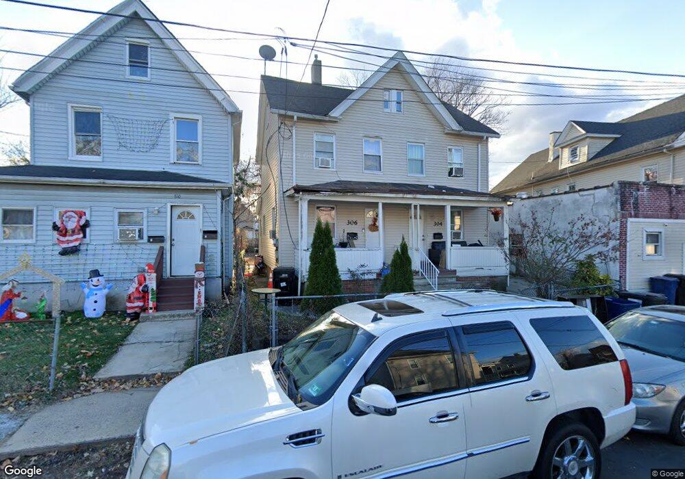
304 Monroe Ave Unit 6 Plainfield, NJ 07063
Estimated Value: $323,226 - $485,000
--
Bed
--
Bath
1,540
Sq Ft
$263/Sq Ft
Est. Value
About This Home
This home is located at 304 Monroe Ave Unit 6, Plainfield, NJ 07063 and is currently estimated at $404,557, approximately $262 per square foot. 304 Monroe Ave Unit 6 is a home located in Union County with nearby schools including Clinton School, Hubbard Middle School, and Plainfield High School.
Ownership History
Date
Name
Owned For
Owner Type
Purchase Details
Closed on
Aug 7, 2014
Sold by
Bedi Rishi
Bought by
Bundee Properties Nj Llc
Current Estimated Value
Purchase Details
Closed on
Jun 27, 2014
Sold by
Airen Surbhi
Bought by
Bedi Rishi
Purchase Details
Closed on
Nov 30, 2011
Sold by
Northern Benetta L and Solomon Benjamin
Bought by
Airen Surehi and Bedi Rishi
Create a Home Valuation Report for This Property
The Home Valuation Report is an in-depth analysis detailing your home's value as well as a comparison with similar homes in the area
Home Values in the Area
Average Home Value in this Area
Purchase History
| Date | Buyer | Sale Price | Title Company |
|---|---|---|---|
| Bundee Properties Nj Llc | -- | None Available | |
| Bedi Rishi | -- | None Available | |
| Airen Surehi | $33,000 | Multiple |
Source: Public Records
Tax History Compared to Growth
Tax History
| Year | Tax Paid | Tax Assessment Tax Assessment Total Assessment is a certain percentage of the fair market value that is determined by local assessors to be the total taxable value of land and additions on the property. | Land | Improvement |
|---|---|---|---|---|
| 2025 | $5,894 | $67,500 | $26,600 | $40,900 |
| 2024 | $5,836 | $67,500 | $26,600 | $40,900 |
| 2023 | $5,836 | $67,500 | $26,600 | $40,900 |
| 2022 | $5,710 | $67,500 | $26,600 | $40,900 |
| 2021 | $5,660 | $67,500 | $26,600 | $40,900 |
| 2020 | $5,644 | $67,500 | $26,600 | $40,900 |
| 2019 | $5,644 | $67,500 | $26,600 | $40,900 |
| 2018 | $5,526 | $67,500 | $26,600 | $40,900 |
| 2017 | $5,391 | $67,500 | $26,600 | $40,900 |
| 2016 | $5,281 | $67,500 | $26,600 | $40,900 |
| 2015 | $5,125 | $67,500 | $26,600 | $40,900 |
| 2014 | -- | $67,500 | $26,600 | $40,900 |
Source: Public Records
Map
Nearby Homes
- 312 Monroe Ave Unit 14
- 318-20 Manson Place
- 338 Manson Place Unit 40
- 223 Monroe Ave
- 333 Mcdowell St Unit 35
- 954 W 4th St
- 667 S 2nd St
- 325-29 Stebbins Place Unit 4
- 318 Halsey St Unit 20
- 950 W 6th St Unit 52
- 951 W Front St
- 355 Bergen St
- 829 S 2nd St
- 1637 S 2nd St
- 809-11 W 4th St
- 20-22 Albert St
- 1222 W 3rd St Unit 24
- 301 Grant Ave Unit 3
- 211 Grant Ave
- 1227 W 6th St
- 308 Monroe Ave Unit 10
- 300 Monroe Ave
- 1007 W 3rd St
- 1009 W 3rd St
- 314 Monroe Ave
- 316 Monroe Ave
- 309 Manson Place Unit 11
- 1021-29 W 3rd St
- 313 Manson Place Unit 15
- 967 W 3rd St Unit 69
- 301 Manson Place Unit 2
- 301 Manson Place Unit 3
- 301 Manson Place Unit 1
- 1000-2 W 3rd St
- 318 Monroe Ave Unit 20
- 317 Manson Place Unit 19
- 305 Monroe Ave Unit 7
- 321 Manson Place Unit 23
- 963 W 3rd St Unit 65
- 1004 W 3rd St