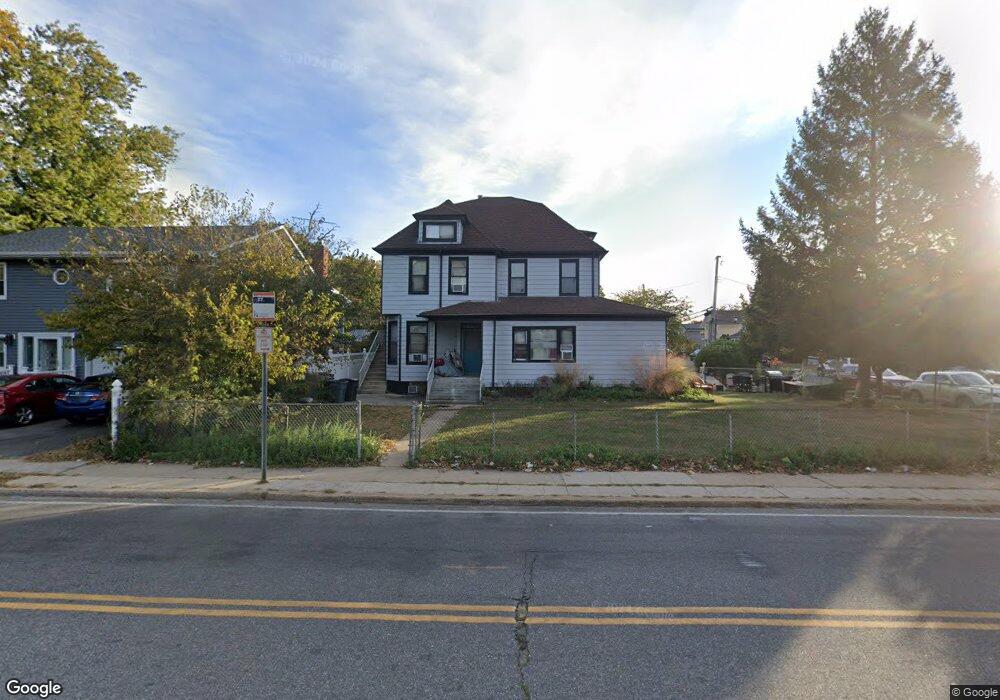
304 Pacific Ave Cedarhurst, NY 11516
Estimated Value: $1,176,168 - $1,220,000
3
Beds
2
Baths
2,235
Sq Ft
$536/Sq Ft
Est. Value
About This Home
This home is located at 304 Pacific Ave, Cedarhurst, NY 11516 and is currently estimated at $1,198,084, approximately $536 per square foot. 304 Pacific Ave is a home located in Nassau County with nearby schools including Lawrence Primary School, Lawrence Elementary School, and Lawrence Middle School.
Ownership History
Date
Name
Owned For
Owner Type
Purchase Details
Closed on
Jul 10, 2017
Sold by
Cohen Levi Y
Bought by
304 Pacific Llc
Current Estimated Value
Purchase Details
Closed on
Mar 30, 2017
Sold by
Capozzi Ralph
Bought by
Cohen Levi Y
Home Financials for this Owner
Home Financials are based on the most recent Mortgage that was taken out on this home.
Original Mortgage
$483,750
Interest Rate
4.1%
Mortgage Type
New Conventional
Purchase Details
Closed on
Mar 30, 2000
Create a Home Valuation Report for This Property
The Home Valuation Report is an in-depth analysis detailing your home's value as well as a comparison with similar homes in the area
Home Values in the Area
Average Home Value in this Area
Purchase History
| Date | Buyer | Sale Price | Title Company |
|---|---|---|---|
| 304 Pacific Llc | -- | Title Issues Agency Llc | |
| Cohen Levi Y | $665,000 | None Available | |
| -- | -- | -- |
Source: Public Records
Mortgage History
| Date | Status | Borrower | Loan Amount |
|---|---|---|---|
| Previous Owner | Cohen Levi Y | $483,750 |
Source: Public Records
Tax History
| Year | Tax Paid | Tax Assessment Tax Assessment Total Assessment is a certain percentage of the fair market value that is determined by local assessors to be the total taxable value of land and additions on the property. | Land | Improvement |
|---|---|---|---|---|
| 2025 | $8,711 | $638 | $327 | $311 |
| 2024 | $3,107 | $674 | $345 | $329 |
Source: Public Records
Map
Nearby Homes
- 335 Summit Ave
- 227 Randall Ave
- 366 Carvel Ave
- 347 Roselle Ave
- 284 Central Ave Unit D6
- 376 Central Ave Unit 3-V
- 461 5th Ave
- 285 Central Ave Unit D-7
- 285 Central Ave Unit B-4
- 285 Central Ave Unit D6
- 324 Buckingham Rd
- 463 Summit Ave Unit 2F
- 250 Central Ave Unit 119
- 250 Central Ave Unit e218
- 260 Central Ave Unit 135
- 260 Central Ave Unit 430
- 467 W Broadway
- 240 Central Ave Unit 2 F
- 23 Park Ave
- 261 Central Ave Unit E4
- 246 Rockaway Turnpike
- 314 Pacific Ave
- 240 Rockaway Turnpike
- 320 Pacific Ave
- 8 Adele Rd
- 2 Adele Rd
- 238 Rockaway Turnpike
- 315 Pacific Ave
- 241 Rockaway Turnpike
- 14 Adele Rd
- 319 Pacific Ave
- 243 Rockaway Turnpike
- 236 Rockaway Turnpike
- 20 Adele Rd
- 245 Rockaway Turnpike
- 239 Rockaway Turnpike
- 330 Pacific Ave
- 325 Pacific Ave
- 280 Pacific Ave
- 247 Rockaway Turnpike