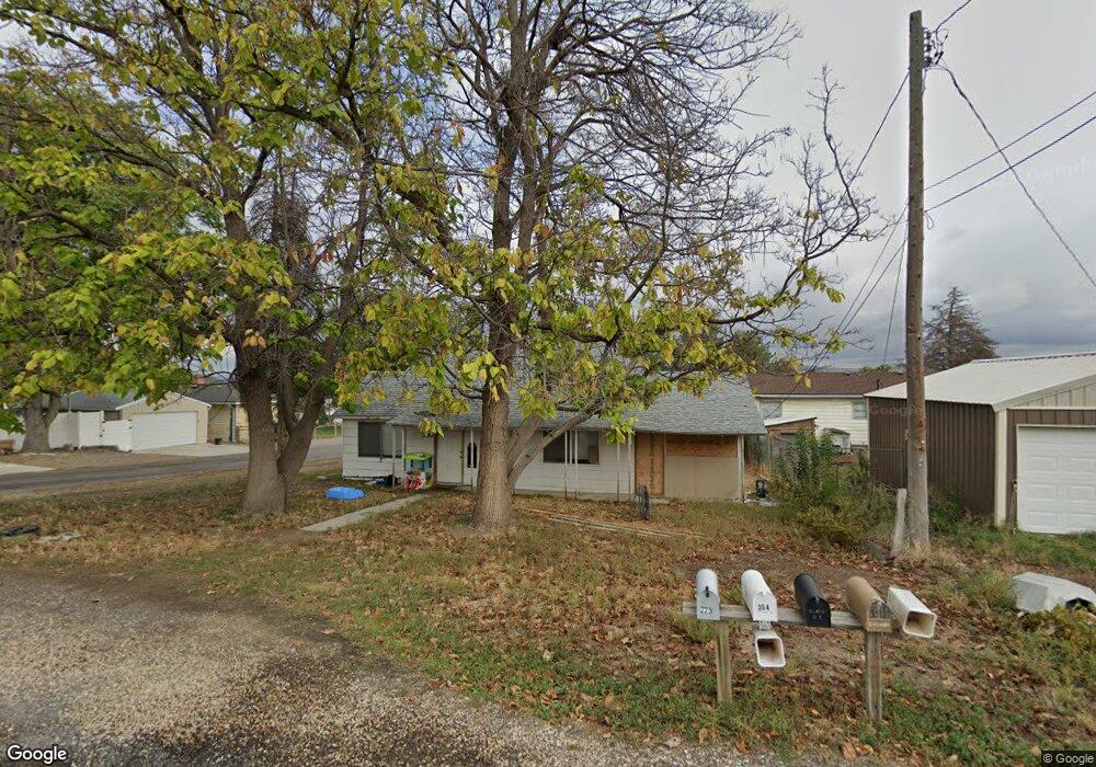
304 Patton St Marsing, ID 83639
Estimated Value: $224,839 - $279,000
2
Beds
1
Bath
848
Sq Ft
$297/Sq Ft
Est. Value
About This Home
This home is located at 304 Patton St, Marsing, ID 83639 and is currently estimated at $252,210, approximately $297 per square foot. 304 Patton St is a home located in Owyhee County with nearby schools including Marsing Elementary School, Marsing Middle School, and Marsing High School.
Ownership History
Date
Name
Owned For
Owner Type
Purchase Details
Closed on
Jan 11, 2021
Sold by
Archer Dorothy Marcella
Bought by
Muller Amanda and Muller Robert
Current Estimated Value
Home Financials for this Owner
Home Financials are based on the most recent Mortgage that was taken out on this home.
Original Mortgage
$80,000
Outstanding Balance
$70,908
Interest Rate
2.71%
Mortgage Type
New Conventional
Estimated Equity
$181,302
Purchase Details
Closed on
Aug 21, 2015
Sold by
Archer Dorothy Marcella
Bought by
Archer Dorothy Marcella
Create a Home Valuation Report for This Property
The Home Valuation Report is an in-depth analysis detailing your home's value as well as a comparison with similar homes in the area
Purchase History
| Date | Buyer | Sale Price | Title Company |
|---|---|---|---|
| Muller Amanda | -- | Pioneer Title Company | |
| Archer Dorothy Marcella | -- | None Available |
Source: Public Records
Mortgage History
| Date | Status | Borrower | Loan Amount |
|---|---|---|---|
| Open | Muller Amanda | $80,000 |
Source: Public Records
Tax History
| Year | Tax Paid | Tax Assessment Tax Assessment Total Assessment is a certain percentage of the fair market value that is determined by local assessors to be the total taxable value of land and additions on the property. | Land | Improvement |
|---|---|---|---|---|
| 2025 | -- | $195,912 | $53,822 | $142,090 |
| 2024 | -- | $195,912 | $53,822 | $142,090 |
| 2023 | $1,149 | $185,962 | $53,822 | $132,140 |
| 2022 | $1,262 | $185,962 | $53,822 | $132,140 |
| 2021 | $1,158 | $128,411 | $45,531 | $82,880 |
| 2020 | $1,151 | $87,676 | $33,782 | $53,894 |
| 2019 | $1,216 | $79,232 | $33,782 | $45,450 |
| 2018 | $1,274 | $78,692 | $28,152 | $50,540 |
| 2017 | $1,174 | $73,702 | $28,152 | $45,550 |
| 2016 | $848 | $51,901 | $23,085 | $28,816 |
| 2014 | $259 | $40,170 | $18,299 | $21,871 |
| 2011 | -- | $27,696 | $10,200 | $17,496 |
Source: Public Records
Map
Nearby Homes
- TBD Canal St
- Poison Creek Rd
- 928 W Main St
- 540 Morning Dove Way
- 5842 Old Bruneau Hwy
- 20056 Sunny Slope Rd
- TBD N Bruneau Rd
- 8065 Moonshine Ln
- 19151 Symms Rd
- TBD Lot 5 Cabernet Ln
- TBD Cabernet Ln - Lot 5 Parcel A
- TBD Riverside Rd
- 5054 Heritage Dr
- 18227 Southlake Cir
- 8142 Us Highway 95
- 1406 Oak River Ln
- TBD Oak River Ln
- 7573 Riverfront Dr
- TBD Manzanita Ln - Parcel 3
- TBD Whetstone Ln - Parcel 9
- 309 Canal St
- 313 Canal St
- 307 Patton St
- 219 Canal St
- 317 Mitchell St
- 317 Patton St
- 315 Patton St
- 215 Patton St
- 205 Canal St
- 211 Canal St
- 407 Canal St
- 225 Canal St
- TBD Well Rd Lots 19 20 21 22
- 225 Patton St
- TBD Well Rd Lot 21&22
- 227 Well Rd
- 233 Well Rd
- 7266 River View Dr
- 7300 River View Dr
- 203 Canal St
Your Personal Tour Guide
Ask me questions while you tour the home.