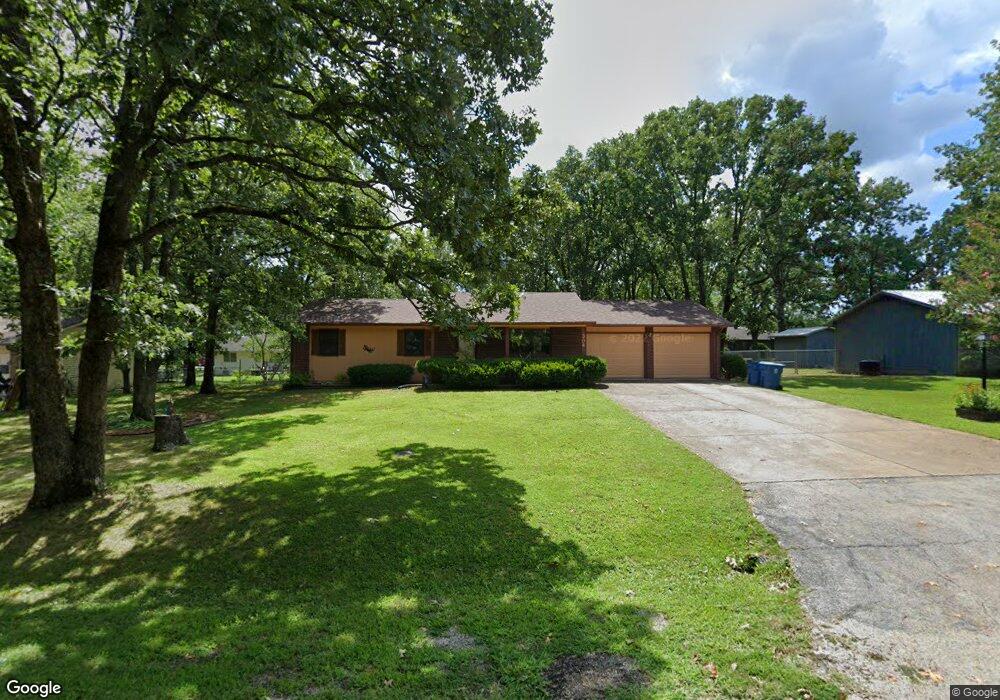
304 Quail Rd Branson, MO 65616
North Branson NeighborhoodEstimated Value: $167,000 - $273,000
About This Home
This home is located at 304 Quail Rd, Branson, MO 65616 and is currently estimated at $231,321, approximately $202 per square foot. 304 Quail Rd is a home located in Taney County with nearby schools including Cedar Ridge Primary, Cedar Ridge Intermediate School, and Cedar Ridge Elementary School.
Ownership History
We collect this data history from publicly available records. To have your information removed, we recommend requesting removal directly through your county’s website.
Purchase Details
Purchase Details
Purchase Details
Purchase Details
Home Values in the Area
Average Home Value in this Area
Purchase History
We collect this data history from publicly available records. To have your information removed, we recommend requesting removal directly through your county’s website.
| Date | Buyer | Sale Price | Title Company |
|---|---|---|---|
| -- | None Available | ||
| -- | None Available | ||
| -- | Hogan Land Title | ||
| -- | -- |
Mortgage History
We collect this data history from publicly available records. To have your information removed, we recommend requesting removal directly through your county’s website.
| Date | Status | Borrower | Loan Amount |
|---|---|---|---|
| Closed | $0 |
Tax History
We collect this data history from publicly available records. To have your information removed, we recommend requesting removal directly through your county’s website.
| Year | Tax Paid | Tax Assessment Tax Assessment Total Assessment is a certain percentage of the fair market value that is determined by local assessors to be the total taxable value of land and additions on the property. | Land | Improvement |
|---|---|---|---|---|
| 2025 | $832 | $14,820 | -- | -- |
| 2024 | $832 | $16,030 | -- | -- |
| 2023 | $832 | $16,030 | -- | -- |
| 2022 | $808 | $16,030 | $0 | $0 |
| 2021 | $804 | $16,030 | $0 | $0 |
| 2019 | $740 | $14,390 | $0 | $0 |
| 2018 | $742 | $14,390 | $0 | $0 |
| 2017 | $677 | $13,270 | $0 | $0 |
| 2016 | $676 | $13,270 | $0 | $0 |
| 2015 | $670 | $13,270 | $0 | $0 |
| 2014 | $616 | $12,750 | $0 | $0 |
Map
- 000 State Highway 248
- Tract 1 State Highway 248
- 153 Sapling Dr
- 108 Sapling Dr
- 000 Branson Hills Pkwy
- Tract 1 Branson Hills Pkwy
- Tract 2 Branson Hills Pkwy
- 301 Stillwood Dr
- 229 Stillwood Dr Unit 6a
- 290 Stillwood Dr
- 201 Prairie Dunes Dr Unit 1105
- 201 Prairie Dunes Dr Unit 1405
- 000 Prairie Dunes Dr
- 152 Rue de Villas Cir Unit 4
- 155 Rue de Villas Cir
- 142 Rue de Villas Cir
- 137 Rue de Villas Cir
- 114 Vista View Dr Unit A
- 116 Pinehurst Dr
- 128 Mulligan Ct
Ask me questions while you tour the home.