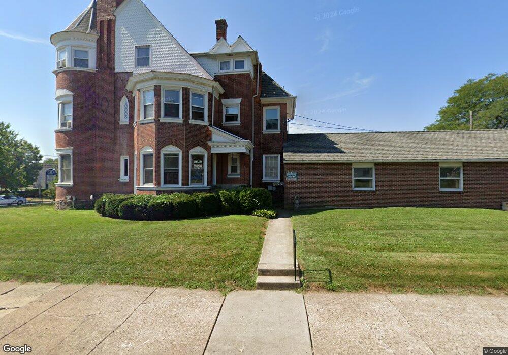
304 S Broad St Lansdale, PA 19446
Estimated Value: $261,500
--
Bed
--
Bath
--
Sq Ft
0.33
Acres
About This Home
This home is located at 304 S Broad St, Lansdale, PA 19446 and is currently estimated at $261,500. 304 S Broad St is a home located in Montgomery County with nearby schools including York Avenue Elementary School, Penndale Middle School, and North Penn Senior High School.
Ownership History
Date
Name
Owned For
Owner Type
Purchase Details
Closed on
Nov 15, 2021
Sold by
Patel Himanshu
Bought by
11Fourteen45 Llc
Current Estimated Value
Purchase Details
Closed on
Dec 19, 2017
Sold by
Hendricks Hendricks D and Hendricks Kathleen
Bought by
Patel Himanshu
Purchase Details
Closed on
Jul 29, 1994
Sold by
Keyser Ralph K
Bought by
Thompson Karl W
Purchase Details
Closed on
Jul 6, 1994
Sold by
Keyser Evelyn K
Bought by
Keyser Evelyn K and Keyser Ralph K
Create a Home Valuation Report for This Property
The Home Valuation Report is an in-depth analysis detailing your home's value as well as a comparison with similar homes in the area
Home Values in the Area
Average Home Value in this Area
Purchase History
| Date | Buyer | Sale Price | Title Company |
|---|---|---|---|
| 11Fourteen45 Llc | $209,000 | None Available | |
| Patel Himanshu | -- | -- | |
| Thompson Karl W | $220,000 | -- | |
| Keyser Evelyn K | -- | -- |
Source: Public Records
Tax History Compared to Growth
Tax History
| Year | Tax Paid | Tax Assessment Tax Assessment Total Assessment is a certain percentage of the fair market value that is determined by local assessors to be the total taxable value of land and additions on the property. | Land | Improvement |
|---|---|---|---|---|
| 2025 | $5,786 | $137,540 | $129,890 | $7,650 |
| 2024 | $5,786 | $137,540 | $129,890 | $7,650 |
| 2023 | $5,413 | $137,540 | $129,890 | $7,650 |
| 2022 | $5,240 | $137,540 | $129,890 | $7,650 |
| 2021 | $5,027 | $137,540 | $129,890 | $7,650 |
| 2020 | $4,875 | $137,540 | $129,890 | $7,650 |
| 2019 | $4,794 | $137,540 | $129,890 | $7,650 |
| 2018 | $1,286 | $137,540 | $129,890 | $7,650 |
| 2017 | $4,475 | $137,540 | $129,890 | $7,650 |
| 2016 | $4,422 | $137,540 | $129,890 | $7,650 |
| 2015 | $4,103 | $137,540 | $129,890 | $7,650 |
| 2014 | $4,103 | $137,540 | $129,890 | $7,650 |
Source: Public Records
Map
Nearby Homes
- 128 S Broad St
- 521 Green St
- 118 S Broad St
- 132 Green St
- 418 Jefferson St
- 118 Green St
- 100 Penn St
- 263 Compass Dr
- 403 Derstine Ave
- 159 Penn St
- 405 Derstine Ave
- 101 E Main St
- 521 Columbia Ave
- 507 Delaware Ave
- 380 E Hancock St Unit 103B
- 380 E Hancock St Unit 102B
- 380 E Hancock St Unit 101B
- 380 E Hancock St Unit 100B
- 380 E Hancock St Unit 104A
- 380 E Hancock St Unit 103A
- 12 W Mount Vernon St Unit 28
- 12 W Mount Vernon St Unit 1
- 12 W Mount Vernon St Unit 3
- 14 W Mount Vernon St
- 308 S Broad St
- 229 S Broad St
- 30 W Mount Vernon St
- 21 W Mount Vernon St
- 233 S Broad St
- 218 S Broad St
- 25 W Mount Vernon St
- 98 W Blaine St
- 225 S Broad St
- 27 W Mount Vernon St
- 37 W Mount Vernon St
- 36 W Mount Vernon St
- 20 Lincoln Ave
- 39 W Mount Vernon St
- 206 S Broad St
- 19 W Hancock St