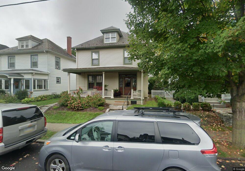
304 S Spruce St Lititz, PA 17543
Estimated Value: $402,000 - $536,000
3
Beds
2
Baths
2,357
Sq Ft
$201/Sq Ft
Est. Value
About This Home
This home is located at 304 S Spruce St, Lititz, PA 17543 and is currently estimated at $472,627, approximately $200 per square foot. 304 S Spruce St is a home located in Lancaster County with nearby schools including Warwick Senior High School, Lititz Christian School, and Linden Hall.
Ownership History
Date
Name
Owned For
Owner Type
Purchase Details
Closed on
Sep 9, 2005
Sold by
Moore Phyllis
Bought by
Anderson Nicholas W and Anderson Tonya R
Current Estimated Value
Home Financials for this Owner
Home Financials are based on the most recent Mortgage that was taken out on this home.
Original Mortgage
$140,000
Outstanding Balance
$74,618
Interest Rate
5.79%
Mortgage Type
Fannie Mae Freddie Mac
Estimated Equity
$398,009
Create a Home Valuation Report for This Property
The Home Valuation Report is an in-depth analysis detailing your home's value as well as a comparison with similar homes in the area
Home Values in the Area
Average Home Value in this Area
Purchase History
| Date | Buyer | Sale Price | Title Company |
|---|---|---|---|
| Anderson Nicholas W | $175,000 | -- |
Source: Public Records
Mortgage History
| Date | Status | Borrower | Loan Amount |
|---|---|---|---|
| Open | Anderson Nicholas W | $140,000 |
Source: Public Records
Tax History Compared to Growth
Tax History
| Year | Tax Paid | Tax Assessment Tax Assessment Total Assessment is a certain percentage of the fair market value that is determined by local assessors to be the total taxable value of land and additions on the property. | Land | Improvement |
|---|---|---|---|---|
| 2025 | $4,757 | $210,300 | $53,700 | $156,600 |
| 2024 | $4,757 | $210,300 | $53,700 | $156,600 |
| 2023 | $4,739 | $210,300 | $53,700 | $156,600 |
| 2022 | $4,476 | $210,300 | $53,700 | $156,600 |
| 2021 | $4,476 | $210,300 | $53,700 | $156,600 |
| 2020 | $4,476 | $210,300 | $53,700 | $156,600 |
| 2019 | $4,476 | $210,300 | $53,700 | $156,600 |
| 2018 | $5,483 | $210,300 | $53,700 | $156,600 |
| 2017 | $3,618 | $133,600 | $36,900 | $96,700 |
| 2016 | $3,618 | $133,600 | $36,900 | $96,700 |
| 2015 | $846 | $133,600 | $36,900 | $96,700 |
| 2014 | $2,519 | $133,600 | $36,900 | $96,700 |
Source: Public Records
Map
Nearby Homes
- 133 S Spruce St
- 256 Cedar St S
- 409 Hensley St
- 417 Woodcrest Ave
- 44 E Center St
- 398 Hensley St
- 108 Meadows Bend
- 394 Hensley St
- 421 Laurel Ave
- LOT 12 Thaton Rd
- LOT 14 Thaton Rd
- 520 Woodcrest Ave
- 301 S Locust St
- 47 W Lincoln Ave
- 131 N Cedar St
- 208 E 6th St
- 128 E New St
- 129 Forney Dr
- 203 N Cedar St
- 453 Crosswinds Dr
- 302 S Spruce St
- 306 S Spruce St
- 308 S Spruce St
- 250 S Spruce St
- 310 S Spruce St
- 246 S Spruce St
- 312 S Spruce St
- 242 S Spruce St
- 303 S Spruce St
- 301 S Spruce St
- 305 S Spruce St
- 247 S Spruce St
- 238 S Spruce St
- 307 S Spruce St
- 243 S Spruce St
- 318 S Spruce St
- 309 S Spruce St
- 234 S Spruce St
- 33 W Marion St
- 230 S Spruce St