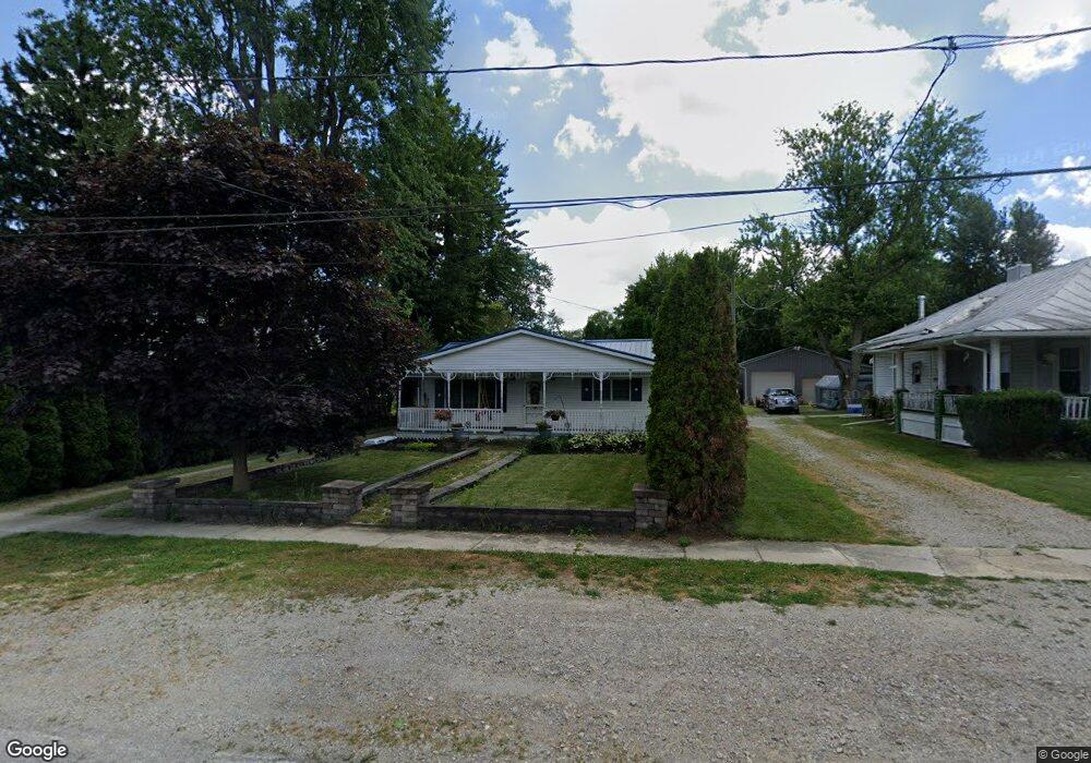
304 Stump Pike Rd Attica, OH 44807
Estimated Value: $106,000 - $148,000
2
Beds
1
Bath
1,000
Sq Ft
$121/Sq Ft
Est. Value
About This Home
This home is located at 304 Stump Pike Rd, Attica, OH 44807 and is currently estimated at $121,194, approximately $121 per square foot. 304 Stump Pike Rd is a home located in Seneca County with nearby schools including Seneca East Elementary School and Seneca East High School.
Ownership History
Date
Name
Owned For
Owner Type
Purchase Details
Closed on
Jun 7, 2018
Sold by
Ally Jeffrey L and Ally Jeffrey Lynn
Bought by
Phillips Brittany L
Current Estimated Value
Home Financials for this Owner
Home Financials are based on the most recent Mortgage that was taken out on this home.
Original Mortgage
$52,000
Outstanding Balance
$44,971
Interest Rate
4.5%
Mortgage Type
New Conventional
Estimated Equity
$76,223
Purchase Details
Closed on
Mar 28, 2003
Purchase Details
Closed on
Nov 1, 1988
Create a Home Valuation Report for This Property
The Home Valuation Report is an in-depth analysis detailing your home's value as well as a comparison with similar homes in the area
Home Values in the Area
Average Home Value in this Area
Purchase History
| Date | Buyer | Sale Price | Title Company |
|---|---|---|---|
| Phillips Brittany L | $65,000 | First American Title | |
| -- | $1,500 | -- | |
| -- | $7,000 | -- |
Source: Public Records
Mortgage History
| Date | Status | Borrower | Loan Amount |
|---|---|---|---|
| Open | Phillips Brittany L | $52,000 |
Source: Public Records
Tax History Compared to Growth
Tax History
| Year | Tax Paid | Tax Assessment Tax Assessment Total Assessment is a certain percentage of the fair market value that is determined by local assessors to be the total taxable value of land and additions on the property. | Land | Improvement |
|---|---|---|---|---|
| 2024 | $1,023 | $26,900 | $3,270 | $23,630 |
| 2023 | $1,025 | $26,900 | $3,270 | $23,630 |
| 2022 | $957 | $20,710 | $2,960 | $17,750 |
| 2021 | $942 | $20,710 | $2,960 | $17,750 |
| 2020 | $927 | $20,710 | $2,965 | $17,745 |
| 2019 | $848 | $20,010 | $2,863 | $17,147 |
| 2018 | $903 | $20,010 | $2,863 | $17,147 |
| 2017 | $918 | $20,010 | $2,863 | $17,147 |
| 2016 | $912 | $19,821 | $2,779 | $17,042 |
| 2015 | $900 | $19,821 | $2,779 | $17,042 |
| 2014 | $804 | $19,821 | $2,779 | $17,042 |
| 2013 | $913 | $20,290 | $2,863 | $17,427 |
Source: Public Records
Map
Nearby Homes
- 210 W Tiffin St
- 14 White Birch Dr
- 113 W Tiffin St
- 106 Lemmon St
- 22 N Seneca St
- 510 Buckeye Dr
- 625 Buckeye Dr
- 5053 S County Road 35
- 5997 U S 224
- 11 Maple St
- 25 Jefferson St
- 0 S Marion St
- 5016 US Highway 224 W
- 3095 Liberty Rd
- 426 Jeffrey Dr
- 0 Tr 0134
- 509 Washington St
- 0 S Tr 173 Unit 20252747
- 209 Maple St
- 3175 Lamar Ct
- 306 W Tiffin St
- 302 W Tiffin St
- 312 W Tiffin St
- 258 W Tiffin St
- 260 W Tiffin St
- 14359 E Us Highway 224
- 14359 U S 224
- 14327 E Us Highway 224
- 216 W Tiffin St
- 214 W Tiffin St
- 14395 E Us Highway 224
- 14411 E Us Highway 224
- 207 W Tiffin St
- 206 W Tiffin St
- 205 W Tiffin St
- 204 W Tiffin St
- 203 W Tiffin St
- 16 Ash Dr
- 2019 W High St
- 209 W High St