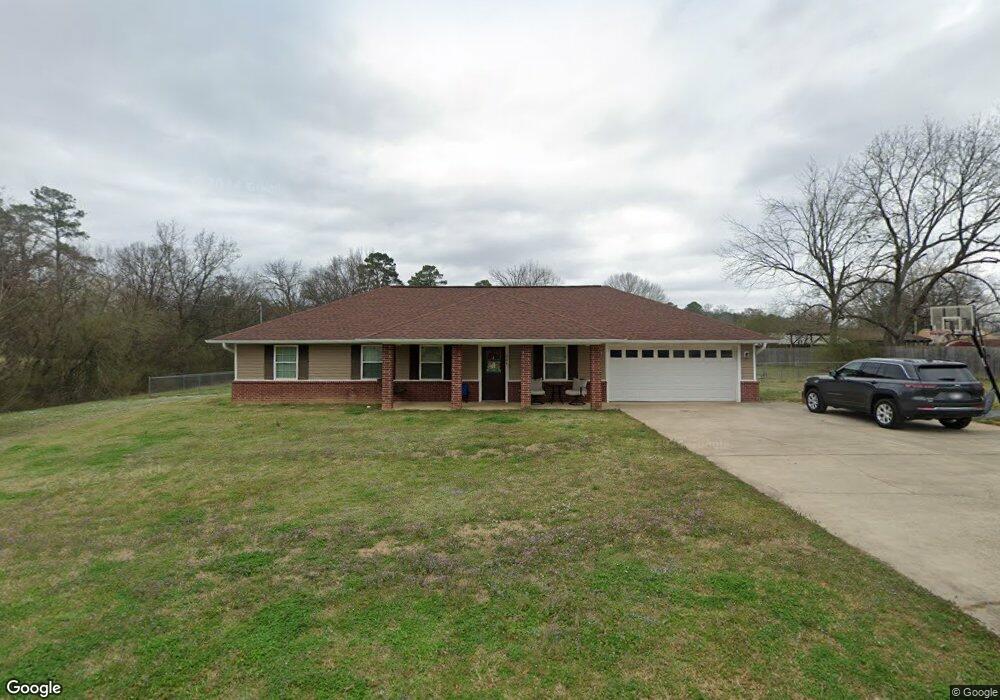
304 W 10th St Murfreesboro, AR 71958
Estimated Value: $129,000 - $191,000
--
Bed
--
Bath
1,320
Sq Ft
$122/Sq Ft
Est. Value
About This Home
This home is located at 304 W 10th St, Murfreesboro, AR 71958 and is currently estimated at $160,931, approximately $121 per square foot. 304 W 10th St is a home with nearby schools including Murfreesboro Elementary School, Murfreesboro High School, and Harvest Time Christian Academy.
Ownership History
Date
Name
Owned For
Owner Type
Purchase Details
Closed on
Feb 26, 2012
Sold by
Hignight Darla and Stamps Darla
Bought by
Cox Melissa J
Current Estimated Value
Purchase Details
Closed on
Dec 21, 2011
Sold by
Stamps Darla
Bought by
Cox Melissa J
Home Financials for this Owner
Home Financials are based on the most recent Mortgage that was taken out on this home.
Original Mortgage
$112,000
Interest Rate
4.02%
Purchase Details
Closed on
Mar 20, 1996
Bought by
Hignight Darla Dianne
Purchase Details
Closed on
May 24, 1993
Bought by
Hignight Robert Neil and Hignight Darla D
Create a Home Valuation Report for This Property
The Home Valuation Report is an in-depth analysis detailing your home's value as well as a comparison with similar homes in the area
Home Values in the Area
Average Home Value in this Area
Purchase History
| Date | Buyer | Sale Price | Title Company |
|---|---|---|---|
| Cox Melissa J | -- | Steel And Gunter, Attorneys | |
| Cox Melissa J | -- | Steel And Gunter, Attorneys | |
| Hignight Darla Dianne | -- | -- | |
| Hignight Robert Neil | $5,000 | -- |
Source: Public Records
Mortgage History
| Date | Status | Borrower | Loan Amount |
|---|---|---|---|
| Previous Owner | Cox Melissa J | $112,000 |
Source: Public Records
Tax History Compared to Growth
Tax History
| Year | Tax Paid | Tax Assessment Tax Assessment Total Assessment is a certain percentage of the fair market value that is determined by local assessors to be the total taxable value of land and additions on the property. | Land | Improvement |
|---|---|---|---|---|
| 2024 | $1,109 | $23,440 | $1,890 | $21,550 |
| 2023 | $664 | $23,440 | $1,890 | $21,550 |
| 2022 | $664 | $23,440 | $1,890 | $21,550 |
| 2021 | $615 | $20,920 | $1,890 | $19,030 |
| 2020 | $615 | $20,920 | $1,890 | $19,030 |
| 2019 | $615 | $20,920 | $1,890 | $19,030 |
| 2018 | $640 | $20,920 | $1,890 | $19,030 |
| 2017 | $990 | $20,920 | $1,890 | $19,030 |
| 2015 | -- | $20,810 | $2,040 | $18,770 |
| 2014 | -- | $20,620 | $2,040 | $18,580 |
| 2013 | -- | $20,620 | $2,040 | $18,580 |
Source: Public Records
Map
Nearby Homes
- TBD Kadoha Rd
- 1456 N Washington Ave
- XXX Kadoha Rd
- 409 E 13th St
- 114 Morgan St
- 416 S Washington Ave
- 102 W Haislip St
- 1860 N Hwy 19
- 863 Arkansas 27
- 0 Hinds Rd
- tbd Arkansas 301
- 1251 Highland Ave
- 2 Brian Harris Dr
- 228 Old Factory Site Rd Rd
- 228 Old Factory Site Rd
- 141 Quail Ln
- 84 N Old Factory Site Rd
- Lot 14 Brian Harris Dr
- xxxx Hwy 26 & 379
- Lot 25 Harris Dr
- 301 W 10th St
- 1006 N Maple Ave
- 924 N Maple Ave
- 910 N Maple Ave
- 1104 N Maple Ave
- 106 Edgewood St
- 904 N Maple Ave
- 1005 N Maple Ave
- 1009 N Maple Ave
- 933 N Maple Ave
- 520 W 10th St
- 107 Edgewood St
- 1114 N Maple Ave
- 521 W 10th St
- 907 N Maple Ave
- 104 Edgewood St
- 1116 N Maple Ave
- 204 W 11th St
- 1105 N Maple Ave
- 820 N Maple Ave