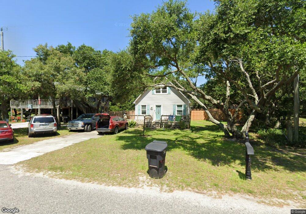
304 W Airstrip Rd Unit Lot 6 Kill Devil Hills, NC 27948
Estimated Value: $409,465 - $1,847,000
3
Beds
2
Baths
1,021
Sq Ft
$761/Sq Ft
Est. Value
About This Home
This home is located at 304 W Airstrip Rd Unit Lot 6, Kill Devil Hills, NC 27948 and is currently estimated at $776,866, approximately $760 per square foot. 304 W Airstrip Rd Unit Lot 6 is a home located in Dare County with nearby schools including First Flight Elementary School, First Flight Middle School, and First Flight High School.
Ownership History
Date
Name
Owned For
Owner Type
Purchase Details
Closed on
Sep 21, 2022
Sold by
Ducharme Donnie P
Bought by
Allen William T and Allen Chasity
Current Estimated Value
Home Financials for this Owner
Home Financials are based on the most recent Mortgage that was taken out on this home.
Original Mortgage
$365,750
Outstanding Balance
$346,439
Interest Rate
4.25%
Mortgage Type
New Conventional
Estimated Equity
$430,427
Purchase Details
Closed on
Oct 30, 2013
Sold by
Workman Barbara J
Bought by
Ducharme Richard E and Ducharme Donnie P
Create a Home Valuation Report for This Property
The Home Valuation Report is an in-depth analysis detailing your home's value as well as a comparison with similar homes in the area
Home Values in the Area
Average Home Value in this Area
Purchase History
| Date | Buyer | Sale Price | Title Company |
|---|---|---|---|
| Allen William T | $2,310,000 | -- | |
| Ducharme Richard E | $102,500 | None Available |
Source: Public Records
Mortgage History
| Date | Status | Borrower | Loan Amount |
|---|---|---|---|
| Open | Allen William T | $365,750 |
Source: Public Records
Tax History Compared to Growth
Tax History
| Year | Tax Paid | Tax Assessment Tax Assessment Total Assessment is a certain percentage of the fair market value that is determined by local assessors to be the total taxable value of land and additions on the property. | Land | Improvement |
|---|---|---|---|---|
| 2025 | $1,920 | $353,400 | $179,400 | $174,000 |
| 2024 | $1,539 | $203,700 | $87,100 | $116,600 |
| 2023 | $816 | $203,700 | $87,100 | $116,600 |
| 2022 | $1,468 | $203,700 | $87,100 | $116,600 |
| 2021 | $734 | $203,700 | $87,100 | $116,600 |
| 2020 | $1,468 | $203,700 | $87,100 | $116,600 |
| 2019 | $1,161 | $133,500 | $68,200 | $65,300 |
| 2018 | $947 | $133,500 | $68,200 | $65,300 |
| 2017 | $1,136 | $133,500 | $68,200 | $65,300 |
| 2016 | $1,083 | $133,500 | $68,200 | $65,300 |
| 2014 | $1,043 | $133,500 | $68,200 | $65,300 |
Source: Public Records
Map
Nearby Homes
- 302 W Clark St Unit Lot 6
- 0 W Martin St
- 803 6th Ave Unit Lot 9
- 0 W Boundary St Unit Lot 1-R 130568
- 1208 Swan St Unit 2
- 1208 Swan St Unit 1
- 1208 Swan St Unit 5
- 1208 Swan St Unit 4
- 1209 Wrightsville Blvd Unit Lot 26
- 200 E Martin St Unit 304
- 200 E Martin St Unit 202
- 205 W Atlantic St Unit Lot 3
- 1302 Theodore St Unit Lot 2
- 1401 Goldie St
- 1014 S Virginia Dare Trail Unit 301
- 1014 S Virginia Dare Trail Unit 402
- 902 S Virginia Dare Trail Unit 703
- 902 S Virginia Dare Trail Unit 502
- 902 S Virginia Dare Trail Unit 503
- 902 S Virginia Dare Trail Unit 102
- 304 W Airstrip Rd
- 306 W Airstrip Rd
- 302 W Airstrip Rd
- 1005 Cardinal St
- 305 W Airstrip Rd
- 300 W Airstrip Rd
- 303 W Airstrip Rd
- 1100 Fox St
- 400 W Airstrip Rd Unit 4
- 400 W Airstrip Rd
- 1003 Cardinal St Unit 9
- 1003 Cardinal St
- 1004 Fox St
- 1004 Cardinal St
- 307 W Airstrip Rd
- 1002 Cardinal St Unit 2
- 1002 Cardinal St
- 1002 Fox St Unit 2
- 1002 Fox St
- 402 W Airstrip Rd Unit 5