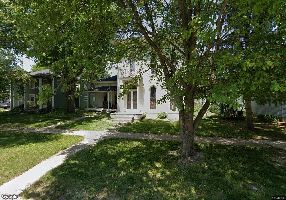
304 W Main St Thorntown, IN 46071
Estimated Value: $226,723 - $275,000
3
Beds
1
Bath
2,812
Sq Ft
$90/Sq Ft
Est. Value
About This Home
This home is located at 304 W Main St, Thorntown, IN 46071 and is currently estimated at $253,431, approximately $90 per square foot. 304 W Main St is a home located in Boone County with nearby schools including Western Boone Junior/Senior High School.
Ownership History
Date
Name
Owned For
Owner Type
Purchase Details
Closed on
Jul 30, 2019
Sold by
Hill Owen N and Hill Maria
Bought by
Jackson Philip E and Jackson Debra K
Current Estimated Value
Home Financials for this Owner
Home Financials are based on the most recent Mortgage that was taken out on this home.
Original Mortgage
$80,000
Outstanding Balance
$67,645
Interest Rate
2.25%
Mortgage Type
New Conventional
Estimated Equity
$185,786
Create a Home Valuation Report for This Property
The Home Valuation Report is an in-depth analysis detailing your home's value as well as a comparison with similar homes in the area
Home Values in the Area
Average Home Value in this Area
Purchase History
| Date | Buyer | Sale Price | Title Company |
|---|---|---|---|
| Jackson Philip E | -- | None Available |
Source: Public Records
Mortgage History
| Date | Status | Borrower | Loan Amount |
|---|---|---|---|
| Open | Jackson Philip E | $80,000 |
Source: Public Records
Tax History Compared to Growth
Tax History
| Year | Tax Paid | Tax Assessment Tax Assessment Total Assessment is a certain percentage of the fair market value that is determined by local assessors to be the total taxable value of land and additions on the property. | Land | Improvement |
|---|---|---|---|---|
| 2025 | $1,423 | $198,600 | $17,100 | $181,500 |
| 2024 | $1,423 | $185,400 | $17,100 | $168,300 |
| 2023 | $1,289 | $170,300 | $17,100 | $153,200 |
| 2022 | $1,331 | $160,800 | $17,100 | $143,700 |
| 2021 | $1,170 | $139,200 | $17,100 | $122,100 |
| 2020 | $970 | $122,200 | $17,100 | $105,100 |
| 2019 | $106 | $32,900 | $17,100 | $15,800 |
| 2018 | $549 | $32,200 | $17,100 | $15,100 |
| 2017 | $520 | $31,200 | $17,100 | $14,100 |
| 2016 | $480 | $30,200 | $17,100 | $13,100 |
| 2014 | $452 | $28,700 | $17,100 | $11,600 |
| 2013 | $538 | $119,900 | $17,100 | $102,800 |
Source: Public Records
Map
Nearby Homes
- 117 N Market St
- 223 S West St
- 328 N Front St
- 1323 Locust Place
- 1321 Locust Place
- 6691 Indiana 47
- Ironwood Plan at Northwood Haven
- Spruce Plan at Northwood Haven
- Ashton Plan at Northwood Haven
- Palmetto Plan at Northwood Haven
- Bradford Plan at Northwood Haven
- Aspen II Plan at Northwood Haven
- Empress Plan at Northwood Haven
- Juniper Plan at Northwood Haven
- Chestnut Plan at Northwood Haven
- Norway Plan at Northwood Haven
- Cooper Plan at Northwood Haven
- 6139 Westfall Dr
- Juniper Plan at Westfall Place
- Chestnut Plan at Westfall Place
- 310 W Main St
- 300 W Main St
- 316 W Main St
- 0 W 400n Rd Unit 2810121
- 5695 N 200 W
- 0 W 400n Rd Unit 21168563
- 250 N 1050 W
- 400 W Main St
- 2400 Indiana 75
- 3820 Indiana 75
- 200 W Main St
- 3546 Indiana 75
- 1400 Indiana 75
- 1400 Indiana 75
- 317 W Bow St
- 119 N West St
- 402 W Main St
- 301 W Main St
- 216 W Main St
- 225 W Bow St